| Highways, Byways, And Bridge Photography |
Renville Co 21 - Redwood Co 17 Bridge
Minnesota River Highway Crossing
Delhi, MN
|
• Structure ID: |
NBI: 89850. |
|
• Location: |
River Mile 219.5. |
|
• River Elevation: |
833 Feet. |
|
• Highway: |
Renville Co 17, Redwood Co 21. |
|
• Daily Traffic Count: |
580 (2003). |
|
• Bridge Type: |
Steel Through Truss, Wood Deck. |
|
• Length: |
191 Feet, 170 Foot Longest Span. |
|
• Width: |
15 Feet. |
|
• Navigation Channel Width: |
Non-Navigable. |
|
• Height Above Water: |
17 Feet. |
|
• Date Built: |
1910. |
The NBI calls this bridge ‘intolerable’ and suggests that it be
replaced as soon as possible. Someone should tell that to this 98 year old
bridge, one that has been around long enough to see the entire evolution of
the automobile, and one that is still standing long after newer and mightier
bridges have collapsed.
Following the I-35W disaster, MN-DOT started a program to quickly inspect all
truss bridges within the state of Minnesota. When this bridge was inspected,
the inspectors found signs of excessive forces on one of the bridge pins. As
a result, the bridge was closed on October 24, 2007. It was decided that
putting a 6 ton weight limit on the bridge along with a warning sign for low
vertical clearance could allow the bridge to safely reopen. Those items were
carried out, and the bridge was opened again on November 30, 2007.
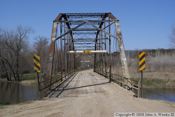
The photo above is looking north down the length of the bridge deck towards
Renville County from the center of Redwood County highway 17.

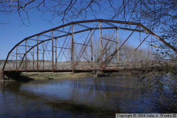
The photo above is looking northeast towards the upstream west face of the
truss structure from near the southwest corner of the bridge. The photo
below is looking east towards the west face of the truss span.
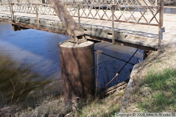
The photo above is a close view of the pier and bearing at the southwest
corner of the bridge. The photo below is a detail view of the truss
structure as it supports the bridge deck.


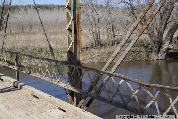
The photo above is looking north down the center of the bridge deck from
inside the truss structure. The photo below is a detail view of one of
the vertical bridge members along with the cables and straps that brace
the truss.
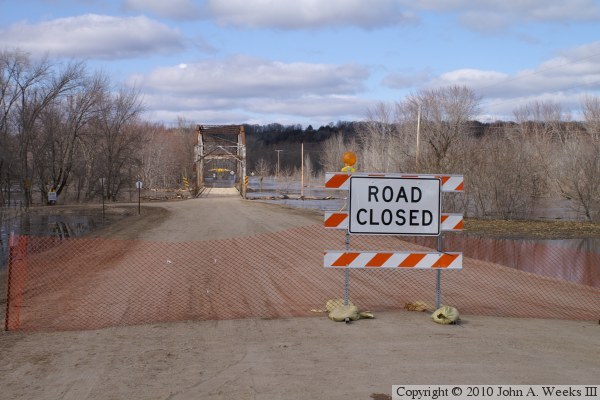
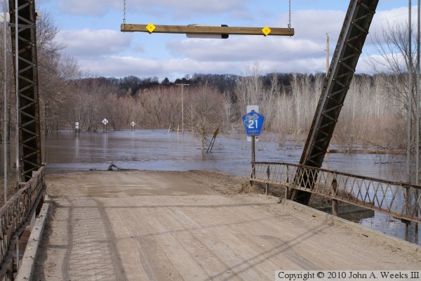
These two photos, and the ten that follow, are views from the spring flood
of 2010. The photo above is looking north down Redwood County highway 17
north towards Renville County. While the bridge is not underwater at the
time of these photos, the approach road north of the bridge was covered with
several feet of water. The photo below is a view looking north from the
north end of the bridge.
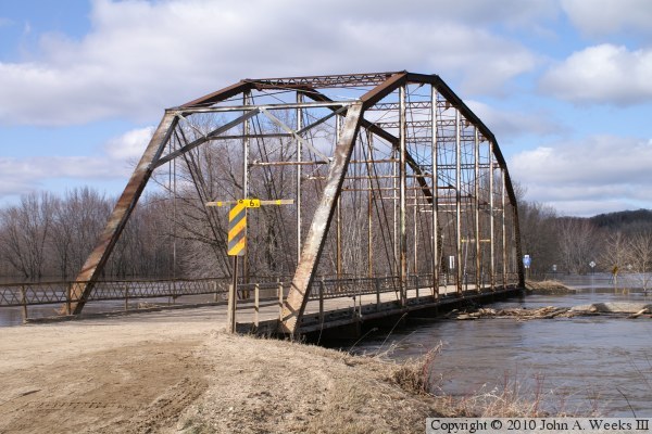
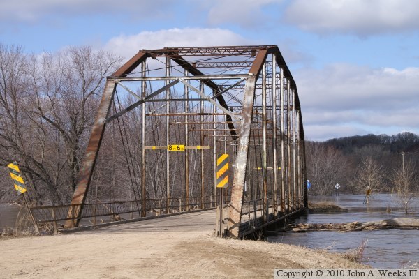
These two photos are views from the southeast corner of the truss
structure. The water level is just under the bridge deck.
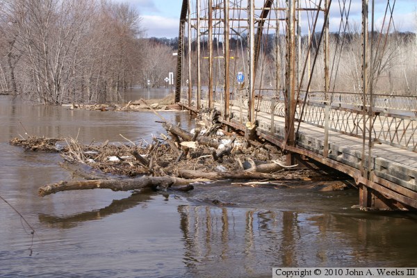
The photo above is looking north along the upriver west side of the bridge.
A large tangle of debris is lodged against the bridge. The photo below is
a close view of this debris. The pressure of the water has pushed this
branch against the bridge so far that it bent the steel tie bar and has a
lower steel bar embedded nearly an inch into the wood.

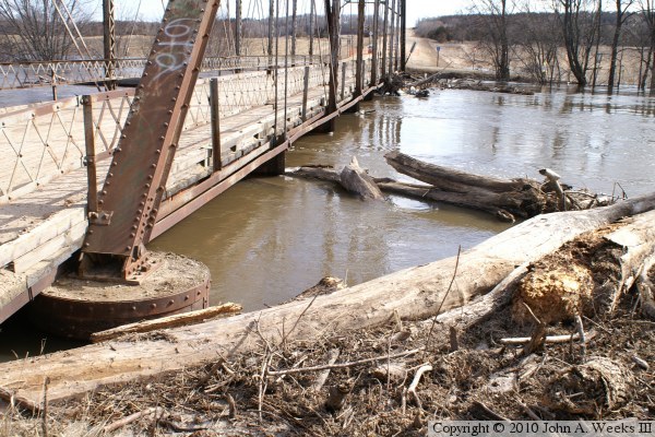
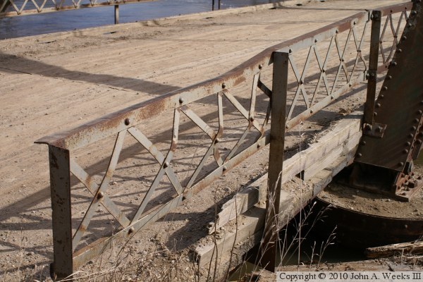
These two photos are views from the northwest bridge pier. The photo above
is a view looking south along the upriver west side of the bridge. The photo
below is a closer view of the railing and deck at the north end of the bridge.
Note that the pier appearing to be ajar is a zoom lens artifact.

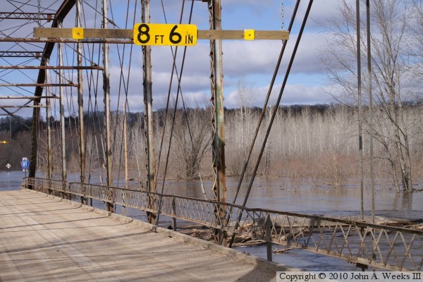
The photo above is the southwest bridge pier. This gives a good idea of
the exact water level. Also notice that there is considerable debris in
the river below the water line. The photo below is looking northeast from
inside the bridge truss.
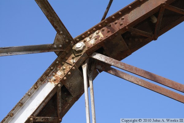
These two photos are looking up at connections along the top of the
main bridge truss beams. The construction using smaller parallel steel
beams connected by a zigzag line of tabs is very typical of early 1900s
bridge design.

|


