Current Weather Conditions
John A. Weeks III
Saturday, July 27, 2024, 9:17:37 AM CDT
Home Photo Tours Rail Fan 12 Easy Steps
Aviation Spacecraft Highways & Bridges About The Author
 
Google Search
Maps   Groups   Images   Search
 
  Home
  • 12 Easy Steps
  • Aviation
  • Spacecraft
  • Highways & Bridges
    » Bridge Photography
      - MSP River Bridges
      - C & D Canal
      - Illinois River
      - Minnehaha Creek
      - Minnesota River
        › Ortonville - Odessa
        › Correll - Wegdahl
          · Cement Bridge
          · Marsh Lake Dam
          · BNSF RR Appleton
          · Twin Bridge (S Span)
          · Twin Bridge (N Span)
          · Milan Bridge
          · Lac Qui Parle D Br
          · Lac Qui Parle Dam
          · C Co 14 LQP Co 20
          · C Co 15 LQP Co 18
          · US-59 / US-212 Br
          · US-212 Bridge (MV)
          · Cpw Co 7 Bridge
        › Granite Fls - Rdwd Fls
        › Morton - Judson
        › Mankato - Jordan
        › MSP West Metro
        › MSP South Metro
      - Mississippi River
      - Missouri River
      - St. Croix River
      - St. Louis River
      - Wisconsin River
      - Best Miss River Photos
      - Cable Stayed Bridges
      - McGilvray Road Bridges
      - I-35W Bridge Disaster
      - Miscellaneous Bridges
      - Madison County Bridges
      - Hist Br Weekend 2013
    » Road Geek Topics
  • Photo Tours
  • Rail Fan
  • About The Author
 
Site Search By JRank
Highways, Byways, And Bridge Photography
Chippewa Co 14 - Lac Qui Parle Co 20 Br
Minnesota River Highway Crossing
Watson, MN

Chippewa Co 14 - Lac Qui Parle Co 20 Bridge

• Structure ID: NBI: 6611.
• Location: River Mile 281.1.
• River Elevation: 921 Feet.
• Highway: Chippewa Co 14, Lac Qui Parle Co 20.
• Daily Traffic Count: 540 (2004).
• Bridge Type: Steel Girder, Concrete Deck.
• Length: 190 Feet.
• Width: 36 Feet, 2 Lanes.
• Navigation Channel Width: Non-Navigable.
• Height Above Water: 19 Feet.
• Date Built: 1948.
This bridge is the upstream bridge of two bridges built between Chippewa County and Lac Qui Parle County between Montevideo and the Lac Qui Parle Dam. These two bridges were built at the same time, using the same bridge plans, resulting in identical looking bridges. Further, both bridges have been extensively rebuilt by adding new pilings, making the piers wider, adding new girders, putting on a new wider deck, and adding modern slanted guardrails. The only differences that I could find between the two bridges is that this one has its steel girders painted red-brown, while the county 15 and county 18 bridge has its girders painted blue-gray.

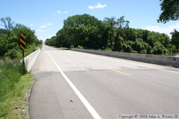
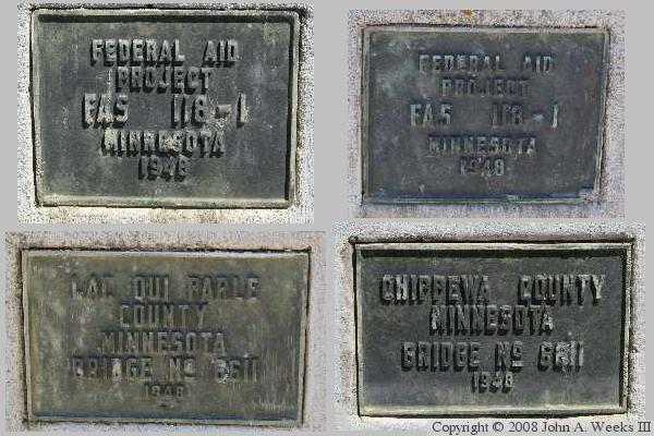
The photo above is a view looking east from the north side of Lac Qui Parle County highway 20. The photo below is a collage that shows each of the 4 bridge plates that are attached to the structure. There is one plate for each county, and two to note the federal aid project that funded the bridge construction.


Chippewa Co 14 - Lac Qui Parle Co 20 Bridge
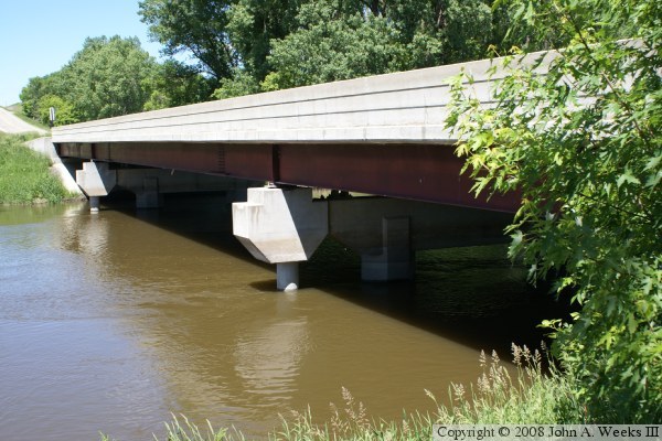
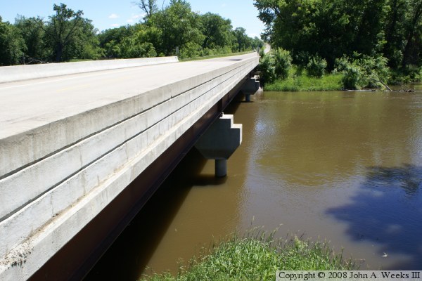
These two photos are views of the south face of the highway 14 and highway 20 bridge. The photo above is looking to the west from the southeast corner of the structure, while the photo below is looking east from the southwest corner of the structure. The bridge widening visible in these two photos. Note the small round pier at the end of each main bridge pier, and that the concrete pier cap is independent of the original H-shaped pier. This additional pier is used to support one additional bridge girder.

Chippewa Co 14 - Lac Qui Parle Co 20 Bridge
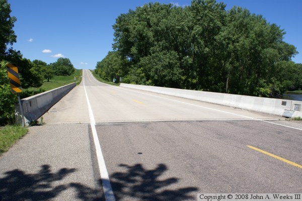
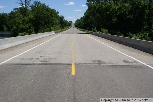
The photo above is looking west down the length of the bridge deck from the south shoulder of Chippewa County highway 14. The photo below is looking east down the length of the bridge deck from the center of Lac Qui Parle County highway 20.

Chippewa Co 14 - Lac Qui Parle Co 20 Bridge

Made With Macintosh
Authored by John A. Weeks III, Copyright © 1996—2016, all rights reserved.
For further information, contact: john@johnweeks.com