Current Weather Conditions
John A. Weeks III
Wednesday, March 22, 2023, 8:37:54 AM CDT
Home Photo Tours Rail Fan 12 Easy Steps
Aviation Spacecraft Highways & Bridges About The Author
 
Google Search
Maps   Groups   Images   Search
 
  Home
  • 12 Easy Steps
  • Aviation
  • Spacecraft
  • Highways & Bridges
    » Bridge Photography
      - MSP River Bridges
      - C & D Canal
      - Illinois River
      - Minnehaha Creek
      - Minnesota River
        › Ortonville - Odessa
        › Correll - Wegdahl
          · Cement Bridge
          · Marsh Lake Dam
          · BNSF RR Appleton
          · Twin Bridge (S Span)
          · Twin Bridge (N Span)
          · Milan Bridge
          · Lac Qui Parle D Br
          · Lac Qui Parle Dam
          · C Co 14 LQP Co 20
          · C Co 15 LQP Co 18
          · US-59 / US-212 Br
          · US-212 Bridge (MV)
          · Cpw Co 7 Bridge
        › Granite Fls - Rdwd Fls
        › Morton - Judson
        › Mankato - Jordan
        › MSP West Metro
        › MSP South Metro
      - Mississippi River
      - Missouri River
      - St. Croix River
      - St. Louis River
      - Wisconsin River
      - Best Miss River Photos
      - Cable Stayed Bridges
      - McGilvray Road Bridges
      - I-35W Bridge Disaster
      - Miscellaneous Bridges
      - Madison County Bridges
      - Hist Br Weekend 2013
    » Road Geek Topics
  • Photo Tours
  • Rail Fan
  • About The Author
 
Site Search By JRank
Highways, Byways, And Bridge Photography
Twin Bridge
MN-119 Minnesota River Highway Crossing
Appleton, MN

Twin Bridge - South Span

• Structure ID: NBI: 76008.
• Location: River Mile 299.5.
• River Elevation: 931 Feet.
• Highway: MN-119.
• Daily Traffic Count: 1,350 (2004).
• Bridge Type: Steel Girder, Concrete Deck.
• Length: 149 Feet.
• Width: 43 Feet, 2 Lanes.
• Navigation Channel Width: Non-Navigable.
• Height Above Water: 16 Feet.
• Date Built: 1977.
This bridge is the southernmost of two bridges in the causeway that make up the Minnesota state highway MN-119 crossing over the Minnesota River. MN-119 is located at the northern extent of Lac Qui Parle, the lake that backs up behind the Lac Qui Parle Dam. This particular bridge crosses the historic Minnesota River main channel.

The bridge has a very simple design that can be quickly erected. The process starts by using a pile driver to pound in 4 rows of steel tubes. The row of tubes on each end of the crossing is used to support the abutments, which are made from ready-mix concrete. The two rows of tubes in the middle of the river are cut off and a concrete box is built around the top of the tubes. From here, steel beams are placed from the abutments to the piers, and between the piers. A plywood form is built between the beams, and the bridge deck is poured. Once the deck is cured enough to support equipment, the guardrails are formed and poured. The abutments are backfilled, metal guardrails are installed, and some landscaping finishes off the project. An experienced crew can install a bridge in this manner in as little as 8 weeks.

The photo above is a view of the south bridge span over the Minnesota River as seen while traveling southbound on highway MN-119 towards Dawson.


Twin Bridge - South Span
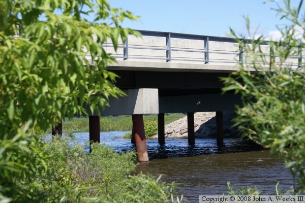
The photo above is the downriver southeast face of the main channel span. The photo below is looking northeast down the southeast face of the bridge.

Twin Bridge - South Span
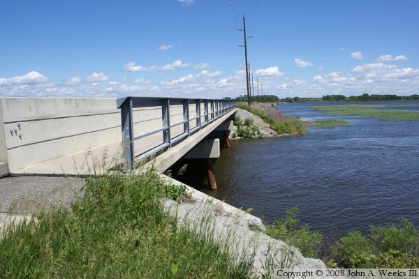
The photo above is looking northeast down the length of the bridge deck from 
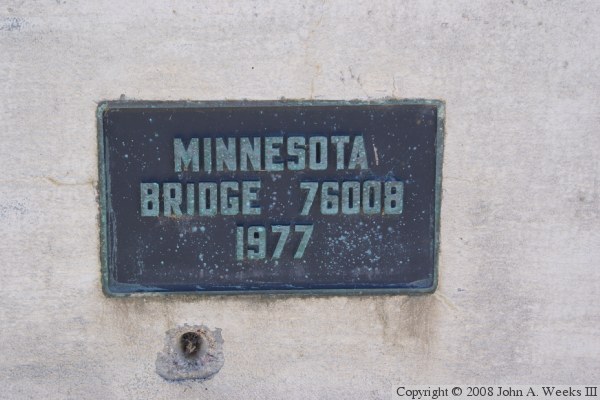
the southeast corner of the structure. The photo below is the bridge plate.

Twin Bridge - South Span
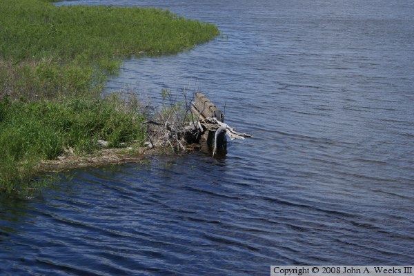
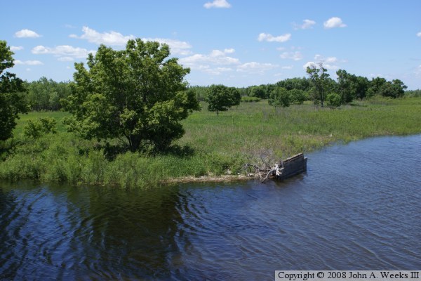
These two photos show an old bridge pier sitting just upstream from the current river crossing. I have not been able to determine exactly what this pier is. It might be from the river crossing that was replaced when the current 1977 bridges were built. The second possibility is that this was part of the pre-1940 river crossing that was flooded when the Lac Qui Parle Dam was completed. The final possibility is that this is part of an old railroad bridge, possibly the BNSF Watertown Subdivision line that was flooded out in 1940 and moved to a new alignment.

Twin Bridge - South Span

Made With Macintosh
Authored by John A. Weeks III, Copyright © 1996—2016, all rights reserved.
For further information, contact: john@johnweeks.com