Current Weather Conditions
John A. Weeks III
Friday, July 26, 2024, 9:43:27 PM CDT
Home Photo Tours Rail Fan 12 Easy Steps
Aviation Spacecraft Highways & Bridges About The Author
 
Google Search
Maps   Groups   Images   Search
 
  Home
  • 12 Easy Steps
  • Aviation
  • Spacecraft
  • Highways & Bridges
    » Bridge Photography
      - MSP River Bridges
      - C & D Canal
      - Illinois River
      - Minnehaha Creek
      - Minnesota River
        › Ortonville - Odessa
        › Correll - Wegdahl
          · Cement Bridge
          · Marsh Lake Dam
          · BNSF RR Appleton
          · Twin Bridge (S Span)
          · Twin Bridge (N Span)
          · Milan Bridge
          · Lac Qui Parle D Br
          · Lac Qui Parle Dam
          · C Co 14 LQP Co 20
          · C Co 15 LQP Co 18
          · US-59 / US-212 Br
          · US-212 Bridge (MV)
          · Cpw Co 7 Bridge
        › Granite Fls - Rdwd Fls
        › Morton - Judson
        › Mankato - Jordan
        › MSP West Metro
        › MSP South Metro
      - Mississippi River
      - Missouri River
      - St. Croix River
      - St. Louis River
      - Wisconsin River
      - Best Miss River Photos
      - Cable Stayed Bridges
      - McGilvray Road Bridges
      - I-35W Bridge Disaster
      - Miscellaneous Bridges
      - Madison County Bridges
      - Hist Br Weekend 2013
    » Road Geek Topics
  • Photo Tours
  • Rail Fan
  • About The Author
 
Site Search By JRank
Highways, Byways, And Bridge Photography
Twin Bridge - North Span
MN-119 Minnesota River Highway Crossing
Appleton, MN

Twin Bridge - North Span

• Structure ID: NBI: 76007.
• Location: River Mile 299.5.
• River Elevation: 931 Feet.
• Highway: MN-119.
• Daily Traffic Count: 1,350 (2004).
• Bridge Type: Steel Girder, Concrete Deck.
• Length: 162 Feet.
• Width: 43 Feet, 2 Lanes.
• Navigation Channel Width: Non-Navigable.
• Height Above Water: 16 Feet.
• Date Built: 1977.
This bridge is the northernmost of two bridges on the causeway that carries Minnesota state highway MN-119 across the Minnesota River. MN-119 is located at the northern extent of Lac Qui Parle, the lake that backs up behind the Lac Qui Parle Dam. This particular bridge connects a part of the lake that would otherwise be cut off from the main lake body.

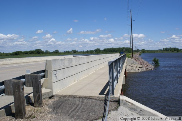
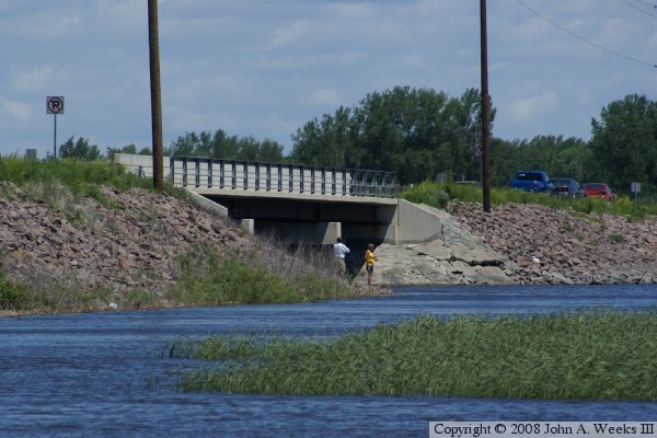
This bridge is nearly an identical twin to the main channel bridge located 715 feet southwest of this location. The only difference is that this bridge is longer by 13 feet. Both bridges are devoid of any decorative elements. They do, however, have the modern guardrails and feature a pedestrian sidewalk. Despite no parking signs posted anywhere near the bridges, there were a number of cars parked for people to stop and go fishing. The county highway department would prefer that these folks use one of the public parking areas, one of which is located adjacent to the main channel bridge.

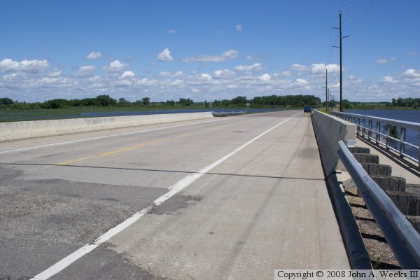
The photo above is a view of the downriver southeast face of the north span of the highway MN-119 bridge. The photo below is the downriver side of the bridge as seen from the walkway leading to the south end of the structure.


Twin Bridge - North Span
These two photos are views while traveling southbound on Minnesota highway MN-119. The vantage point in the photo above is the middle of the causeway. The photo below is approaching the northernmost of the two bridge spans.

Twin Bridge - North Span
The photo above is looking northeast down the length of the bridge deck from the southeast corner of the structure. The photo below is the bridge plate.

Twin Bridge - North Span

Made With Macintosh
Authored by John A. Weeks III, Copyright © 1996—2016, all rights reserved.
For further information, contact: john@johnweeks.com