The Marsh Lake Dam was built in the 1930s as one of three flood control
projects on the Minnesota River. It was built by the WPA, the Works
Progress Administration, one of several 3-letter agencies created
during the great depression to put people to work. The US Army Corps of
Engineers took over the dam once it was completed. Ironically, during
periods of high water, the lake behind the Lac Qui Parle dam backs up
and floods the Marsh Lake Dam, so it effectively serves no significant
flood control management according to the US Army Corps of Engineers.
The dam is 19 feet tall, but is designed with a 7 foot water fall.
Much of the 11,800 foot length is an earthen embankment. The main
structure of the dam has a single 112 foot wide gate that is fixed in
position to maintain Marsh Lake at the 938 foot elevation. An overflow
spillway sits next to the main gate. The overflow is little more than
a cut in the dam that is paved with concrete.
Some maps show a river crossing over the dam. In fact, several topographical
maps call this 113th Avenue. It is remotely possible that cars could
cross the dam during low water when the overflow was dry and before the
main gate was built. A local resident stated that the dam was blocked
off for as long as he could remember.
Marsh Lake is a major stopping place for Canadian Geese, with as many as
150,000 birds passing through per day. The dam is the site of one of only two
nesting colonies of White Pelicans in the state. These huge birds can have
wingspans of nearly 10 feet.
The photo above is a close-up view of the dam main structure. The
colony of White Pelicans can be seen at the left. The birds are fishing
for fish that go over the dam and are dazed as a result of the sudden
turbulence. The photo below is a view of the dam from the far southwest
end of the structure. One can see the gate that blocks vehicles from
traveling on the dam.
These two photos are two more views of the dam from the southwest end of
the structure. The photo above shows that the vehicle path is still
well defined. I suspect that this is from US Army Corps of Engineers
vehicles inspecting the dam. The photo below shows the US Geological
Survey gauge station. It measures and records the water level behind
the dam.
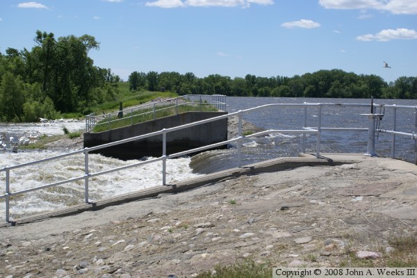
The photo above is a close-up view of the main dam gate. The photo
below is a close-up view of the overflow spillway. The White Pelicans
can again be seen in this photo.
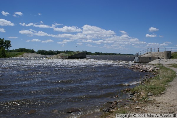
These two photos are views of the entire main structure of the dam. The
photo above is a view from downstream, while the photo below is a view
from the base of the dam.
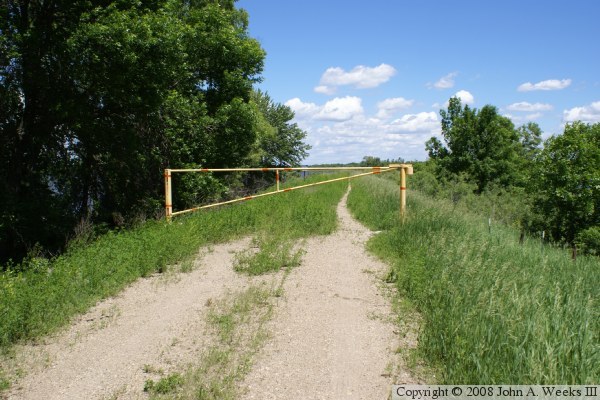
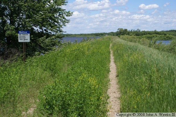
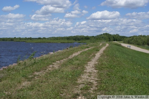
These two photos are views of the top of the dam. The photo above is
looking southwest. The dam extends about a half-mile before it meets
the base of the bluffs along the edge of the river valley. The photo
below is looking northeast. The road from the day use area at the
base of the dam follows the top of the dam for a mile and a half.