Current Weather Conditions
John A. Weeks III
Tuesday, April 16, 2024, 3:53:07 AM CDT
Home Photo Tours Rail Fan 12 Easy Steps
Aviation Spacecraft Highways & Bridges About The Author
 
Google Search
Maps   Groups   Images   Search
 
  Home
  • 12 Easy Steps
  • Aviation
  • Spacecraft
  • Highways & Bridges
    » Bridge Photography
      - MSP River Bridges
      - C & D Canal
      - Illinois River
        › Joliet - La Salle
          · Dresden Island L&D
          · EJ&E Railroad Br
          · Morris Bridge
          · Seneca Rail Bridge
          · Seneca Bridge
          · Marseilles Dam
          · Marseilles Bridge
          · Marseilles Mill Ruins
          · Marseilles Canal
          · Marseilles Lock
          · Veterans Memorial Br
          · Ottawa Rail Bridge
          · Starved Rock L&D
          · Utica Bridge
          · Abraham Lincoln Br
          · La Salle Rail Bridge
          · Shippingsport Bridge
        › Peru - Peoria
        › Pekin - Beardstown
        › LaGrange - Grafton
      - Minnehaha Creek
      - Minnesota River
      - Mississippi River
      - Missouri River
      - St. Croix River
      - St. Louis River
      - Wisconsin River
      - Best Miss River Photos
      - Cable Stayed Bridges
      - McGilvray Road Bridges
      - I-35W Bridge Disaster
      - Miscellaneous Bridges
      - Madison County Bridges
      - Hist Br Weekend 2013
    » Road Geek Topics
  • Photo Tours
  • Rail Fan
  • About The Author
 
Site Search By JRank
Highways, Byways, And Bridge Photography
Marseilles Bridge
Illinois River Highway Crossing
Marseilles, IL

Marseilles Bridge

• Structure ID: NBI 000050021931766
• Location: River Mile 246.9
• River Elevation: 483 Feet
• Highway: IL-15
• Daily Traffic Count: 4,500 (2002)
• Bridge Type: Steel Plate Girder, Concrete Deck
• Bridge Length: 1,661 Feet, ??? Foot Longest Span
• Bridge Width: 30 Feet, 2 Lanes
• Navigation Channel Width: ??? Feet
• Height Above Water: ??? Feet
• Date Built: Completed December 1997
The highway bridge at Marseilles is relative new having been completed in December of 1997. The previous bridge, a steel truss bridge, was removed in 1998. The bridge has modern features like solid guardrails, a wide sidewalk, and street lights. At the same time, the bridge is very narrow and does not have any shoulders. This would seem to make the bridge dangerous for wide loads and farm equipment. I am surprised that a modern bridge would be built that narrow.

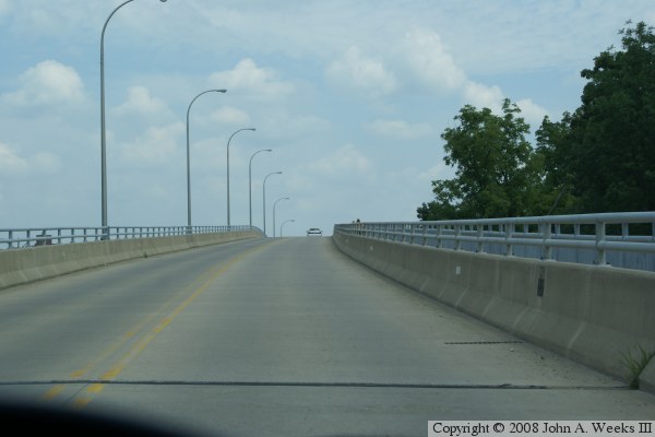
The river has two channels at this location. The main channel of the Illinois River is on the north. There is a dam just upstream, so the water is relatively shallow but rough. Since this is not navigable, the bridge has piers in the water. The navigation traffic follows a canal that has been cut from the native rock and runs along the south side of the river. Since large tow boats use the canal, the bridge spans the entire canal width, and a hump in the bridge provides the vertical clearance needed by tow boats and river boats.

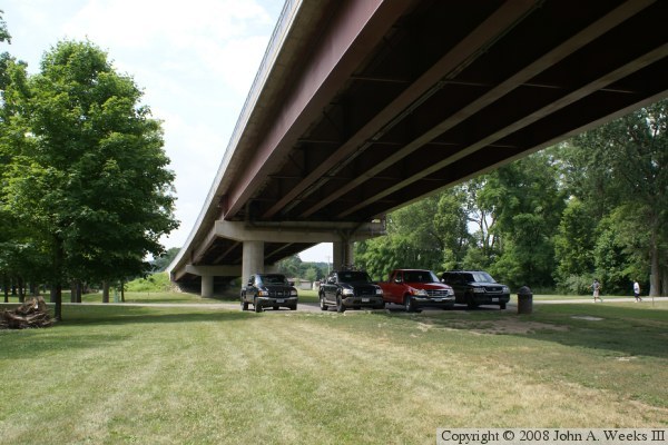
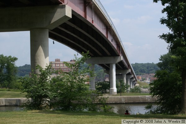
The bridge is a steel plate girder bridge. The steel beams were built up from plate steel in a fabrication yard and trucked to the site. Plate girders allow for long main spans, such as the span across the 225 foot wide canal.

This is perhaps one of the most interesting spots on the Illinois River. In this small area, there is this large bridge, a canal, a boat lock, a river dam, the milling district, two water power canals, several smaller bridges, several smaller water control gates, and the historic power plant. Even more remarkable, most of it is easy to photograph.


Marseilles Bridge
Marseilles Bridge
Marseilles Bridge
Marseilles Bridge
Marseilles Bridge
Marseilles Bridge
Marseilles Bridge
Marseilles Bridge

Made With Macintosh
Authored by John A. Weeks III, Copyright © 1996—2016, all rights reserved.
For further information, contact: john@johnweeks.com