Current Weather Conditions
John A. Weeks III
Friday, March 29, 2024, 1:12:30 AM CDT
Home Photo Tours Rail Fan 12 Easy Steps
Aviation Spacecraft Highways & Bridges About The Author
 
Google Search
Maps   Groups   Images   Search
 
  Home
  • 12 Easy Steps
  • Aviation
  • Spacecraft
  • Highways & Bridges
    » Bridge Photography
      - MSP River Bridges
      - C & D Canal
      - Illinois River
        › Joliet - La Salle
          · Dresden Island L&D
          · EJ&E Railroad Br
          · Morris Bridge
          · Seneca Rail Bridge
          · Seneca Bridge
          · Marseilles Dam
          · Marseilles Bridge
          · Marseilles Mill Ruins
          · Marseilles Canal
          · Marseilles Lock
          · Veterans Memorial Br
          · Ottawa Rail Bridge
          · Starved Rock L&D
          · Utica Bridge
          · Abraham Lincoln Br
          · La Salle Rail Bridge
          · Shippingsport Bridge
        › Peru - Peoria
        › Pekin - Beardstown
        › LaGrange - Grafton
      - Minnehaha Creek
      - Minnesota River
      - Mississippi River
      - Missouri River
      - St. Croix River
      - St. Louis River
      - Wisconsin River
      - Best Miss River Photos
      - Cable Stayed Bridges
      - McGilvray Road Bridges
      - I-35W Bridge Disaster
      - Miscellaneous Bridges
      - Madison County Bridges
      - Hist Br Weekend 2013
    » Road Geek Topics
  • Photo Tours
  • Rail Fan
  • About The Author
 
Site Search By JRank
Highways, Byways, And Bridge Photography
Marseilles Lock
Illinois River Lock
Marseilles, IL

Marseilles Lock

• Structure: Marseilles Lock
• Location: River Mile 244.6
• Structure Width: 110 Feet Lock
• River Elevation (Pool): 483 Feet
• River Elevation (Outflow): 459 Feet
• Water Fall: 24 Feet
• Annual Lock Traffic: 4,844 Vessels, 20,133,000 Tons (2005)
• Date Built: 1933
The Marseilles Lock is part of the water control system that maintains the 9-foot navigation channel in the Illinois River. The other locks on the Illinois River are part of lock and dam structures. In the case of Marseilles, the lock is 2.4 miles downriver from the dam. The reason is a large rapids in the river near the city of Marseilles.

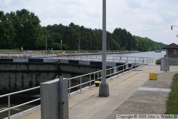
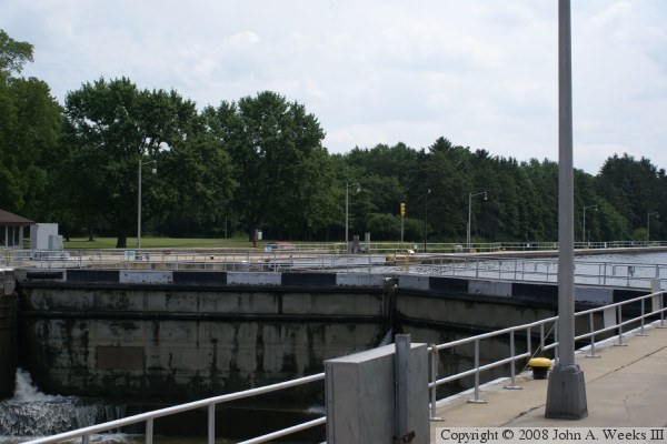
The US Army Corps of Engineers started the project by building a 2.7 mile long canal just to the south of the Illinois River to bypass the rapids. A dam was built across the river at the upstream end of the canal. The locks were were built here at the downstream end of the canal. This allowed the dam to keep the water high in the canal, and the canal to bypass the rapids.

The lock at this location is the same size as the other four locks on the Illinois River, the 110 foot wide by 600 foot long Panama Canal standard size lock. While the Panama Canal locks were big when built, today, they are small compared with the size of barge tow that often uses the river. In fact, many tows have to be broken up into two pieces to lock through, and then are reassembled after the second piece exists the lock. This takes time and dramatically reduces the traffic level that the lock can maintain.

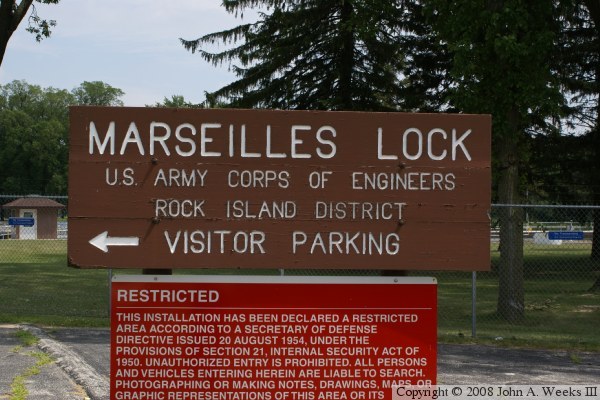
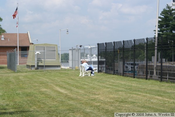
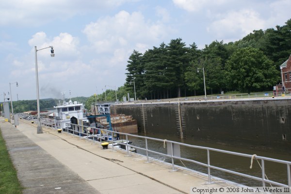
The Marseilles Lock can be accessed from the Illini State Park on the south side of the river, and then following the park service road to the west. There is a parking area and observation plaza for the public to watch the lock in operation. A large iron fence has been erected, but the bars are far enough apart to slide your camera between the bars and take photos.


Marseilles Lock
Marseilles Lock
Marseilles Lock
Marseilles Lock

Made With Macintosh
Authored by John A. Weeks III, Copyright © 1996—2016, all rights reserved.
For further information, contact: john@johnweeks.com