Current Weather Conditions
John A. Weeks III
Saturday, April 20, 2024, 4:26:29 AM CDT
Home Photo Tours Rail Fan 12 Easy Steps
Aviation Spacecraft Highways & Bridges About The Author
 
Google Search
Maps   Groups   Images   Search
 
  Home
  • 12 Easy Steps
  • Aviation
  • Spacecraft
  • Highways & Bridges
    » Bridge Photography
      - MSP River Bridges
      - C & D Canal
      - Illinois River
        › Joliet - La Salle
          · Dresden Island L&D
          · EJ&E Railroad Br
          · Morris Bridge
          · Seneca Rail Bridge
          · Seneca Bridge
          · Marseilles Dam
          · Marseilles Bridge
          · Marseilles Mill Ruins
          · Marseilles Canal
          · Marseilles Lock
          · Veterans Memorial Br
          · Ottawa Rail Bridge
          · Starved Rock L&D
          · Utica Bridge
          · Abraham Lincoln Br
          · La Salle Rail Bridge
          · Shippingsport Bridge
        › Peru - Peoria
        › Pekin - Beardstown
        › LaGrange - Grafton
      - Minnehaha Creek
      - Minnesota River
      - Mississippi River
      - Missouri River
      - St. Croix River
      - St. Louis River
      - Wisconsin River
      - Best Miss River Photos
      - Cable Stayed Bridges
      - McGilvray Road Bridges
      - I-35W Bridge Disaster
      - Miscellaneous Bridges
      - Madison County Bridges
      - Hist Br Weekend 2013
    » Road Geek Topics
  • Photo Tours
  • Rail Fan
  • About The Author
 
Site Search By JRank
Highways, Byways, And Bridge Photography
Marseilles Canal
Illinois River Canal
Marseilles, IL

Marseilles Canal

• Structure: Marseilles Canal
• Location: River Mile 244.3 To 247.0
• Structure Length: 2.7 Miles
• Structure Width: 225 Feet (Average)
• River Elevation: 483 Feet
• Date Built: Mid-1920s
The Marseilles Canal was built in the 1920s by the US Army Corps of Engineers to provide a boat and barge bypass around a major rapids near the city of Marseilles, Illinois. The canal is 2.7 miles long. It is a minimum of 225 feet wide, and has a wider pool area near the Marseilles Lock on the west end of the canal. The Lock was opened in 1933 with the completion of the 9-foot navigation project. The lock keeps the canal water level at 483 feet above sea level, despite the river being 24 feet lower at 459 feet.

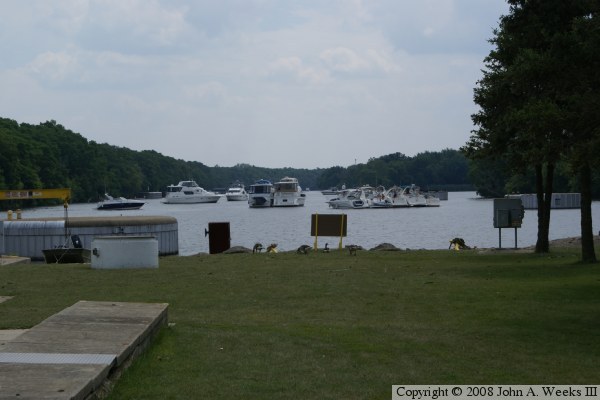
The photo above is looking east upstream into the canal from the Marseilles Lock. The boats are in line waiting to lock through. There is a line due to a large barge tow that tied up the lock for over an hour.

Made With Macintosh
Authored by John A. Weeks III, Copyright © 1996—2016, all rights reserved.
For further information, contact: john@johnweeks.com