The Big Stone Lake Dam was built in 1937 as part of a depression era
WPA project to lessen the downstream impact of periodic flooding. The
dam features ten concrete pylons. Steel pates are fitted in slots on the
sides of these pylons. These slots support and guide the steel plates as
they are raised and lowered to control the water flowing out of Big Stone
Lake and Whetstone River into the Minnesota River.
Big Stone Lake is just to the north of the dam. It is a long and narrow
lake that runs for about 26 miles. To the north of Big Stone Lake is
Traverse Lake and Mud Lake, which are also long and narrow lakes that
run for about 22 miles. These lakes run though a deep river channel
that was carved about 8,000 years ago when a giant glacial lake overflowed
and drained, creating the Minnesota River Valley and part of the Mississippi
River Valley.
Interestingly, Big Stone Lake drains through the Minnesota River and
Mississippi River, delivering water to the Gulf Of Mexico. Traverse
Lake drains north through the Red River and delivers water to Hudson
Bay. There is a very low mound of earth separating these two lakes
at the Traverse Gap, low enough that during high water periods, the
water can flow either way.
These lakes are often called the West Coast of Minnesota. The area is
far enough out of the way that the traffic is low, yet the roads on the
high bluffs overlooking the water is very reminiscent of the Pacific
Coast Highway overlooking the Pacific Ocean.
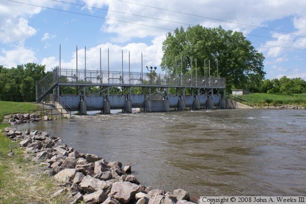
The photo above is a view of the downriver face of the dam as seen in the
spring of 2008. In this photos, the lake water is high, so the dam is left
open in an attempt to bring the lake water back down to normal.
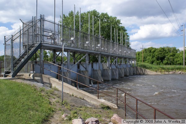
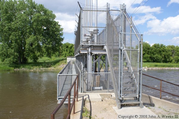
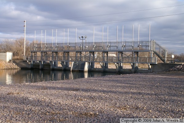
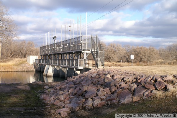
These two photos are views of the south end of the dam. The photo above
is a view looking across the downriver face of the dam. The photo below
is a view of the south end of the dam. Note the public walkway on the
upriver side of the structure, which provides access to the far side of
the river.
These two photos are views of the downriver face of the dam. The photo above
is a profile shot, while the photo below is a view from the southeast corner
of the structure. The water level is lower than in the spring photos above.
These two photos are views of the upriver face of the dam. The photo above
is a profile shot, while the photo below is a view from the southwest corner
of the structure.
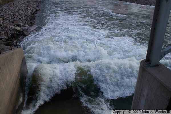
These two photos show the water rushing though the open dam gate. A large
wave is created at the base of the dam due to the fast moving water. The
photo above is looking downriver from the path that crosses the dam. The
photo below is a view from the north end of the dam.
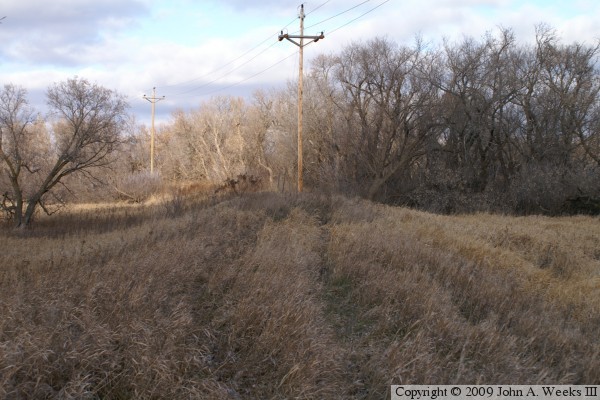
These two photos are views of the dike on either side of the Big Stone Lake
Dam. The photo above is on the north side of the dam on the Ortonville side
of the Minnesota River. The photo below is on the south side of the dam.
The vantage point is very close to where the Minnesota and South Dakota
state line crosses the dam embankment.
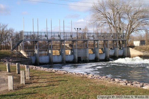
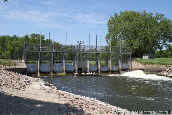
The photo above is a view from early summer of 2010. The water flow is
relatively low, so just one gate is open. The water level in the channel
is low, leaving the apron in front of the dame exposed for the birds to use
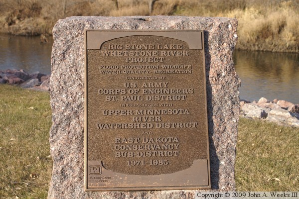
as a platform to watch for fish. The photo below is a marker that is placed
just downriver of the dam site.