The solution to the flood problem is a diversion channel that could rapidly carry water out of Big Stone Lake into a wetlands area several miles downstream that was about 15 feet lower in elevation. While the solution is simple in concept, there ended up being a number of component pieces. First, it was desired to avoid flooding communities and farms downstream. That meant building flood control dams downstream. Next, the lake levels on Big Stone Lake should not vary widely, so a dam was needed near the lake. The Minnesota River channel was a series of dozens of sharp S-turns, so the diversion channel would need its own path. Finally, existing streams needed to be accommodated, so the existing river channel needed to be preserved.
Construction on the project was undertaken during the Great Depression by the Works Progress Administration, a government jobs program. The river was channelized near the south end of Big Stone Lake, and a headwaters dam was built in Ortonville. The channel passed under the 1920 era bridge on highway US-12. From that point south, the diversion channel cut a new path that was north of the river for about 2 miles, and then south of the river for a final mile. The photos on this page show the location where the diversion channel and the Minnesota River cross within the boundaries of the Big Stone Wildlife Refuge.
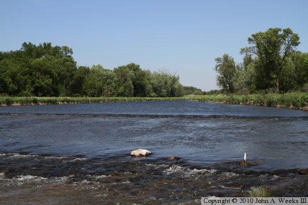
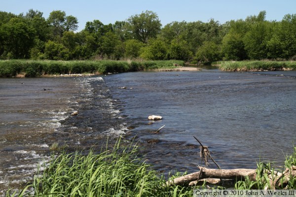
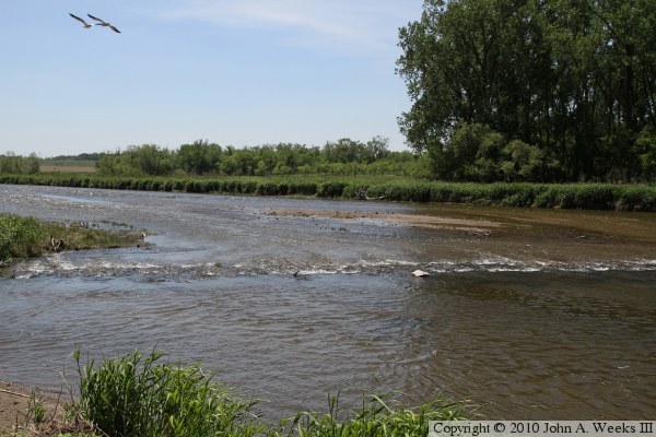
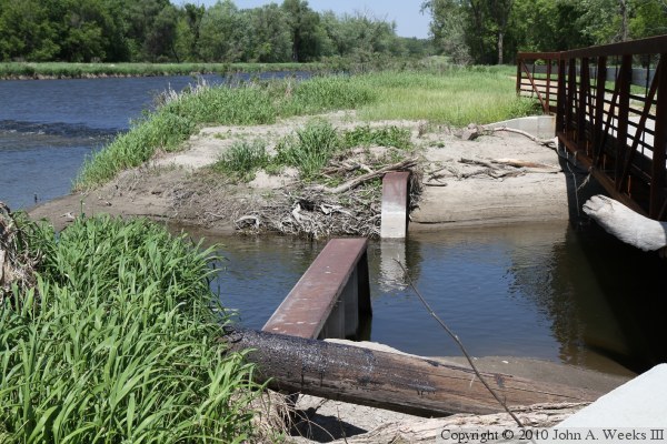
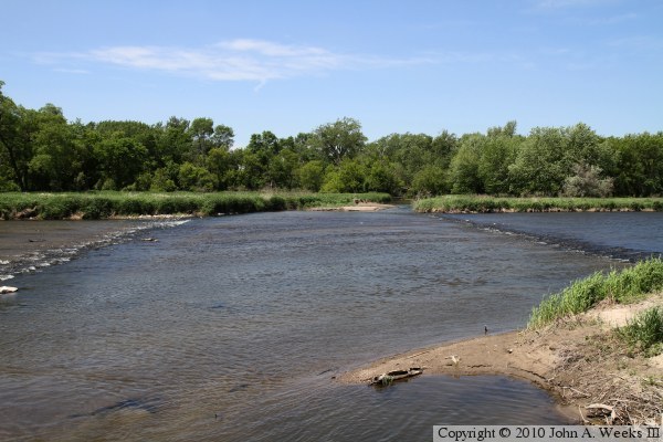
The crossing of the flood diversion channel and the Minnesota River channel is a very interesting location. The trail between Ortonville and the wildlife refuge was rebuilt in 2008 and 2009, making this location easily accessible from the trailhead parking area just off of the refuge Auto Tour Route. The diversion channel flows southeast, and is about 175 feet wide at the intersection. The Minnesota River channel enters the diversion channel from the west, and exits to the east. There is a low head dam that drops about 6 inches on each side of the Minnesota River channel. The upstream low head dam maintains the water level in the diversion channel. The downstream low head dam forces a portion of the diversion channel water and Minnesota River water to flow east down the Minnesota River. The remaining water flows into a wetlands area in the refuge. When a flood occurs, the low head dams are swamped, and the channel water flows freely. However, it is also desired to regulate the water flow into the Minnesota River channel, so a pair of steel wing dams are located at the entrance of the river channel. The narrow gap between the wing dams limit the flow into the river. It is amazing that this all happens with no moving parts.
The photo above is looking west across the flood diversion channel along the upriver path of the Minnesota River Channel. The two ripples on either side of the photo are low head dams built into the diversion channel.