The previous bridge at this location was a 1947 era steel pony truss bridge.
An inspection prompted by the I-35W bridge disaster found that the floor
beams on the 1947 bridge were deteriorated too far to be practical to fix.
As a result, the old truss bridge was removed in May and June of 2008.
The new bridge is both wider and longer than the old bridge. It was built
by Duininck Brothers, Inc. They bid $22,000 to remove the old bridge, and
$498,530 to build the new bridge. This was about 13% higher than the
construction estimate that was prepared by the design engineer. The bridge
design is very traditional, but the style is somewhat unusual compared to
other recently built river bridges in Minnesota. The most common design
that is being used is the concrete girder method. Those bridges are built
by placing concrete girders across the spans, then building a deck on top of
the girders. This bridge, however, is built as a single concrete slab that
was poured in place on top of temporary wooden forms. There are no beams
or girders, rather, the deck is the structural element.
The photo above is a view looking southeast towards the bridge from a
vantage point near a boat landing in the Big Stone National Wildlife Refuge.
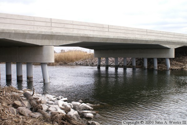
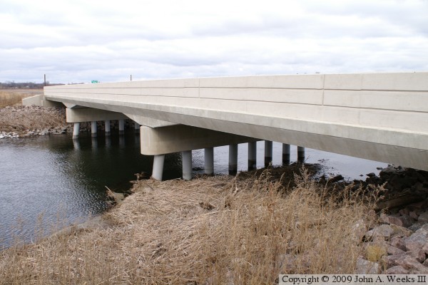
These two photos are views from a boat landing located northwest of the
highway 15 and highway 19 bridge over the Minnesota River. The photo above
is a overview shot, while the photo below is a close view of the main river
channel span. Note that the bridge appears to be much higher than in the
photos of the old bridge on an adjacent page. That is a bit of an illusion
since the water levels are low in these photos taken in November, 2009, while
the photos of the old bridge were taken during a period of high water in
spring of 2008.
These two photos are views from the southwest corner of the structure. The
photo above is the upriver west face of the bridge. The photo below is looking
northeast across the bridge deck. Note that there are no guard rails on
either end of this bridge.
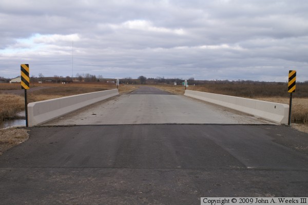
The photo above is looking directly north down the length of the bridge deck
from the center of Lac Qui Parle county highway 15. The county line is at
the center of the bridge, so the far side is Big Stone county highway 19.
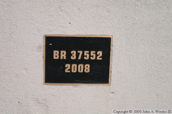
The photo below is the bridge plate.