Current Weather Conditions
John A. Weeks III
Sunday, February 9, 2025, 5:36:50 AM CST
Home Photo Tours Rail Fan 12 Easy Steps
Aviation Spacecraft Highways & Bridges About The Author
 
Google Search
Maps   Groups   Images   Search
 
  Home
  • 12 Easy Steps
  • Aviation
  • Spacecraft
  • Highways & Bridges
    » Bridge Photography
      - MSP River Bridges
      - C & D Canal
      - Illinois River
      - Minnehaha Creek
      - Minnesota River
        › Ortonville - Odessa
          · Traverse Gap
          · BS Co 30 Bridge
          · BNSF RR Ortonville
          · Big Stone Lake Dam
          · US-12 Bridge
          · Old US-12 Bridge
          · Headwaters Trail N
          · Flood Diversion Chnl
          · Headwaters Trail S
          · Auto Tour Route Br
          · BS Co 19 LQP Co 15
          · BS 19 LQP 15 (Old)
          · Highway 75 Dam
          · US-75 Main Channel
          · Township Road #159
          · US-75 Tailrace Br
        › Correll - Wegdahl
        › Granite Fls - Rdwd Fls
        › Morton - Judson
        › Mankato - Jordan
        › MSP West Metro
        › MSP South Metro
      - Mississippi River
      - Missouri River
      - St. Croix River
      - St. Louis River
      - Wisconsin River
      - Best Miss River Photos
      - Cable Stayed Bridges
      - McGilvray Road Bridges
      - I-35W Bridge Disaster
      - Miscellaneous Bridges
      - Madison County Bridges
      - Hist Br Weekend 2013
    » Road Geek Topics
  • Photo Tours
  • Rail Fan
  • About The Author
 
Site Search By JRank
Highways, Byways, And Bridge Photography
Township Road #159 Bridge
Road #159 Minnesota River Highway Crossing
Odessa, MN

Township Road #159 Bridge

• Structure ID: NBI: 96952.
• Location: River Mile 314.6.
• River Elevation: 940 Feet.
• Highway: Township Road #159.
• Daily Traffic Count: 28 (1973).
• Bridge Type: Cast In Place Concrete Culvert.
• Length: 16 Feet.
• Width: ??? Feet, 2 Lanes.
• Navigation Channel Width: Non-Navigable.
• Height Above Water: 1 Foot.
• Date Built: 1990.
As shown in the photo above, there is no indication that you are crossing a river bridge on this side road other than the four black and yellow marker signs. There is no indication at all that you are crossing the main channel of the Minnesota River rather than some unnamed brook that wanders across a few local farms.

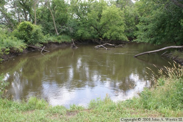
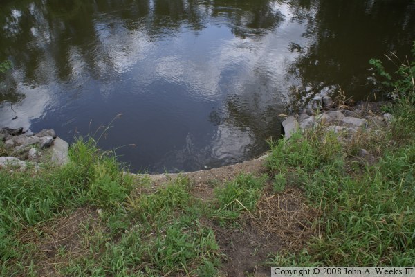
As it turns out, the Highway 75 Dam is just upstream of this location. The main outflow channel of the dam bypasses this section of the river channel. There is a very small valve in the dam that allows a small amount of water to follow the historic main channel of the Minnesota River. The river flows under a bridge on US-71, makes a loop to the east, then turns south to cross Township Road #159, and then joins with the outflow channel about a mile and a half downstream.

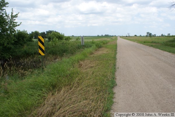
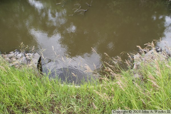
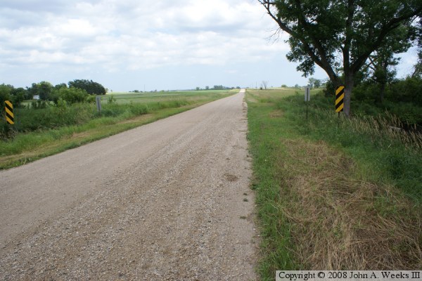
The bridge at this location is little more than a concrete tube about two feet in diameter. While the road is only about a lane and a half wide, the culvert extends about 12 feet past the edge of the road on both sides of the road. The photo below shows the distance between the edge of the graded road and the edge of the bridge structure, which is in line with the two marker signs.


Township Road #159 Bridge
These two photos are looking upstream to the north of the bridge. The photo above shows the river channel upstream. It is typical in this area for the Minnesota River main channel to be choked with fallen trees and wood remaining from the logging era 100 years ago. The photo below is a top view of the river flowing into the culvert.

Township Road #159 Bridge
These two photos are looking downstream to the south of the bridge. The photo above is the river channel downstream. The photo below is a top view of the river flowing out of the culvert.

Township Road #159 Bridge

Made With Macintosh
Authored by John A. Weeks III, Copyright © 1996—2016, all rights reserved.
For further information, contact: john@johnweeks.com