Current Weather Conditions
John A. Weeks III
Sunday, February 9, 2025, 5:34:44 AM CST
Home Photo Tours Rail Fan 12 Easy Steps
Aviation Spacecraft Highways & Bridges About The Author
 
Google Search
Maps   Groups   Images   Search
 
  Home
  • 12 Easy Steps
  • Aviation
  • Spacecraft
  • Highways & Bridges
    » Bridge Photography
      - MSP River Bridges
      - C & D Canal
      - Illinois River
      - Minnehaha Creek
      - Minnesota River
        › Ortonville - Odessa
          · Traverse Gap
          · BS Co 30 Bridge
          · BNSF RR Ortonville
          · Big Stone Lake Dam
          · US-12 Bridge
          · Old US-12 Bridge
          · Headwaters Trail N
          · Flood Diversion Chnl
          · Headwaters Trail S
          · Auto Tour Route Br
          · BS Co 19 LQP Co 15
          · BS 19 LQP 15 (Old)
          · Highway 75 Dam
          · US-75 Main Channel
          · Township Road #159
          · US-75 Tailrace Br
        › Correll - Wegdahl
        › Granite Fls - Rdwd Fls
        › Morton - Judson
        › Mankato - Jordan
        › MSP West Metro
        › MSP South Metro
      - Mississippi River
      - Missouri River
      - St. Croix River
      - St. Louis River
      - Wisconsin River
      - Best Miss River Photos
      - Cable Stayed Bridges
      - McGilvray Road Bridges
      - I-35W Bridge Disaster
      - Miscellaneous Bridges
      - Madison County Bridges
      - Hist Br Weekend 2013
    » Road Geek Topics
  • Photo Tours
  • Rail Fan
  • About The Author
 
Site Search By JRank
Highways, Byways, And Bridge Photography
BNSF Railroad Bridge
Minnesota River Railroad Crossing
Ortonville, MN

BNSF Bridge At Ortonville

• Structure ID: N/A.
• Location: River Mile 328.5.
• River Elevation: 966 Feet.
• Railroad: Burlington Northern Santa Fe.
• Daily Traffic Count: 4 Trains Per Day.
• Bridge Type: Steel Deck Plate Girder.
• Length: 184 Feet (Estimated).
• Width: 1 Track.
• Navigation Channel Width: Non-Navigable.
• Height Above Water: ??? Feet.
• Date Built: 1880.
The rail crossing at this location dates to the Hastings & Dakota railroad, which built a mainline across Minnesota in 1880. The line was bought by the Milwaukee Road in the mid-1880s, which operated the line until 1982. The line is currently operated by the Twin Cities & Western and the BNSF.

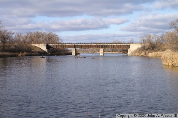
The bridge piers and abutments appear to be poured concrete. While poured concrete was somewhat unusual for a bridge in the 1880s, the concrete appears aged enough to have been from that era. As a result, I am unable to tell if this is the original 1880 bridge, or if it is a newer structure. I would at least expect that the steel would have been replaced as trains became ever heavier in the early 1900s.

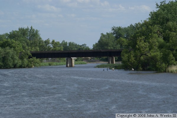
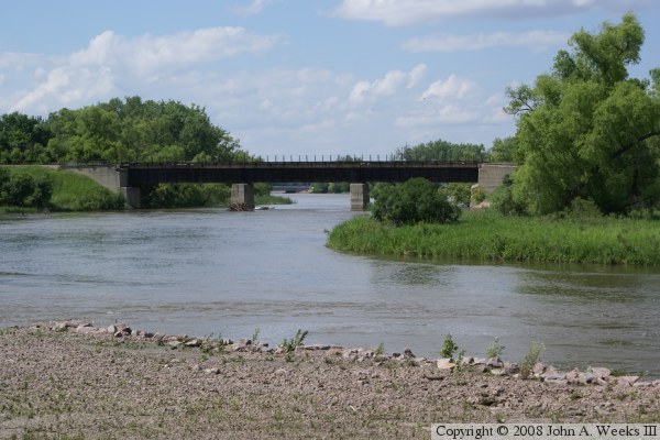
The two photos above and below are two views from early summer. The photo above is looking north from the Big Stone Lake Dam. The photo below is looking south from the new CSAH-30 Bridge.


BNSF Bridge At Ortonville
These two photos are views looking north from the confluence of the Whetstone River and the Minnesota River near the Big Stone Lake Dam. The photo above is a overview photo of the south face of the bridge, while the photo below is a slightly closer view of the structure.

BNSF Bridge At Ortonville

Made With Macintosh
Authored by John A. Weeks III, Copyright © 1996—2016, all rights reserved.
For further information, contact: john@johnweeks.com