The Minnesota Headwaters Trail is a 4-1/2 mile path that runs between
Ortonville and the Big Stone National Wildlife Refuge. The trail runs
through a park in Ortonville, crosses the old US-12 rainbow style bridge,
follows a township road, an old railroad bed, and then follows along the
north bank of the Minnesota River. The path is 10 feet wide and paved
with blacktop. It is fully handicap accessible.
The trail crosses the Minnesota River in three places. The northernmost
crossing is on a 1920-era highway bridge that has been refurbished for use
as a regional trail. The middle crossing is on a steel truss bridge located
at the site of an old railroad bridge over the river. The third crossing,
located within the Big Stone Wildlife Refuge, is this newly installed steel
truss bridge.
To get to this bridge, turn off of highway MN-7 at the entrance to the Auto
Tour Route within the Big Stone Wildlife Refuge. Park at the trailhead on the
south side of the Minnesota River. From there, walk 1-1/4 miles northwest on
the trail. The bridge is located in a very interesting area. The main water
flow of the Minnesota River runs down a flood diversion channel. The original
channel of the Minnesota River crosses the flood diversion channel at the
site of this trail bridge. There is a series of two load head dams that
holds water in the diversion channel, allows water from the original channel
to flow across the diversion channel, and diverts part of the water from the
diversion channel into the Minnesota River channel.
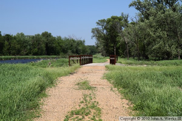
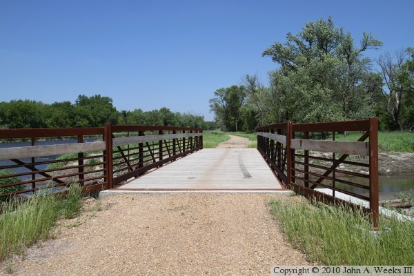
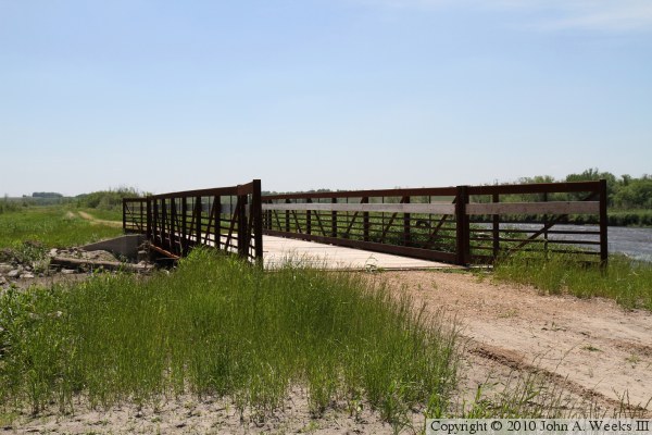
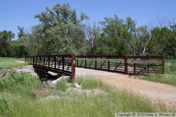
The photo above is approaching the trail bridge from the south. The photo
below is a view looking down the length of the trail bridge. The diversion
channel is to the left of bridge.
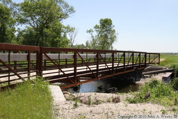
These two photos are views of the northeast side of the bridge. The photo
above is from the east corner of the structure, while the photo below is
looking upstream along the Minnesota River channel. It is hard to believe
that this little stream is going to require mile long bridges to cross it
on the other side of the state.
The photo above is looking downstream from the bridge deck. Not only has
the river channel wandered across the wildlife refuge, but it has wandered
all over the Ortonville area over the past 8,000 years. The area is very
flat, allowing the river to easily carve new channels, at least until the
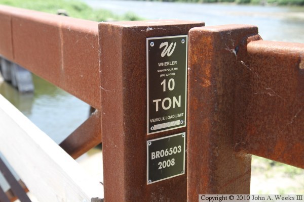
flood control projects were constructed. The photo below is the bridge plate.
These two photos are views from the northeast side of the river looking to
the south. The diversion channel is on the right side of the bridge in the
photo above. The photo below shows the large wings on the abutments. Given
the muddy soil, the bridge would quickly was out without these wings.
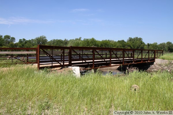
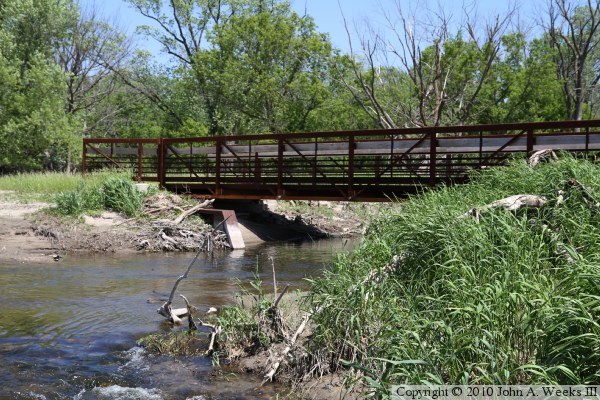
These two photos are views of the upstream side of the bridge. The photo
above is a view from the northwest corner of the structure, while the photo
below is looking to the north from the south side of the channel. Note the
steel wing dams on each side of the Minnesota River channel just upstream
of the bridge. These wing dams help hold back some of the flow from the
diversion channel during periods of moderately high water in an attempt to
keep the water flowing into wetlands area to the south rather than flooding
the river channel.
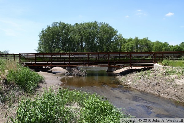
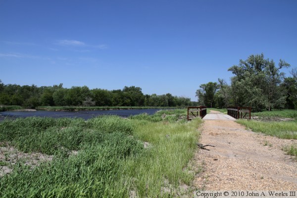
These two photos are final views of the southern of the three bridges that
carry the Minnesota Headwaters Trail over the Minnesota River as we start to
walk back to the trailhead. The photo below is looking north towards the
southeast end of the structure. The photo above is a wider view of the
scene looking northwest along the trail and the diversion channel. The
original channel of the Minnesota River enters from the far left side of the
photo, crosses the diversion channel, and then flows under the bridge.