Current Weather Conditions
John A. Weeks III
Friday, December 6, 2024, 3:39:03 AM CST
Home Photo Tours Rail Fan 12 Easy Steps
Aviation Spacecraft Highways & Bridges About The Author
 
Google Search
Maps   Groups   Images   Search
 
  Home
  • 12 Easy Steps
  • Aviation
  • Spacecraft
  • Highways & Bridges
    » Bridge Photography
      - MSP River Bridges
      - C & D Canal
      - Illinois River
      - Minnehaha Creek
      - Minnesota River
      - Mississippi River
        › Lake Itasca Area
        › Bemidji Area
          · Beltrami Co Hwy 7
          · Fern Lake Road Br
          · Jefferson Ave Bridge
          · US-2 Bemidji Bridge
          · Yellowhead Road Br
          · BNSF Bemidji Br
          · Bemidji Ped Bridge
          · Nymore Bridge
          · MN-197 Bridge
          · Lake Bemidji Ped Br
          · Beltrami Co Hwy 19
          · Stump Lake Dam
          · Beltrami Co Hwy 12
          · Beltrami Hwy 8 (W)
        › Cass Lake - Ball Club
        › Grand Rapids Area
        › Blackberry - Crosby
        › Brainerd Lakes Area
        › Little Falls Area
        › St. Cloud Area
        › North Metro Area
        › Port Of Minneapolis
        › St. Anthony Falls Area
        › Mississippi Rvr Gorge
        › St. Paul Area
        › S St. Paul - Hastings
        › Red Wing - Winona
        › La Crosse Area
        › Lansing - Clinton
        › Quad Cities Area
        › Muscatine - Louisiana
        › St. Louis Area
        › Chester - Cairo
        › Miss - Tenn - Ark
        › Ark - Miss - Louisiana
        › Louisiana Structures
      - Missouri River
      - St. Croix River
      - St. Louis River
      - Wisconsin River
      - Best Miss River Photos
      - Cable Stayed Bridges
      - McGilvray Road Bridges
      - I-35W Bridge Disaster
      - Miscellaneous Bridges
      - Madison County Bridges
      - Hist Br Weekend 2013
    » Road Geek Topics
  • Photo Tours
  • Rail Fan
  • About The Author
 
Site Search By JRank
Highways, Byways, And Bridge Photography
Beltrami Co Highway 12
Mississippi River Highway Crossing
Near Bemidji, MN

Beltrami Co Highway 12

• Structure ID: NBI 04511
• Location: River Mile 1275.6
• River Elevation: 1,318 Feet
• County: Beltrami
• Highway: Beltrami County Highway 12
• Daily Traffic Count: 1,850 (2003)
• Bridge Type: Steel Girder
• Bridge Length: 140 Feet, 70 Foot Longest Span
• Bridge Width: 36 Feet, 2 Lanes
• Height Above Water: 11 Feet (To Low Steel)
• Date Built: 1975
The Highway 12 bridge is located just downstream from the Stump Lake Dam, sometimes known locally as the Otter Tail Power Dam. The fast moving cold water is ideal habitat for large fish. Based on the activity around the bridge, large numbers of people appear to take advantage of the excellent fishing at this location.

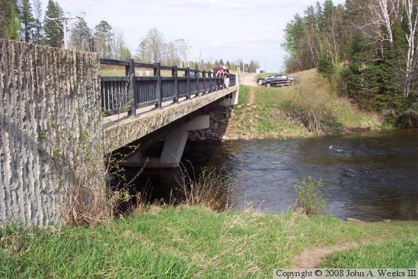
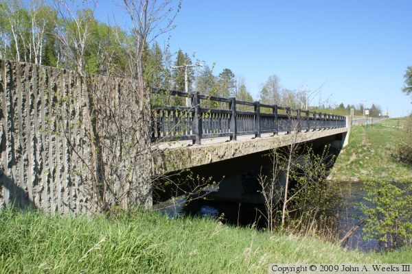
The bridge itself is an attempt to make an attractive structure out of an otherwise routine bridge. The bridge features broken wall concrete accents and ornamental iron railings. Unfortunately, form carried more weight than function, and the bridge needs to be updated to meet current standards. The key problem is the railings. They are simply bolted to the deck. This might hold up a pedestrian, but it offers little resistance to a speeding car. In addition, the open bottom of the railing allows snow that is kicked up from a snowplow to go through the railing and into the river. That is not good since it pollutes the water and adds salt to the river. What is needed is a large concrete railing, or at least a healthy sized curb.

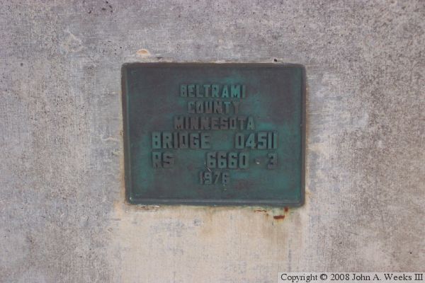
An interesting detail is that the construction records and NBI database state that the bridge was built and open before the end of 1975, yet the bridge plate has 1976. I do not know why there is a difference in the dates, but I suspect that the bridge may have been open ahead of schedule, or possibly opened before final construction details were completed.

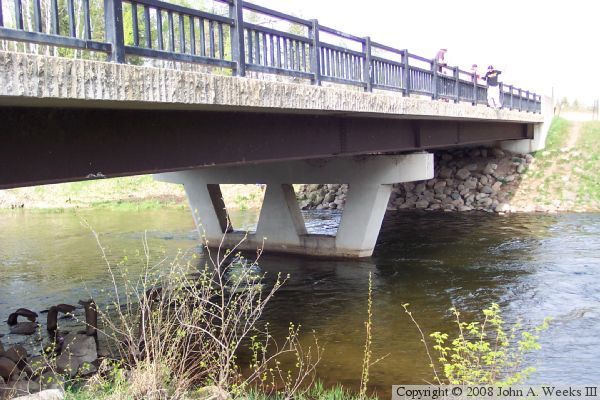
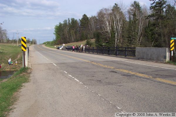
The photo above is a view under the bridge from the water level at the southwest corner of the bridge. Steel remains from the previous bridge at this location are visible in the lower left corner corner of the photograph. The photo below is a view from the northwest corner of the bridge looking east across the traffic deck. Several groups of people are enjoying the unusually warm spring day to try their luck at fishing.

Beltrami Co Highway 12
These two photos are a similar view of the downriver face of the bridge from the southwest corner of the structure. The upper photo was taken several years before the lower photo. Notice that the brush in the foreground has grown considerably in the time between these two views.

Beltrami Co Highway 12
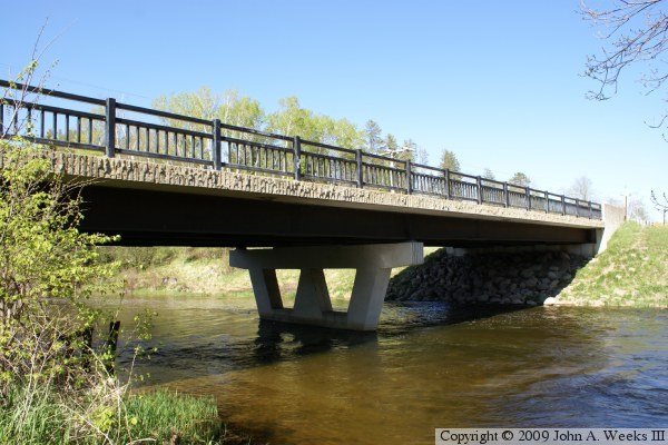
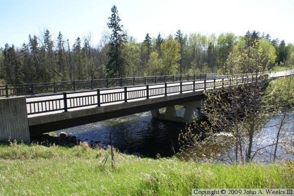
The photo above is the downriver face of the bridge as seen from the riverbank on the west side of the Mississippi River. The photo below is the upriver face of the bridge as seen from high ground located northeast of the structure.

Beltrami Co Highway 12
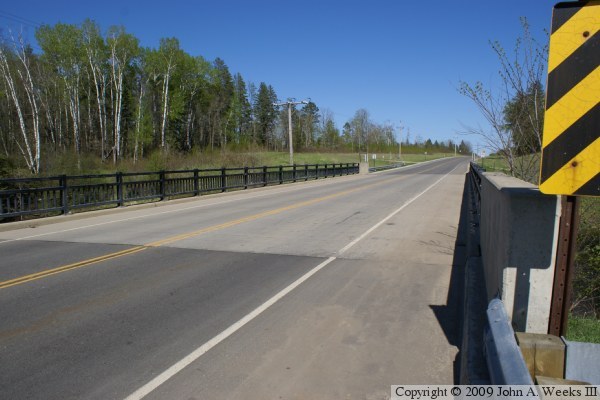
The photo above is the traffic deck from the southwest corner of the bridge. The photo below is the bridge plate.

Beltrami Co Highway 12

Made With Macintosh
Authored by John A. Weeks III, Copyright © 1996—2016, all rights reserved.
For further information, contact: john@johnweeks.com