| Highways, Byways, And Bridge Photography |
Helena Bridge
US-49 Mississippi River Crossing At Helena
Helena, Arkansas
|
• Structure ID: |
NBI: 000000000002899. |
|
• Location: |
River Mile 661.8. |
|
• River Elevation: |
151 Feet. |
|
• Highway: |
US-49. |
|
• Daily Traffic Count: |
7,000 (2002). |
|
• Bridge Type: |
Continuous Steel Truss Through Deck. |
|
• Length: |
5,204 Feet, 3,108 Foot Truss, 840 Foot Longest Span. |
|
• Width: |
28 Feet, 2 Lanes. |
|
• Navigation Channel Width: |
800 Feet. |
|
• Height Above Water: |
119 Feet. |
|
• Date Built: |
Opened July 27, 1961. |
The Helena Bridge is a very long bridge. The continuous truss superstructure
has 5 spans covering 3/5 of a mile, a total length that is longer than the
I-10 bridge in Baton Rouge or the Business US-90 bridge in New Orleans. When
you cross this bridge, it seems to go on forever. The river crossing spans
from the river flats on the Mississippi side to the levee on the Arkansas side
resulting in approach trestle spans are relatively short and steep. Factor in
the narrow bridge deck, and you have a bridge that many people find to be a
white-knuckle experience.
The second thing you notice about the Helena Bridge is that it is pretty
lonely out there. Helena is a very small town, and, at least today, has very
little going on. The opposite side of the river has nothing but a small
casino. It is true that Helena was a major cotton and shipping center during
the riverboat era, but those industries were largely a memory by the time
this bridge was constructed in the late 1950s. The net result is a bridge
with the lowest traffic count on the lower Mississippi River. One wonders why
it was even built. Mark Twain, however, felt otherwise. He stated that
Helena occupied the prettiest location on the Mississippi River. Many
restored period homes still exist in the city. In fact, Twain helped raise
funds to build the nearby Delta Cultural Center.
The Helena Bridge was struck by a dragline crane as it was being towed
upriver on July 15, 1997, resulting in the bridge being closed. A temporary
pedestrian bridge was brought in to cross the damaged area of the bridge.
A shuttle service was established to transport people from the marina on
the west side of the river to the pedestrian bridge, where the passengers
would cross the damaged section on foot using the temporary bridge, and then
be picked up by a second shuttle to be transported to the Lady Luck Casino
on the east side of the river. This shuttle service ran during the early
morning and late afternoon to allow commuters to get to their jobs on
the other side of the river. The bridge reopened on August 4, about two
weeks earlier than initially predicted.
This was not the only time that the Helena Bridge was struck by river traffic.
In fact, barge strikes are very common despite the bridge being on a
relatively straight and calm section of river. For example, at around 2 PM on
January 9, 2011, a barge broke away from the towboat ‘Chris
Parsonage’, struck a bridge pier, then sank in the Mississippi River.
The Arkansas Highway Department checked the bridge for damage. No damage was
found, so the bridge was not closed after this accident.
Due to all the barge strikes, the states of Arkansas and Mississippi applied
for a grant through the TIGER program, which stands for Transportation
Investment Generating Economic Recovery. A grant was awarded in December, 2011,
as part of the TIGER III program to install Intelligent Transportation Systems
on several bridges over the Mississippi River. The improvements will include
dynamic messaging signs, vehicle detection devices, CCTV, highway advisory
radio, and other fiber optic connections that would coordinate communication
across the bridges, as well as real-time river monitoring systems that will
provide information for barges traveling beneath the bridges. It is hoped
that these systems will reduce barge strikes and allow highway crews to
better respond to and manage any future incidents.
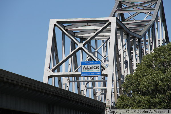
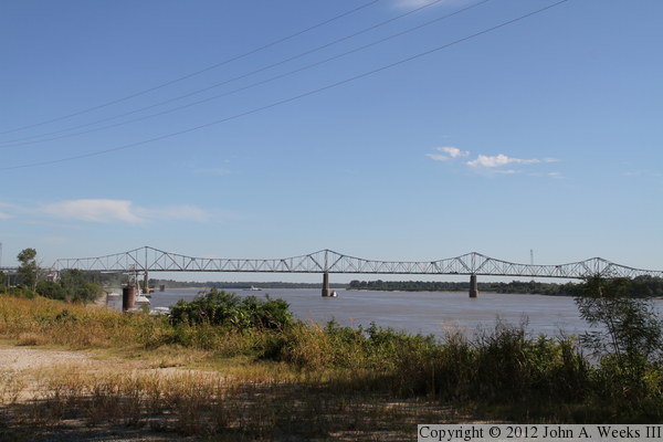
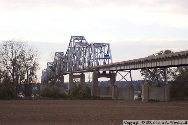
The photo above is a view of east end of the Helena Bridge from ground level
on the Mississippi side of the river. This is a short distance telephoto
view, which compresses the background making the bridge structure look very
massive. I was attempting to get a fairly tight view of the Arkansas state
line sign. In retrospect, I wish I had backed off the zoom just a bit so
the top of the bridge wasn't cut off.
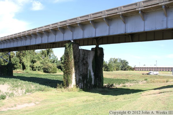
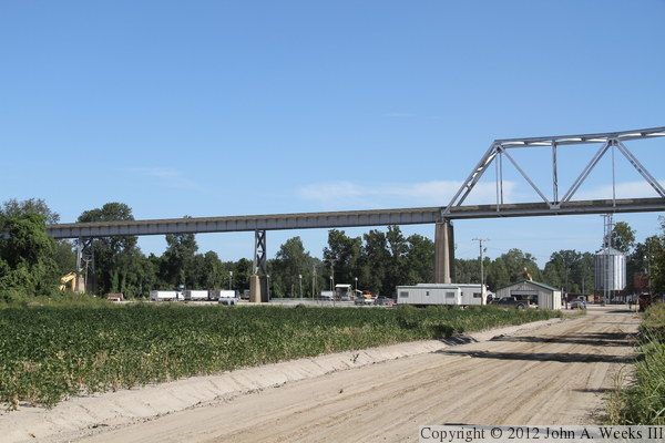
These two photos, and the six that follow, are from the Mississippi side
of the river at the east end of the bridge. The photo above is looking
west along the south side of the approach trestle. The photo below is
a closer view of the bridge piers as seen from the north side of the
approach trestle.
These two photos are views from the access road to the Isle of Capri Lula
Casino. Traffic traveling eastbound on US-49 uses this access road to enter
and exit the casino. The photo above is looking northeast towards the first
approach trestle span, with the bridge abutment hidden in the shadows behind
the trees. The photo above is the second trestle pier heading eastbound.
It was very bright on the day I visited in late summer of 2011, resulting in
the background being washed out. The truck in the distance is parked in the
oversized vehicle parking lot at the casino.
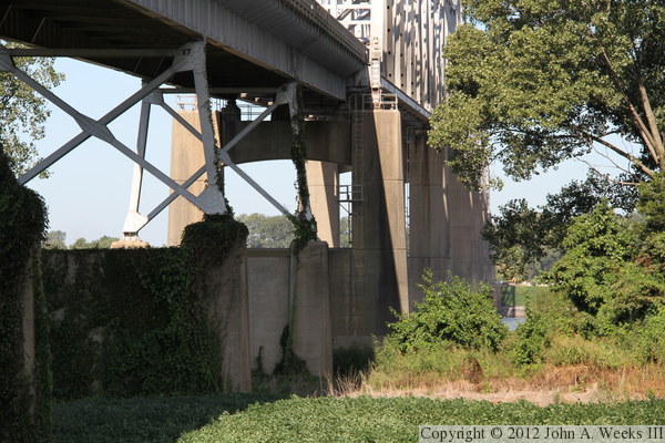
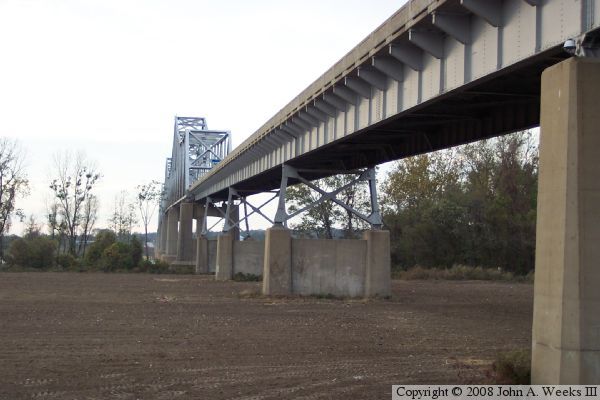
The east approach trestle has two concrete piers followed by three steel
truss piers. The photo above is looking northwest towards the three
truss piers. The photo below is a similar view looking west along the
length of the approach trestle towards the main river truss spans.
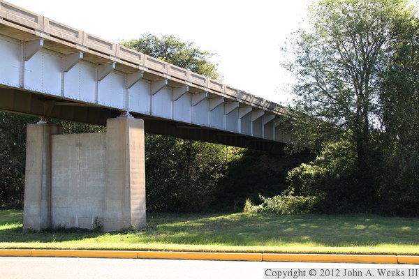
The photo above is a closer view of the truss piers supporting the approach
trestle. The photo below is the underside of the approach trestle. With
only two man parallel bridge girders, this span would be considered to be
fracture critical. That is, if either of these girders were to fail, the
approach trestle would collapse. The steel does appear to be freshly painted
and is being maintained very well, so risk of that happening is remote.

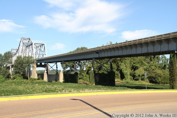
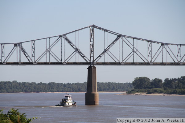
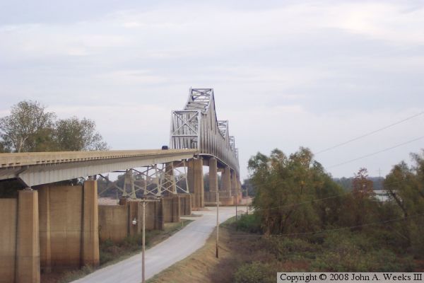
These two photos, and the 10 that follow, are views from the Arkansas side
of the Mississippi River taken from downstream of the Helena Bridge. The
photo above is the last two spans of the west approach trestle and the
western end of the main bridge truss spans. The facility located under
the bridge is the Helena Marine Barge Terminal, which handles grain,
fertilizer, and other farm products. The photo below is the bridge
structure at the second main bridge pier on the west side of the river.
The dock in the foreground is the Archer Daniels Midland Company soybean
plant. The plant consists of 108 concrete silos and four steel storage
bins for a total capacity of 7-million bushels of beans. It was the
largest soybean processing plant in the world when it was built in the
early 1960s.

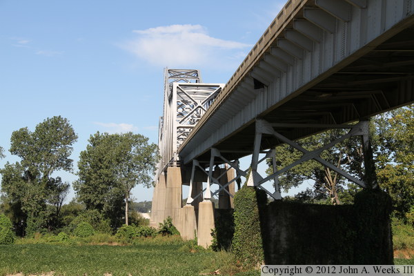
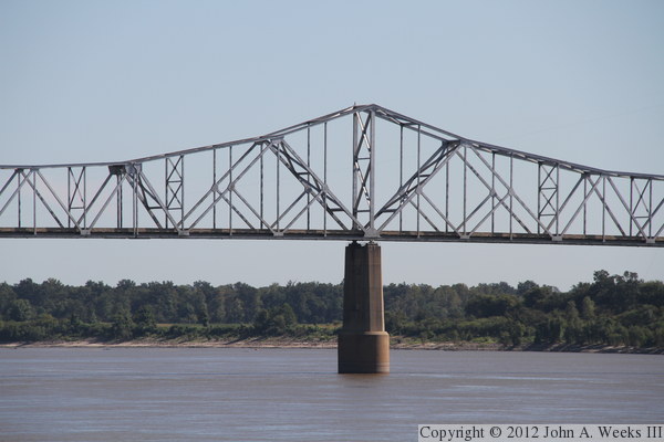
The photo above is the third main bridge pier counting from the west end
of the structure. The photo below is the forth main bridge pier. These
two photos show that the truss is one long continuous structure rather than
being a series of smaller trusses set end to end.

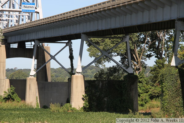
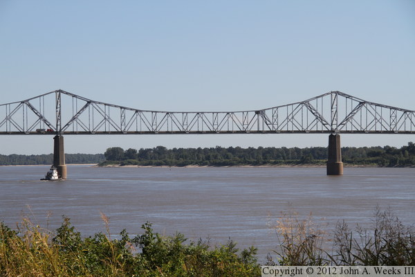
The photo above is the second bridge span from the west end of the structure.
The main river navigation channel passes under this span. The photo below
is the third span from the west end of the structure. River traffic can
also pass under this span, but it is slightly shallower. The spans to the
east are too shallow for barge traffic.
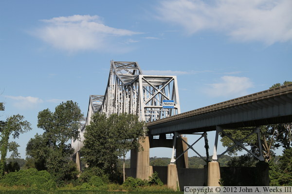
The photo above is a view of nearly the entire main bridge truss structure.
This view is from about 3/4 of a mile downstream. The photo below also shows
a majority of the main bridge truss spans. This view is from about 1,000 feet
downstream of the west send of the bridge. There is enough scrub brush along
the riverbank that it is hard to get a clear view from ground level. I ended
up standing on top of my car for both of these photos.


The photo above is the third main bridge pier counting from the west end
of the bridge. The photo below are the first two spans at the east end
of the bridge. Counting from the west, this is the forth, fifth, and
sixth main bridge piers. These two views are from about 1,200 feet downstream
of the bridge.

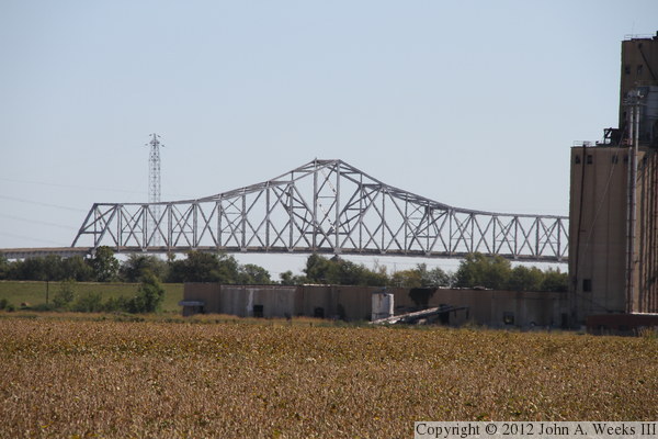
These two photos are looking northeast from Westover Road, which is about a
mile from the west river bank. The photo above is the west end of the
bridge, while the photo below is a view of the entire truss structure. The
concrete silos at the right edge of the photo are part of the ADM soybean
processing plant.


These two photos, and the 10 that follow, show a typical bridge crossing
heading westbound from Mississippi into Arkansas. These crossing was made
around 10 AM on a bright late summer morning in 2011. In the photo above,
we are approaching the east end of the approach trestle. We are climbing
up the east approach trestle in the photo below.
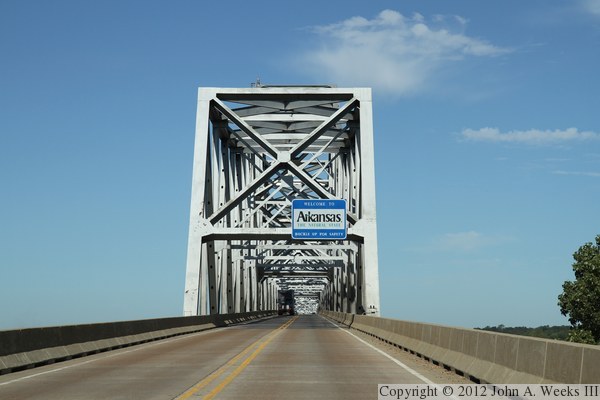
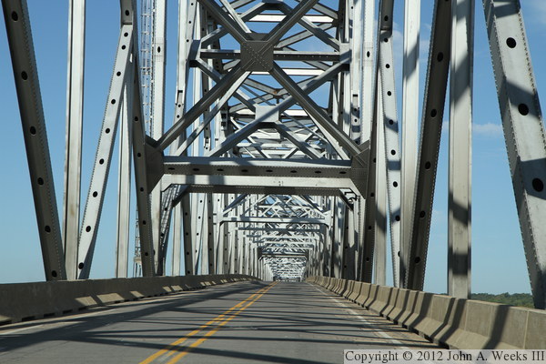
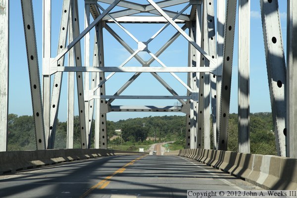
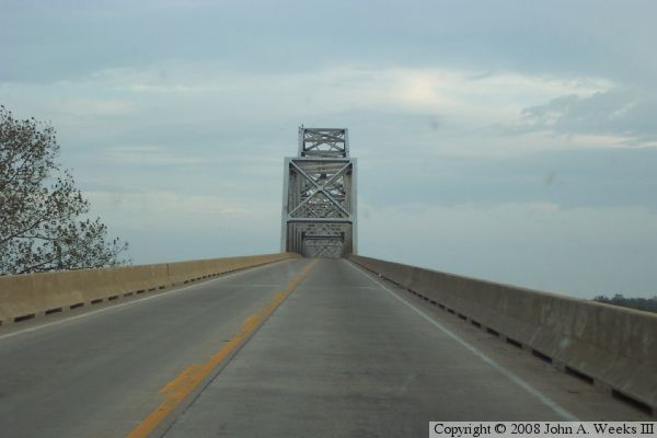
These two photos continue our westbound bridge crossing. In the photo
above, we are approaching the east bridge portal, while in the photo below,
we are crossing the first truss span. The first one and a half spans at
each end of the bridge has a noticeable uphill slope, while the middle
span is mostly level.
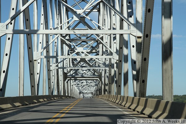
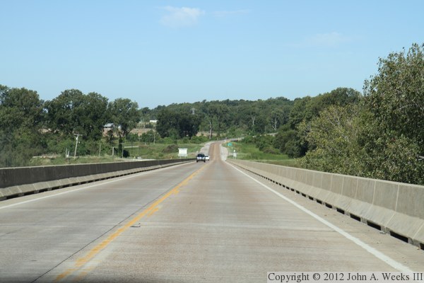
These two photos continue our westbound bridge crossing. In the photo
above, we are passing the second main bridge pier and entering the second
bridge span. The bridge deck levels out about half way across this second
span. In the photo below, we are passing the third main bridge pier. The
bridge deck is level across half of the second, all of the third, and
half of the forth bridge spans.
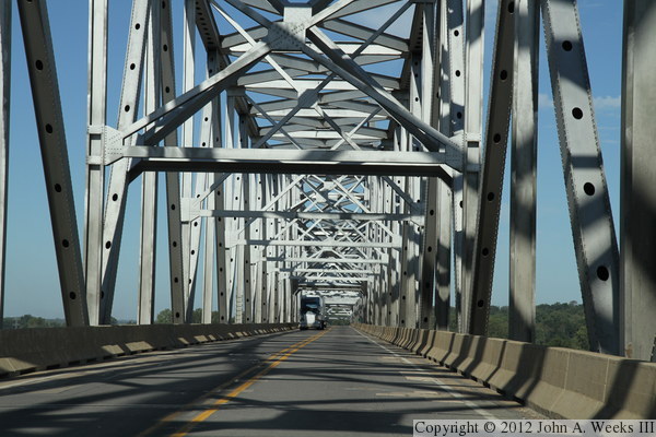
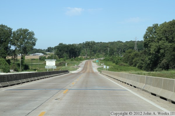
These two photos continue our westbound bridge crossing. In the photo
above, we are near the center of the bridge crossing the third truss span.
In the photo below, we are passing the forth main bridge pier and approaching
the point where the bridge deck starts to slope down towards the west
bridge portal.

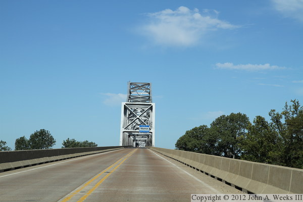
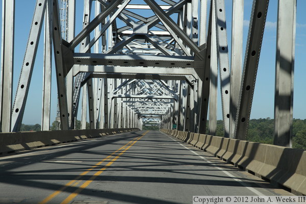
These two photos continue our westbound bridge crossing. In the photo
above, we are passing the fifth main bridge pier and entering the final
bridge span at the west end of the structure. In the photo below, we
have entered the west approach trestle and are heading downhill towards
the levee on the Arkansas side of the river.
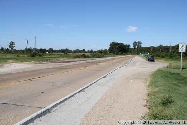
These two photos conclude our westbound bridge crossing. In the photo
above, we are approaching the west end of the west approach trestle and
west bridge abutment. The wide spot in the road at the center of the photo
is the former location of the toll booth. The photo below is a ground
level view of the location of the old toll plaza.

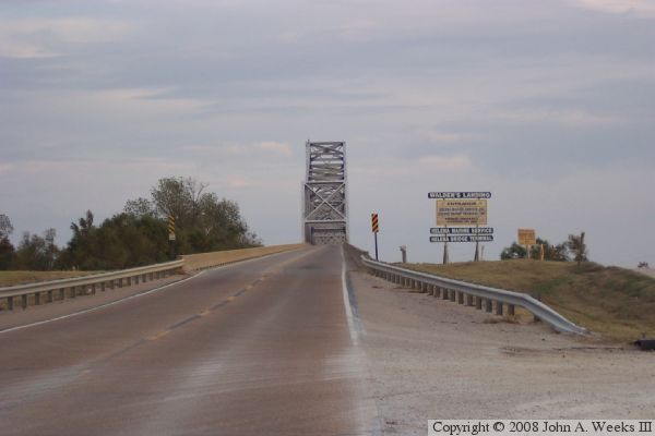
The photo above is a highway sign located about a mile and a half west of
the bridge. It includes a Great River Road sign as well as an America's
Byways logo sign. The photo below is a sign located near the former toll
plaza for the Trail of Tears Removal Route. This sign was erected by the
Department of Arkansas Heritage. It is a local route and not part of
either the state Trail of Tears Byway or the Trail of Tears National
Historic Route.

These two photos, and the four that follow, are older photos from late fall of
2005. The photo above is a view of the south face of the structure as seen
from the Mississippi side of the crossing on the east side of the Mississippi
River. The photo above is a view from the south side of the highway looking
to the east from the Arkansas side of the river.
The photo above is a view looking east down the south face of the Helena
Bridge. The photo below is the south face of the bridge as seen from the
Mississippi side of the river crossing.
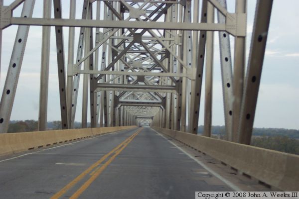
These two photos are views of the Helena Bridge from the traffic deck
while crossing the bridge eastbound heading into Mississippi. The photo
above is climbing the approach span towards the main truss structure.
The photo below is traveling through the massive truss.
|
