Current Weather Conditions
John A. Weeks III
Friday, July 26, 2024, 7:20:45 PM CDT
Home Photo Tours Rail Fan 12 Easy Steps
Aviation Spacecraft Highways & Bridges About The Author
 
Google Search
Maps   Groups   Images   Search
 
  Home
  • 12 Easy Steps
  • Aviation
  • Spacecraft
  • Highways & Bridges
    » Bridge Photography
      - MSP River Bridges
      - C & D Canal
      - Illinois River
      - Minnehaha Creek
      - Minnesota River
      - Mississippi River
        › Lake Itasca Area
        › Bemidji Area
        › Cass Lake - Ball Club
        › Grand Rapids Area
        › Blackberry - Crosby
        › Brainerd Lakes Area
        › Little Falls Area
        › St. Cloud Area
        › North Metro Area
        › Port Of Minneapolis
        › St. Anthony Falls Area
        › Mississippi Rvr Gorge
        › St. Paul Area
        › S St. Paul - Hastings
        › Red Wing - Winona
        › La Crosse Area
        › Lansing - Clinton
        › Quad Cities Area
        › Muscatine - Louisiana
        › St. Louis Area
        › Chester - Cairo
        › Miss - Tenn - Ark
        › Ark - Miss - Louisiana
          · Helena Bridge
          · Charles W. Dean Br
          · Ben G Humphreys Br
          · Greenville Bridge
          · Old Vicksburg Bridge
          · Vicksburg Bridge
          · Natchez-Vidalia Br
          · Old River Control
        › Louisiana Structures
      - Missouri River
      - St. Croix River
      - St. Louis River
      - Wisconsin River
      - Best Miss River Photos
      - Cable Stayed Bridges
      - McGilvray Road Bridges
      - I-35W Bridge Disaster
      - Miscellaneous Bridges
      - Madison County Bridges
      - Hist Br Weekend 2013
    » Road Geek Topics
  • Photo Tours
  • Rail Fan
  • About The Author
 
Site Search By JRank
Highways, Byways, And Bridge Photography
Natchez-Vidalia Bridge
US-65/US-84 Mississippi River Crossing At Natchez
Natchez, Mississippi

US-65/US-84 Bridge

Westbound Span
• Structure ID: NBI: 21000840010001A.
• Location: River Mile 363.30.
• Length: 4,205 Feet Overall, 3 Spans Of 848 Feet Each.
• Width: 24 Feet, 2 Lanes.
• Date Built: Opened September 26, 1940.
   
Eastbound Span
• Structure ID: NBI: 21000840010001B.
• Location: River Mile 363.29.
• Length: 4,202 Feet Overall, 3 Spans Of 848 Feet Each.
• Width: 42 Feet, 2 Lanes Plus Shoulder.
• Date Built: Opened July 1988.
   
Statistics Common To Both Bridges
• River Elevation: 30 Feet.
• Highway: US-65 / US-84.
• Daily Traffic Count: 29,680 (2004).
• Bridge Type: Continuous Steel Truss Through Deck.
• Navigation Channel Width: 848 Feet.
• Height Above Water: 125 Feet.
The Natchez-Vidalia Bridge is actually two parallel bridges. The older 1940 span is on the upriver side of the crossing. That bridge became overwhelmed with traffic, so a twin span was built just downstream of the original bridge. The new bridge opened to traffic in 1988. While the two bridges look very similar and have the same footprint, the newer bridge is wider than the older structure.

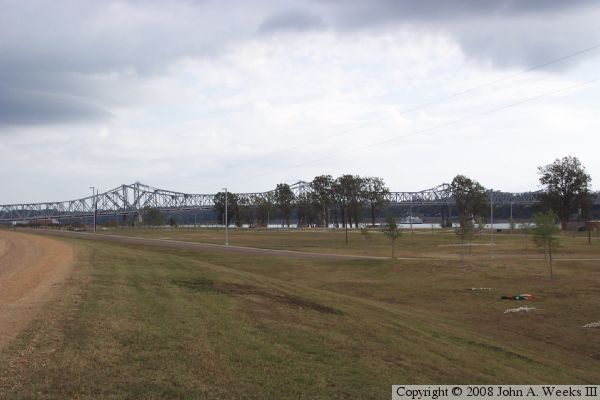
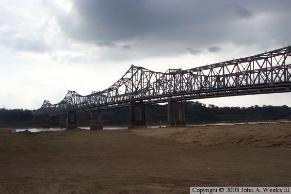
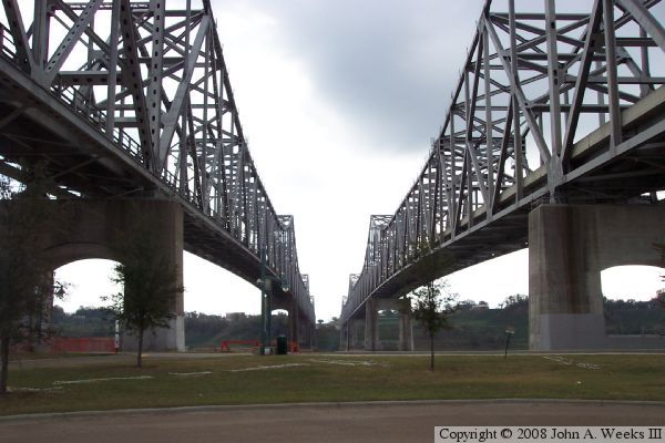
In visiting this area, I was curious why two such small towns as Natchez, Mississippi, and Vidalia, Louisiana, could justify not just one but two huge bridges across the Mississippi River. The City of Vidalia web site clears up the issue noting that over 2-million people live within a 200-mile radius of the twin spans, and the bridges carry an average of nearly 30,000 vehicles per day.

The city of Vidalia has been impacted greatly by the river over the years. Vidalia was ground zero during the great flood of 1927. The city flooded in late may. Many residents escaped by ferry boat to high ground on the east side of the river. Those that remained were forced to camp out for several weeks on a narrow levee, the last dry ground for miles. In total, 26,000 square miles of land in seven states were flooded. The outcry lead to the Flood Control Act of 1928, giving the US Army Corps of Engineers the mandate to implement and maintain food control on the great river.

The Mississippi River affected Vidalia again in the late 1930s. The US Army Corps of Engineers developed a plan to cut off a section of the Mississippi River upriver of Vidalia known as the Natchez Gorge. The new river channel and supporting levees would have left much of Vidalia in the river flood plain with no flood protection. To protect their city, the entire city was relocated a mile southwest to higher ground. Over 100 buildings were moved or demolished and rebuilt at the new town site during 1938 and 1939.

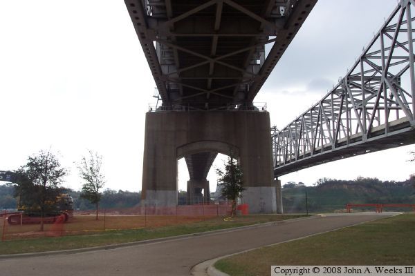
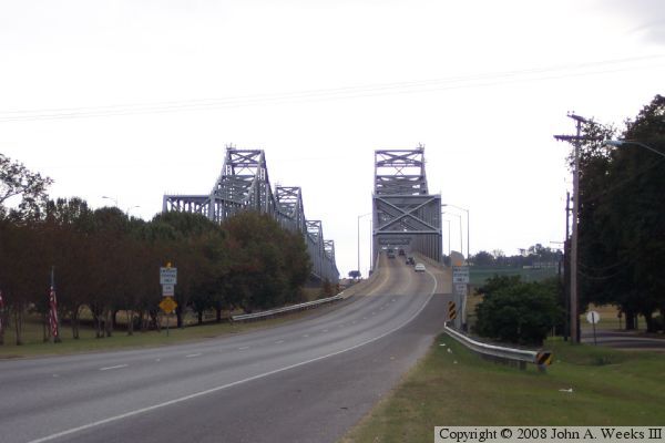
The City of Vidalia and Mississippi DOT are collaborating on a project to add lighting to the twin spans. Mississippi DOT will pay for the lighting project, while the city will supply the electrical power to operate the lights. The $3-million project is expected to be complete in the Spring of 2010. It is hoped that the bridges will become an area attraction after the lighting project is compete.

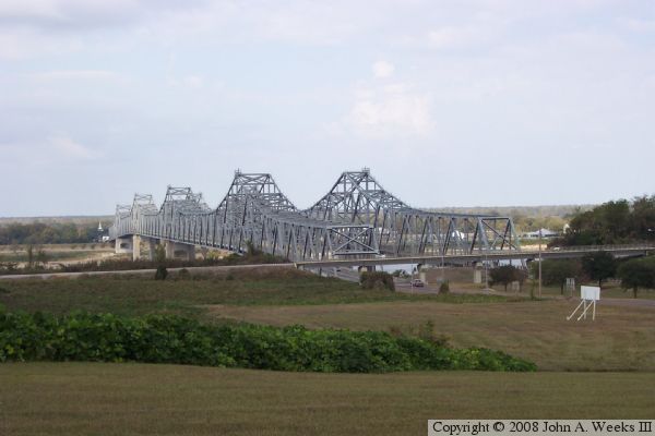
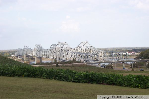
The photo above is a view looking northwest towards the river crossing from an overpass located just east of the bridges. The two truss spans look very similar from a distance despite being built 50 years apart.


US-65/US-84 Bridge
The photo above is another view overlooking the bridges similar to the photo at the top of the page. The photo below is an overview of the river crossing looking north from the Louisiana side of the river on the west bank of the Mississippi.

US-65/US-84 Bridge
US-65/US-84 Bridge
These two photos are views from under the bridge truss spans as seen from the riverside park on the Louisiana side of the river. The photo above is the upriver face on the north side of the older westbound span. The photo below is the downriver face of the newer eastbound span.

US-65/US-84 Bridge
US-65/US-84 Bridge
These two photos are views from under the bridge truss spans as seen from the riverside park on the Louisiana side of the river. The photo above is looking east through a bridge pier on the older of the two bridges. The photo below is looking east from a vantage point midway between the two bridges.

US-65/US-84 Bridge
US-65/US-84 Bridge
The photo above is looking northeast towards the downriver face of the bridge spans from the riverside park located on the west bank of the Mississippi River. The photo above is the west approach to the newer of the two bridges.

US-65/US-84 Bridge
US-65/US-84 Bridge
These two photos are views of the bridge portals as seen from the traffic deck. The photo above is heading eastbound on the newer of the two bridge spans. The photo below is heading westbound on the older of the two bridge spans.

US-65/US-84 Bridge

Made With Macintosh
Authored by John A. Weeks III, Copyright © 1996—2016, all rights reserved.
For further information, contact: john@johnweeks.com