| Highways, Byways, And Bridge Photography |
Vicksburg Bridge
I-20 Mississippi River Crossing At Vicksburg
Vicksburg, Mississippi
|
• Structure ID: |
NBI: 053304510900001. |
|
• Location: |
River Mile 437.7. |
|
• River Elevation: |
49 Feet. |
|
• Highway: |
I-20. |
|
• Daily Traffic Count: |
28,200 (2003). |
|
• Bridge Type: |
Continuous Steel Truss Through Deck. |
|
• Length: |
12,974 Feet Overall, 870 Foot Longest Clear Span. |
|
• Width: |
60 Feet, 4 Lanes. |
|
• Navigation Channel Width: |
846 Feet. |
|
• Height Above Water: |
116 Feet. |
|
• Date Built: |
Opened February 14, 1973. |
This bridge near Vicksburg, Mississippi, was built as part of the Interstate
I-20 highway project. Due to the configuration of the river and the existing
US-80 bridge, safe river navigation demanded that the I-20 bridge had to be
built either right next to the existing US-80 bridge, or it would need to be
at least a mile and a half downstream. The decision was made to build the new
bridge next to the old bridge. This decision forced a key design element in
that the piers of the new bridge had to match the spacing of the piers on the
old bridge. This was to allow barge tows to sail straight through both
structures without having to zigzag. While the two bridges look similar, the
new bridge has a simpler design based on fewer but heavier structural members.
It was noted that the Old Vicksburg Bridge suffered an event where the ground
under two piers moved shortly after that bridge was completed. The old bridge
was able to survive that incident, but the structure was left with a slight
lean. As a result, engineers were watching the new bridge for signs of
similar movement. In a two year period from March 2000 to March 2002, the
eastern two piers of the I-20 bridge moved 4 inches laterally. A consulting
engineering firm was brought in to look at the situation. They discovered an
active fault line running along the riverbed near the east bank of the
Mississippi. It will be interesting to see how this turns out in the future.
Another ground movement problem has surfaced around 2010. While the ground
movement due to the fault was being studied, it was noticed that the riverbank
was moving slightly. An old retaining wall built when the old bridge was
put up started to fail. That can lead to landslides on the bluff along
the east bank of the river. Enough ground movement could seriously damage
the bridge. Asa result, a project is in progress in 2011 and 2012 to
stabilize the bluff in the vicinity of the bridges.
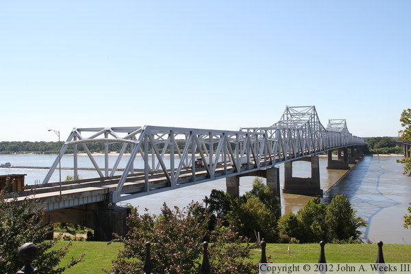
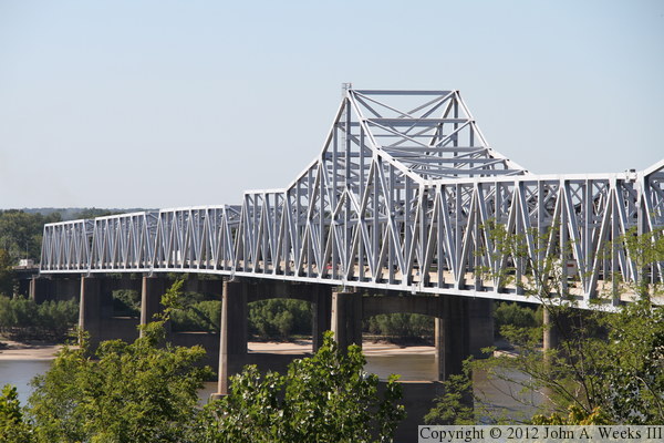
The photo above is a view looking west along the upstream north face of the
Vicksburg Bridge. The vantage point is the sidewalk along the parking lot
at the Mississippi Welcome Center located between the two bridges. The photo
below is a closer view of the bridge truss structure as seen from the
observation deck at the Welcome Center.
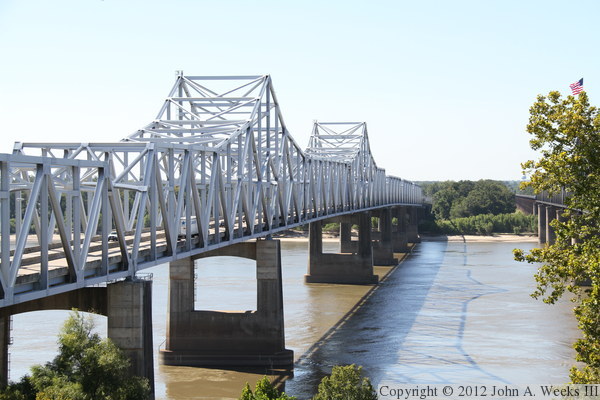
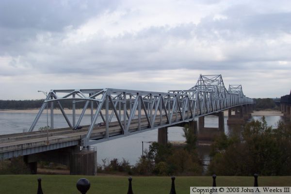
The photo above is a view looking west along the upstream face of the truss
structure. The vantage point is the sidewalk along highway US-61 between
the welcome center and the Interstate highway I-20 overpass. The photo below
is a view of the approach span at the east end of the bridge as seen from
the pedestrian bridge leading to Navy Circle, a Civil War monument located
just north of the welcome center.
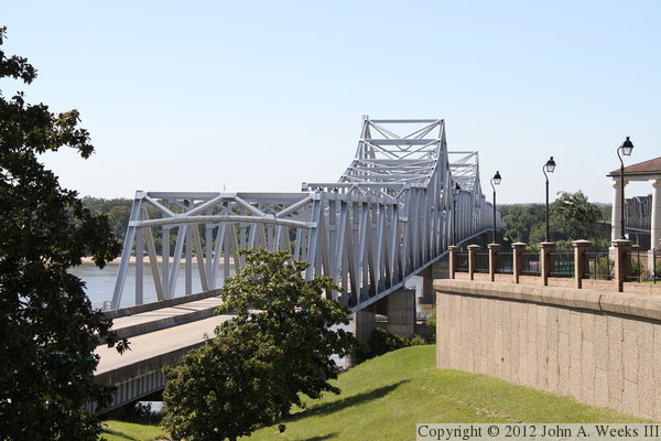
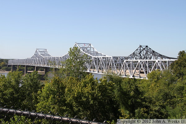
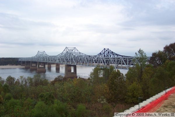
These two photos are views looking to the northwest towards the downstream
face of the Vicksburg Bridge. The photo above shows the western half of
the bridge. That is as much of the bridge that I could see without having
trees in the way. The photo below is a wider view of the vast majority of
the truss spans including the trees that are in the way.

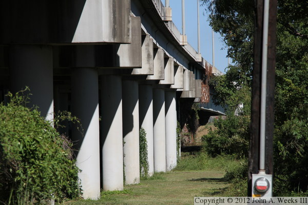
These two photos are views are looking northwest towards the east end of the
I-20 Vicksburg Bridge. The vantage point is the highway US-61 overpass over
Interstate highway I-20. While these to photos are very similar, they are
taken from slightly different angles. I like the photo above, except that
the utility pole is obscuring the bridge. I moved just slightly to get out
of the way of the utility pole in the photo below, but now the sign gantry
is blocking the view of the approach span.

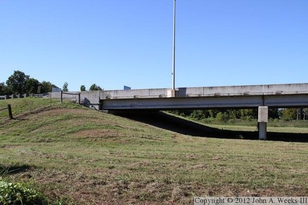
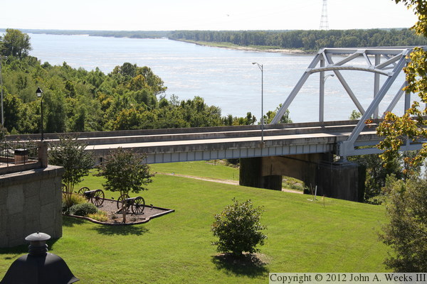
The photo above is looking north towards the west bridge abutment near the
small town of Delta, Louisiana. The photo below is where the bridge passes
over Old Highway 80 near the west abutment. Note that these three bridge
piers are each set at a different angle to the bridge deck. The pier on
the left is set perpendicular to the bridge deck, the same as nearly all of
the other bridge piers. The pier on the right is set parallel to Old Highway
80. The pier in the middle splits the difference.
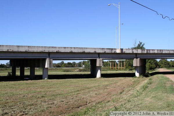
The photo above is a telephoto view looking east along the downstream face
of the approach spans on the Louisiana side of the river. The telephoto
lens compresses distance, making the piers appear to be very close together.
A longer girder span is visible in the background where the bridge passes
over the levee. The photo below is the underside of the bridge as it passes
over Old Highway 80 near the west bridge abutment.


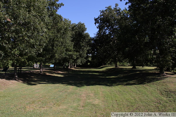
The west end of the Vicksburg Bridge is the site of an interesting chapter
in Civil War history. The rebels in Vicksburg controlled an important
section of the Mississippi River that the Union had to overcome in order
to gain complete control of the river. Rather than lay siege to the city,
an attempt was made to cut a canal across a loop in the river, causing the
Mississippi River to change course and bypass Vicksburg. The canal was built
at great cost in manpower, but the river refused to budge. As a result,
the Union had no choice but to take Vicksburg by force. The west end of
the bridge passes the old canal. The photo above is a marker at the site,
while the photo below is the last remaining section of the canal.
These two photos are older views from the summer of 2005. The photo above is
the downstream face of the Vicksburg Bridge. The vantage point is a hotel
situated two blocks south of Interstate I-20 on the east side of the great
river. The photo below is a view of the upstream face of the Vicksburg Bridge
as seen from the visitor center near the northeast corner of the structure.
|
