| Highways, Byways, And Bridge Photography |
Father Louis Hennepin Bridge
CSAH-52 Mississippi River Crossing
Minneapolis, MN
|
• Structure ID: |
NBI: 27636. |
|
• Location: |
River Mile 854.30. |
|
• River Elevation: |
801 Feet. |
|
• Highway: |
CSAH-52, Hennepin Avenue. |
|
• Daily Traffic Count: |
23,500 (2001). |
|
• Bridge Type: |
Steel Suspension. |
|
• Length: |
1,037 Feet, 625 Foot Suspended Span. |
|
• Width: |
3 Traffic Lanes Per Span, 2 Spans, 134 Feet. |
|
• Navigation Channel Width: |
485 Feet. |
|
• Height Above Water: |
37 Feet. |
|
• Date Built: |
Opened September 1990. |
Bridge fans consider the area around the Father Louis Hennepin Bridge to
be hallowed ground. This location was the site of what is believed to be
the first permanent bridge over the Mississippi River. What was once the
most important bridge over the Mississippi River is now the most elegant
and stylish bridge to span the mighty river.
The first bridge was built in 1854 and was opened on January 23, 1855.
According to the state historical society, it was proclaimed as a link
between the Atlantic and Pacific, and it was called the "Gateway to the
West". The bridge was 620 feet long and 17 feet wide. It was a pure
suspension bridge with tall wooden towers, wire suspension cables, a
stone base, and cast iron anchors. The bridge was built by private
investors and was operated as a toll bridge. The historical society
further reports that the bridge suffered from maintenance problems and
quickly deteriorated. Hennepin County purchased the bridge in 1869
to prepare for construction of a new bridge.
The second bridge was another pure suspension bridge. It was 675 feet
long and 32 feet wide, with towers that were slightly taller than the
first bridge. Due to the importance of the river crossing, the second
bridge was built parallel to the first bridge, and the first bridge was
not removed until after the second bridge opened in 1876. Despite the
second bridge being built to last longer than the first bridge, it also
suffered from maintenance problems, and it was removed in 1891.
Construction of the third bridge started in 1888 and was completed in
1891. This bridge was a steel arch bridge that was designed in-house
by Minneapolis bridge engineers which included Frederick Cappelen, who
designed many of the large concrete arch bridges over the river in the
early 1900s. The third bridge was 1160 feet long, spanning the river
in two 580 foot arches. The bridge had a 56 foot wide wooden roadway
and two 12-foot wide sidewalks. The historical society reports that
the wooden deck was replaced with a steel grid in 1954.
By the 1980s, various members of city government believed that the
third bridge had outlived its usefulness. A bridge inspection
revealed that the bridge was in bad shape. Some engineers felt that
the bridge could not economically be repaired. Other engineers stated
that the bridge could be fixed and could support modern traffic loads.
Preservationists wanted to save the nearly century old bridge. At one
point in the process, it was determined that the river crossing had to
be a minimum of 6 lanes. That doomed the third bridge. It was removed
to make way for the fourth bridge.
The remaining debate on the new Father Louis Hennepin Bridge was the
style of the bridge. Some wanted an economical structure much like
the Plymouth Avenue bridge. While that would serve the purpose, city
hall wanted a signature structure that would reflect the history of
the site and the importance of the river crossing. The design that
emerged was a pair of parallel suspension bridges supported by 150 foot
tall towers. While this certainly would be an amazing bridge, it
came with an amazing price tag that was more than three times the cost
of a conventional structure. Interestingly enough, the resulting bridge
is the shortest pure suspension bridge to carry highway traffic built
in modern times.
Both MN-DOT and NBI consider this to be a single bridge despite there
being two distinct suspension spans side by side.
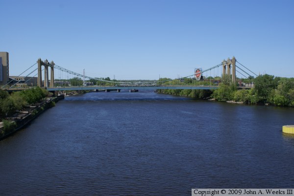
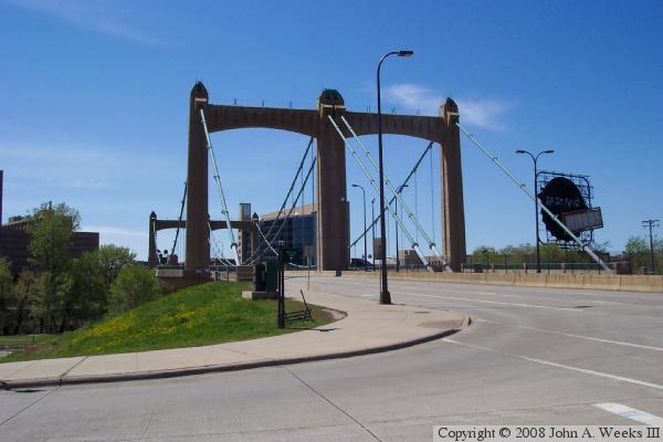
The photo above is a view of the bridge taken from the Third Street Bridge
located 1,150 feet downstream from the Father Louis Hennepin Bridge.
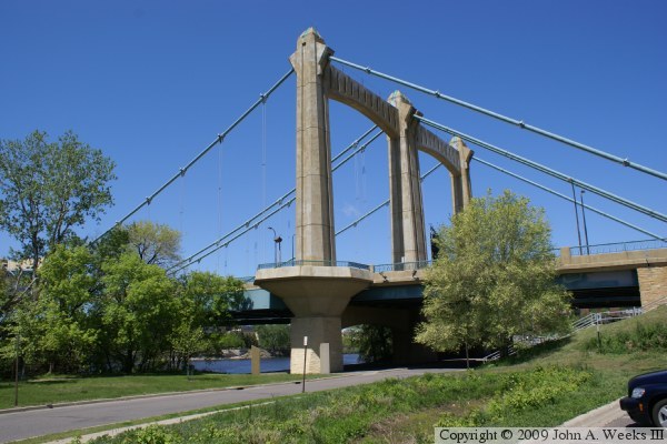
These two photos are the bridge suspension towers. The photo above is the
southwest tower located on the downtown side of the river channel. The photo
below is the northeast tower located on the Nicollet Island side of the
river channel. The towers rise approximately 175 feet above the water, and
are tipped with decorative lights.


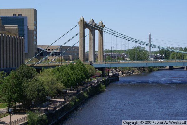
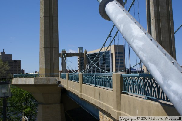
The photo above is a view of the downriver face of the bridge looking
northeast towards Nicollet Island from the downtown side of the river.
The photo below is another view of the tower located on Nicollet Island.
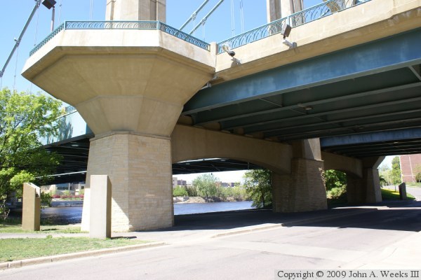
The photo above is the base of the downriver leg of the tower located on
Nicollet Island. A viewing platform is incorporated into the tower at the
bridge deck level. The photo below is another view of this observation
platform from the bridge deck level.

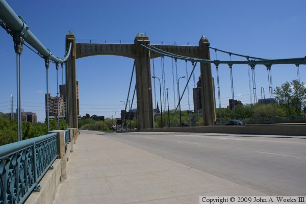
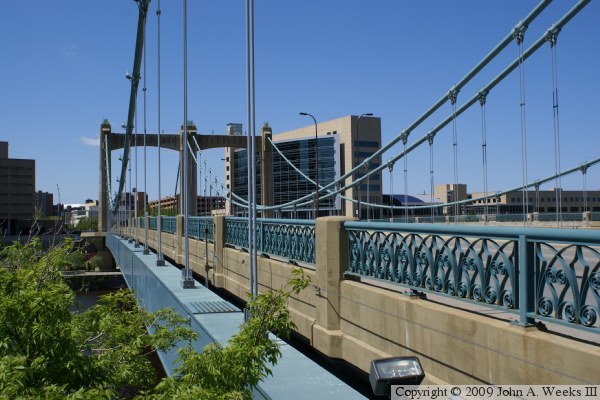
These two photos are views from the bridge deck near mid-span. The photo
above is taken from the downriver side of the bridge looking southwest
towards downtown. The large building to the right of the bridge is the
Federal Reserve Bank. The photo below is taken from the upriver side of
the bridge looking northeast towards the old Main Street area of Minneapolis.
The large building to the left is Riverplace, a mixed office and condo
project, while the building on the left is part of Saint Anthony Main.
The photo above is a view of the beam that carries the bridge on the
downriver side of the structure. The photo below is a close view of
the connection between the vertical suspension cables and the bridge girder.

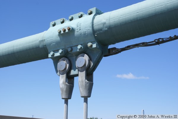
The photo above is a close view of the connection between a bridge suspension
cable and two vertical suspension cables. The photo below is the suspension
cable anchor point on the northeast corner of the bridge.
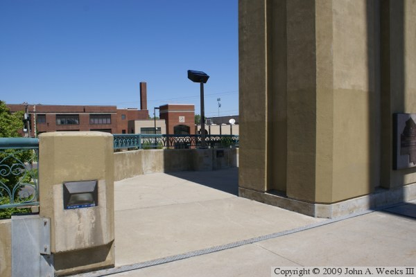
The photo above is the observation platform located adjacent to the
tower at the northwest corner of the bridge. The photo below is another
view of the same observation platform as seen from the sidewalk on
Nicollet Island. The building in the background of the photo above is
the DeLaSalle High School.

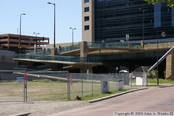
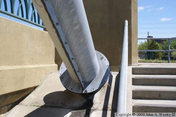
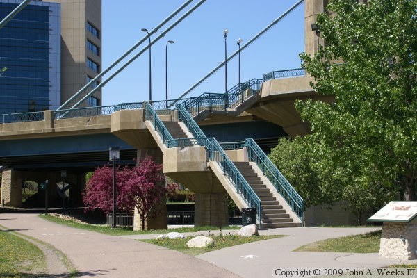
The photo above is the bicycle access ramp leading from the West River
Parkway to the bridge pedestrian walkway. The photo below is the stairway
leading from the West River Parkway to the observation platform on the
downriver tower on the downtown end of the bridge.

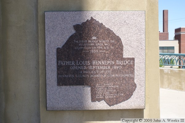
The photo above is the bridge plate. The photo below is the monument
commemorating the opening the bridge and recognizing the first bridge
built across the Mississippi River in 1855.
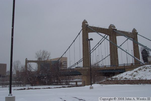
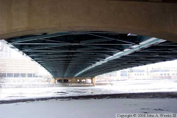
These two photos are views of the bridge during a winter snow storm. The
photo above is a view from Nicollet Island looking southwest towards
downtown Minneapolis. The photo below is taken from directly under the
bridge, again, on the Nicollet Island side of the river. The gap between
spans can be seen in this view. The river would normally be frozen this
time of the year, but a swift current caused by the upper Saint Anthony
Falls dam keeps the water open in all but the coldest weather.
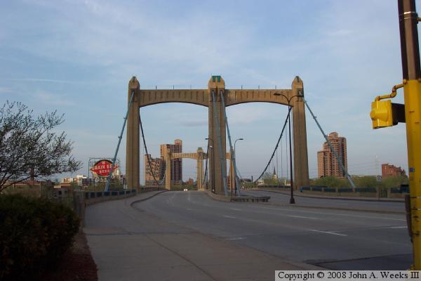
The photo above is looking north across the bridge as seen from street level.
The large building in the background is the River Place condominium project.
The photo below is looking south across the bridge towards downtown. The
large building in the background is the new Federal Reserve Bank. The
Grain Belt sign can be seen in both photos.

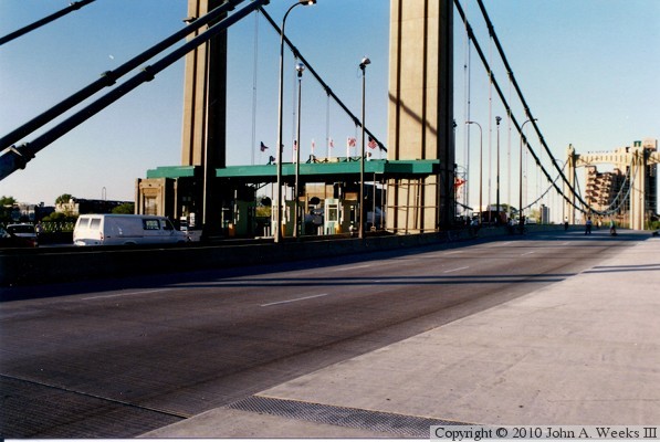
Shortly after the new Hennepin Avenue Bridge opened, it was closed for a few
days in 1992 for the filming of the movie ‘Crossing The Bridge’,
where the bridge played the part of the border crossing between Windsor,
Ontario, Canada, and Detroit, Michigan. These two photos are looking north
down the length of the bridge deck. The northbound lanes are closed, and
the southbound lane features a temporary border crossing station.
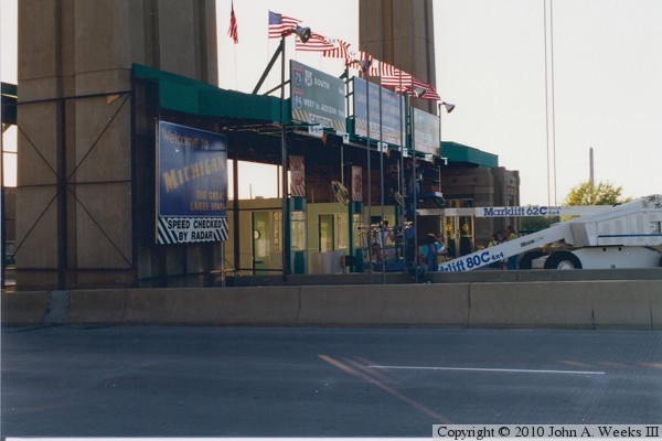
These two photos are the north side of the movie set constructed across the
southbound lanes. The nearest blue sign is a Michigan state line sign, while
the center blue sign states that ‘You Are Entering The United States
Of America’. The remaining two signs are green freeway signs that
give distances to I-75, I-94, and US-24. This set played a major role in
the movie as the three main characters contemplated an attempt to smuggle a
large quantity of heroin into the country from Canada.

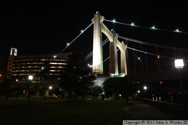
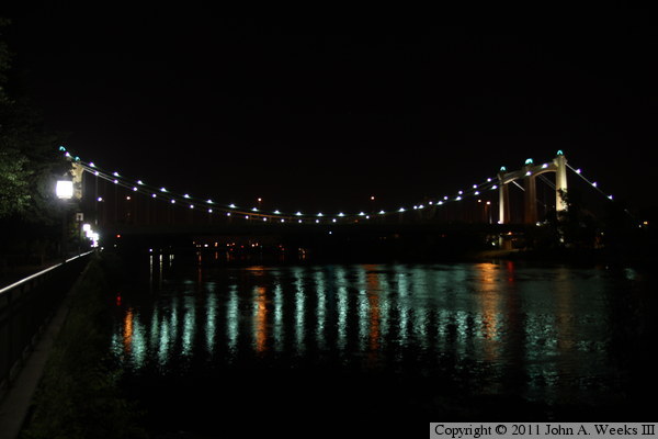
These two photos are night views of the Father Louis Hennepin Bridge.
The photo above is the southwest main bridge tower as seen from the West
River Parkway just downstream from the bridge. The photo below is a view
of the main suspended bridge span as seen from the riverfront walkway
from just upstream of the Third Avenue Bridge.
|
