Current Weather Conditions
John A. Weeks III
Saturday, July 27, 2024, 3:03:19 AM CDT
Home Photo Tours Rail Fan 12 Easy Steps
Aviation Spacecraft Highways & Bridges About The Author
 
Google Search
Maps   Groups   Images   Search
 
  Home
  • 12 Easy Steps
  • Aviation
  • Spacecraft
  • Highways & Bridges
    » Bridge Photography
      - MSP River Bridges
      - C & D Canal
      - Illinois River
      - Minnehaha Creek
      - Minnesota River
        › Ortonville - Odessa
        › Correll - Wegdahl
        › Granite Fls - Rdwd Fls
        › Morton - Judson
        › Mankato - Jordan
          · US-169 North Star
          · Veterans Memorial Br
          · US-14 Bridge
          · Omaha Bridge Ruins
          · MN-22 Bridge
          · Broadway Bridge
          · MN-93 Bridge
          · US-169 Bridge
          · MN-19 Bridge
          · Blakeley Bridge
          · MN-25 Bridge
          · Crvr Co 45 Scott Co 9
        › MSP West Metro
        › MSP South Metro
      - Mississippi River
      - Missouri River
      - St. Croix River
      - St. Louis River
      - Wisconsin River
      - Best Miss River Photos
      - Cable Stayed Bridges
      - McGilvray Road Bridges
      - I-35W Bridge Disaster
      - Miscellaneous Bridges
      - Madison County Bridges
      - Hist Br Weekend 2013
    » Road Geek Topics
  • Photo Tours
  • Rail Fan
  • About The Author
 
Site Search By JRank
Highways, Byways, And Bridge Photography
MN-25 Bridge
Minnesota River Highway Crossing
Belle Plaine, MN

MN-25 Bridge

• Structure ID: NBI: 72012.
• Location: River Mile 52.5.
• River Elevation: 699 Feet.
• Highway: MN-25.
• Daily Traffic Count: 6,800 (2004).
• Bridge Type: Steel Girder, Concrete Deck.
• Length: 593 Feet.
• Width: 44 Feet, 2 Lanes.
• Navigation Channel Width: Non-Navigable.
• Height Above Water: ???.
• Date Built: Opened November 22, 2006.
MN-25 runs generally north and south, but it wanders all over the state between its endpoints near Belle Plaine and Brainerd. Belle Plaine is located on the east side of the Minnesota River, and it is one of three cities that you pass through when traveling south from the Twin Cities on US-169 when heading towards Mankato.

A large three section steel truss bridge stood at this location from 1934 to 2005. The steel truss bridge was obsolete as far as bridges go, but it may have still had more life if the 2001 flood had not happened. During that flood, the rushing waters scoured the soil from around the two piers that sat in the river channel. That action mortally wounded the structure. MN-DOT was able to bring in rip-rap to shore up the piers and abutments, but that was a temporary action at best. The bridge became unsafe and had to be closed, and then removed to make way for a new bridge.

The National Bridge Inventory record for the old bridge is still in the NBI database as bridge number 5260. It is listed as 457 feet long and 27 feet wide, both shorter and narrower than the new bridge.

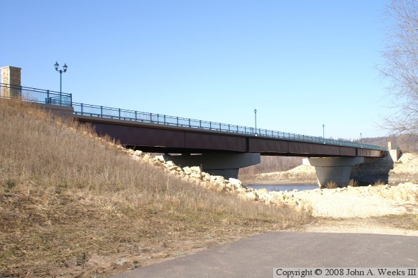
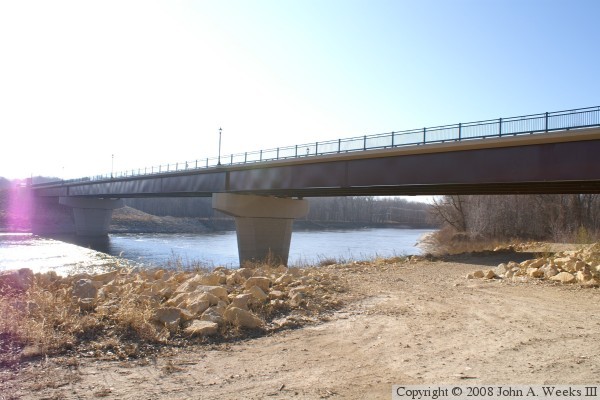
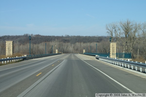
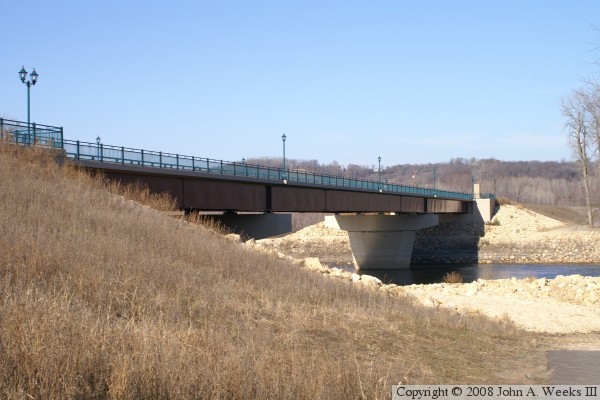
The new MN-25 bridge is a steel girder bridge, which is a bit unusual compared to most new bridges in Minnesota of that size. The bridge is decorated with monuments at each corner, decorative iron works, a fancy railing, green paint highlights, and retro style street lamps. More importantly, the bridge is raised up high enough that it should not flood, at least not in the routine floods that happen every other and every third year. The approach road to the north does look like it is much lower, and probably would flood.

Belle Plaine has a very rich history. It was a major landing for the river boat traffic prior to 1900. A number of industries sprang up in the area, some that went by the wayside, others that are still running. Perhaps the most unusual of those industries was the late 1990s attempt to revive the Excelsior-Henderson motorcycle brand. The founders raised nearly $100-million dollars, some of it from a public employee pension fund, and built a state of the art factory. They attended trade shows, did advertising, set up a dealer network, designed cool logos, built a fantastic motorcycle museum, and did everything except build motorcycles. By the time they started to ramp up manufacturing, they were out of money, and were unable to raise more funding in a world that had gone Internet crazy. The dream ended with investors holding the bag, and the city of Belle Plaine wondering what to do with the empty factory building.

The photo above is looking north along the upriver east face of the MN-25 bridge.


MN-25 Bridge
The photo above is a view looking northwest towards the upriver east face of the MN-25 bridge from the south bank of the Minnesota River. The photo below is looking southwest towards the upriver east face of the MN-25 bridge from the north bank of the river.

MN-25 Bridge
MN-25 Bridge
The photo above is a view of the downriver east face of the MN-25 Bridge during the flood of 2010. The vantage point is very close to the location where the photo directly above was shot. Note the water levels by comparing how much of the bridge piers are visible. The photo below is looking north down the length of the highway deck from the northbound traffic lane. Many of the decorative features are visible in this photo, such as the monuments, decorative railings, and street lamps.

MN-25 Bridge

Made With Macintosh
Authored by John A. Weeks III, Copyright © 1996—2016, all rights reserved.
For further information, contact: john@johnweeks.com