Current Weather Conditions
John A. Weeks III
Friday, July 26, 2024, 6:55:40 PM CDT
Home Photo Tours Rail Fan 12 Easy Steps
Aviation Spacecraft Highways & Bridges About The Author
 
Google Search
Maps   Groups   Images   Search
 
  Home
  • 12 Easy Steps
  • Aviation
  • Spacecraft
  • Highways & Bridges
    » Bridge Photography
      - MSP River Bridges
      - C & D Canal
      - Illinois River
      - Minnehaha Creek
      - Minnesota River
        › Ortonville - Odessa
        › Correll - Wegdahl
        › Granite Fls - Rdwd Fls
        › Morton - Judson
        › Mankato - Jordan
          · US-169 North Star
          · Veterans Memorial Br
          · US-14 Bridge
          · Omaha Bridge Ruins
          · MN-22 Bridge
          · Broadway Bridge
          · MN-93 Bridge
          · US-169 Bridge
          · MN-19 Bridge
          · Blakeley Bridge
          · MN-25 Bridge
          · Crvr Co 45 Scott Co 9
        › MSP West Metro
        › MSP South Metro
      - Mississippi River
      - Missouri River
      - St. Croix River
      - St. Louis River
      - Wisconsin River
      - Best Miss River Photos
      - Cable Stayed Bridges
      - McGilvray Road Bridges
      - I-35W Bridge Disaster
      - Miscellaneous Bridges
      - Madison County Bridges
      - Hist Br Weekend 2013
    » Road Geek Topics
  • Photo Tours
  • Rail Fan
  • About The Author
 
Site Search By JRank
Highways, Byways, And Bridge Photography
Blakeley Bridge
Minnesota River Highway Crossing
Blakeley, MN

Blakeley Bridge

• Structure ID: NBI: 70535.
• Location: River Mile 61.3.
• River Elevation: 716 Feet.
• Highway: Sibley Co 5, Scott Co 1.
• Daily Traffic Count: 1,250 (2003).
• Bridge Type: Prestressed Concrete Girder.
• Length: 604 Feet.
• Width: 40 Feet, 2 Lanes.
• Navigation Channel Width: Non-Navigable.
• Height Above Water: ???.
• Date Built: 2005.
Blakeley, MN, is a tiny village on the east bank of the Minnesota River between Belle Plaine and Henderson. The town appears to be left over from the days when trains were forced to stop to take on water. Blakeley was the site of a river ferry, which closed when a steel truss bridge was built over the Minnesota River in 1925. That truss bridge survived for 80 years. The major issue is that the river would flood every three years on average, leaving the river crossing closed for months at a time. The new bridge is built higher, but the long approach road to the north still looks like it would be prone to flooding.

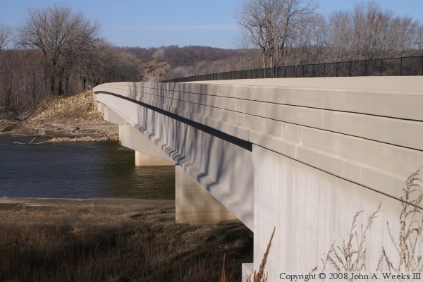
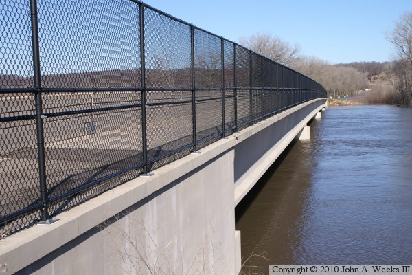
The new bridge at Blakeley is a typical modern MN-DOT style prestressed concrete girder bridge, like so many of the new bridges that are being built in the 1990s and 2000s. This one has no special features to dress it up. The bridge does have a sidewalk that is protected with a concrete barrier, which is a nice feature for pedestrians and those riding bicycles.

The photo above is a view looking down the upriver south face of the Blakeley Bridge from the east side of the Minnesota River.


Blakeley Bridge
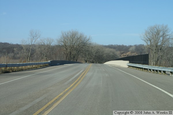
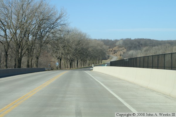
These two photos show a typical bridge crossing when traveling westbound across the Minnesota River at Blakeley. The photo above is approaching the east end of the bridge, while the photo below is a view from mid-channel.

Blakeley Bridge
Blakeley Bridge
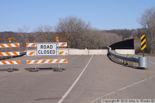
The photo above is another view of the bridge deck looking west across the Minnesota River. In this view, the bridge is closed for the flood of 2010. The photo below is a view looking down the downstream north face of the bridge. Note that the water is closed to the top of the bridge piers, and that the highway on the west end of the bridge is under water.

Blakeley Bridge

Made With Macintosh
Authored by John A. Weeks III, Copyright © 1996—2016, all rights reserved.
For further information, contact: john@johnweeks.com