The Winona & Saint Peter railroad started building west from Winona,
Minnesota, during the 1860s. It reached Saint Peter in 1871. The railroad
pushed west through New Ulm, and later to the state line and into South Dakota.
The Winona & Saint Peter was incorporated into the Chicago, Milwaukee,
Saint Paul, and Omaha Railroad, more commonly known as the Omaha Road. The
Omaha Road was later controlled by and eventually purchased by the Chicago
& North Western Railway. The C&NW later merged with the Union Pacific.
The line running across southern Minnesota is now operated by the Dakota,
Minnesota, and Eastern Railroad.
The Minnesota River was a significant obstacle at that time. The railroad
approached Saint Peter from the southeast, crossed the river just south of
the city, then ran north through Saint Peter before turning west and heading
towards New Ulm. Later, it was decided to shorten the railroad and reduce the
grades. A new line was built in 1899 around the south side of Mankato, avoiding
a crossing of the Minnesota River. This new line joined the older route near
New Ulm, also bypassing the Minnesota River bridge at Redstone. The line
through Saint Peter and Redstone was still used as a secondary route for
many years.
The first bridge at Saint Peter was built in 1871. It was a long timber
bridge that included timber truss spans. That bridge was replaced by an
iron bridge in 1879. The rail line was used into the early 1950s. I have
not yet determined exactly when the route through Saint Peter was abandoned,
and when the bridge over the Minnesota River was removed. The bridge at
Redstone still stands. It carries a rail spur to a quarry on the north side
of the river.
The 1879 bridge at Saint Peter featured a center pin style swing span. This
style of bridge has a single large truss that pivots in the middle. They
are a bit tricky to build and to keep balanced. More modern swing spans
will have two truss spans that are joined over the pivot point. In addition
to the swing span, the bridge had another through truss span. The remainder
of the bridge was a trestle supported by iron piers. There are 4 piers that
remain from the 1879 bridge. The supports for the iron trestle appear to
be gone. The western abutment appears to have been removed when US-169 was
rerouted past the west end of this railroad bridge. I have not yet
determined if there are any additional remains on the east side of the river.
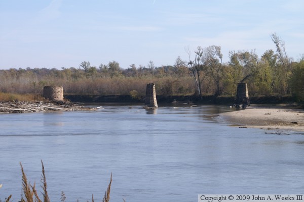
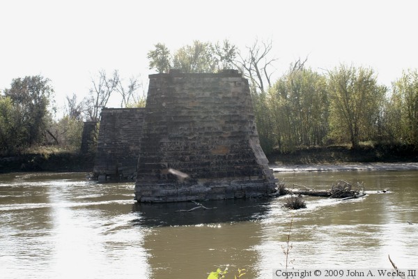
The photo above is a view of 3 remaining piers from the Omaha Bridge,
including the round swing span pivot pier. The vantage point is a parking
area maintained by the Department of Natural Resources located 1200 feet
due west of the bridge remains. The river makes a bend between this parking
area and the bridge site making this photo look like it was taken from the
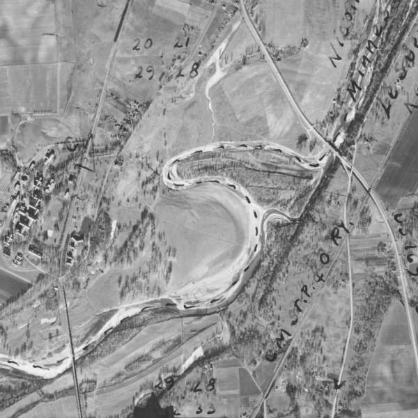
middle of the river channel. The photo below is an aerial photograph taken
in 1937. The city of Saint Peter starts at the north edge of this photo.
The state hospital for the criminally insane is at the left of the image.
The Omaha Bridge is just below the hospital. The highway bridge is marked
as US-169. That highway is now MN-22, and US-169 runs on a new alignment
between the hospital and the river passing near the location of the north
abutment of the Omaha Bridge.
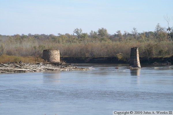
The photo above is a view looking downriver towards the northeast at the
former main river span that was once bridged by the eastern half of the
swing span. The photo below is looking east across the former river
crossing along the upriver side of the piers. This photo is looking
directly into the midday sun, so it is a bit washed out.
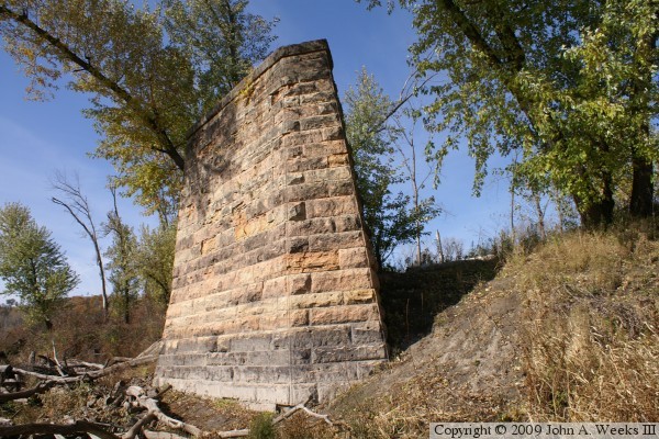
These two photos are views of the pier that once supported the western
end of the swing span. The photo above is the west face of that pier looking
towards the Minnesota river. The photo above is looking at the north and
east face of the pier.
These two photos, also shot looking directly into the midday sun, are views
of the river channel from a vantage point next to the pier that supported
the swing span pivot point. The photo above is looking at the downriver
side of the piers from north of the pivot pier, while the photo below is
looking at the downriver side of the piers from the south side of the pivot
pier. Note that the leading edge of the piers are well worn. That is from
over 100 years of fighting floods and logjams on the Minnesota river.
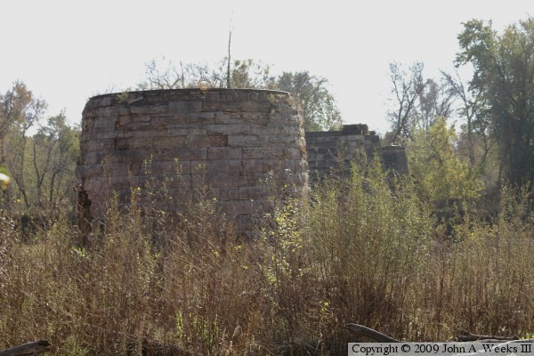
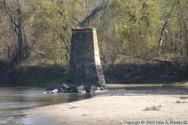
These two photos are views of the pier that supported the swing span. It is
round, a shape dictated by its function, which was to support the swing span
on a set of rollers that followed a circular rail mounted to the top of the
pier. The photo above is the northwest side of the pier, while the photo
below is the southwest side of the pier.
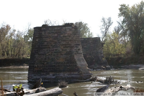
These two photos are views from a vantage point located just upstream of
the bridge site. The photo above is the easternmost bridge pier, while
the photo below is the mid-river pier that once supported the eastern end
of the swing span. The pile of stones in the river in the upper photo is
interesting. That pier appears to be in excellent condition. Those stones
are not from that pier. I wonder if they were dumped there during construction,
or were discarded in that spot after the bridge was demolished.
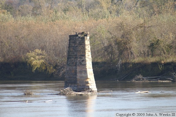
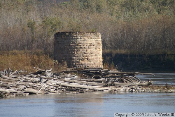
The photo above is a view of the swing span pivot pier as seen from a vantage
point located upstream of the former river crossing. The metal rail on top
of the pier is visible int his view. This bend in the river accumulates
a lot of driftwood and timber. I suspect that the dry land next to the
pier was once a river channel that was filled in by a sandbar. The river
looks like it has shifted a bit to the east since the bridge was built.
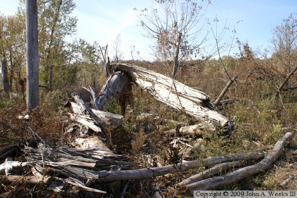
The photo below is a view of the land on the west side of the river at the
bridge site. An F4 tornado blew through this area in 2006 leveling every
tree in a narrow half-mile long path. The timber was being salvaged in
2008 and 2009. A haul road bulldozed for this salvage operation provided
a relatively easy path to walk to the bridge remains on the west side of
the Minnesota River.
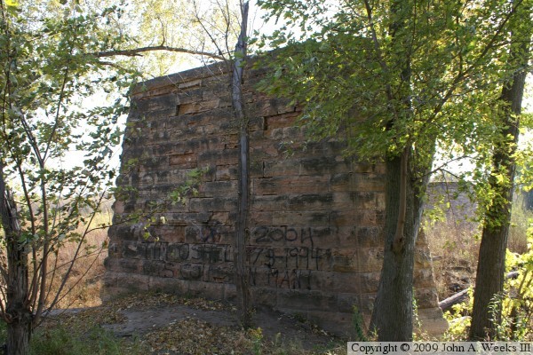
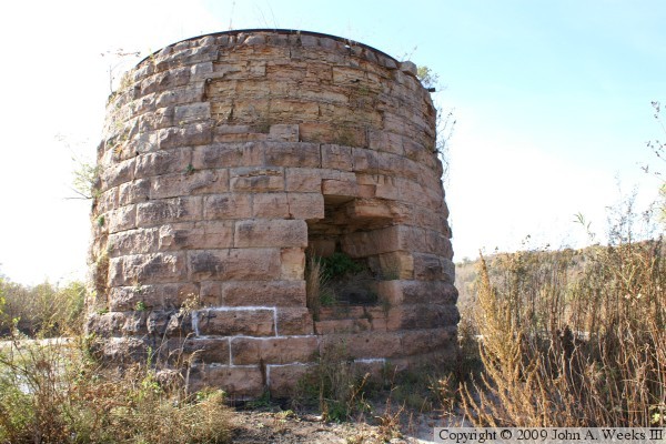
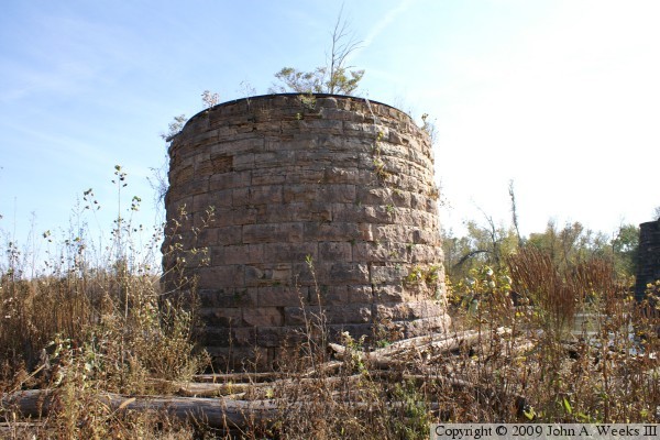
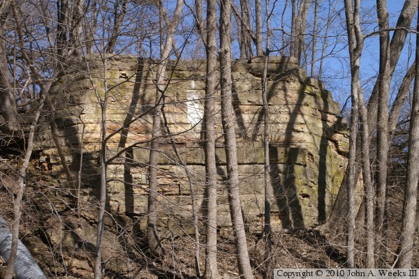
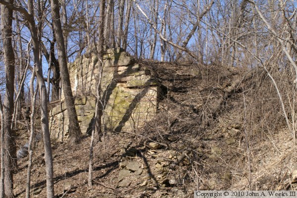
These two photos are views of the abutment at the northwest end of the Omaha
Bridge. These ruins are hiding right out in plain sight adjacent to the
shoulder of the southbound lanes of highway US-169. This structure is
normally obscured by snow in the winter and brush in the summer. While
driving in this area, I typically look towards the river, but I never spotted
it until March of 2010. I had suspected that the abutment was on the grounds
of the state hospital, or had been destroyed when US-169 was built. I was
pleased to find that it still exists and is easily visible if you know where
to look.