| Highways, Byways, And Bridge Photography |
MN-19 Bridge
Minnesota River Highway Crossing
Henderson, MN
|
• Structure ID: |
NBI: 40001. |
|
• Location: |
River Mile 74.0. |
|
• River Elevation: |
726 Feet. |
|
• Highway: |
MN-19. |
|
• Daily Traffic Count: |
1,550 (2004). |
|
• Bridge Type: |
Steel Girder, Concrete Deck. |
|
• Length: |
484 Feet. |
|
• Width: |
44 Feet, 2 Lanes. |
|
• Navigation Channel Width: |
Non-Navigable. |
|
• Height Above Water: |
???. |
|
• Date Built: |
1987. |
Henderson is a very small town of 1,000 people on the west bank of the
Minnesota River just south of the Minneapolis and Saint Paul metro area. It
is very much an island city. While it connects to dry land most of
the year, spring flooding on the Minnesota River threatens to erase
Henderson from the state map. Citizens have fought back by enclosing
the entire city in a large circular levee system.
The MN-19 Bridge is a very modern steel girder bridge. Steel girder
bridges are somewhat unusual for this type of shorter span, but it does
the job well. The deck features the modern style solid guardrails and
there is a sidewalk on the downstream side of the bridge. The only
decorative elements on the bridge are the three fancy street lamps.
MN-19 runs 198 miles across the state of Minnesota, starting within
5 miles of Wisconsin on the east and ending at South Dakota SD-30 on
the west side. MN-19 crosses the Minnesota River twice. The easternmost
of the two crossings is at Henderson. The other MN-19 Minnesota River
crossing is the US-71/MN-19 bridge at Morton, Minnesota.
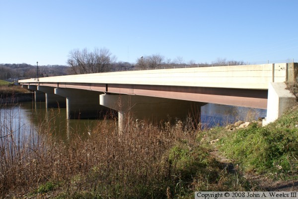
The photo above is a view of the upriver south face of the MN-19 bridge as
seen from the east river bank from a location just south of the roadway.

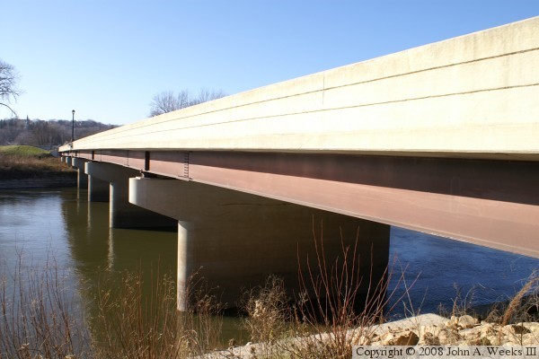
The photo above is approaching the west end of the bridge while traveling
eastbound on MN-19. The side walk is on the left side of the bridge. A
very ugly chain link fence acts as the guard rail for this walkway. The
photo below is looking west along the upriver south face of the bridge.
The city of Henderson is located on the far side of the river.
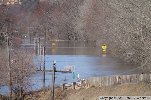
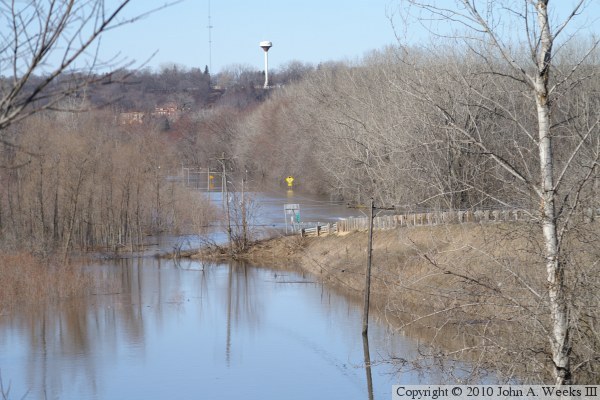
These two photos are views looking west from a side road towards the
MN-19 bridge at Henderson during the flood of 2010. The river bridge is
3/4 miles west of this vantage point, located just beyond the green highway
sign in the distance in the photo above. The photo above is a close view
of the flooded highway, while the photo below is a wider view of the scene
with the city of Henderson in the background.

These two photos, and the 6 that follow, were taken around 2 PM on the
afternoon of March 20, 2011, as a large ice jam was slowly inching downstream
towards the MN-19 bridge at Henderson. The photo above is looking upstream
towards the ice jam, while the photo below is looking west down the south side
of the MN-19 bridge. Once the ice starts to pile up against the bridge, it
will cause a dam that will cause the river to flood. City crews were
standing by to close the floodwalls to protect Henderson, which would isolate
it from the outside world for the third time in 12 months.

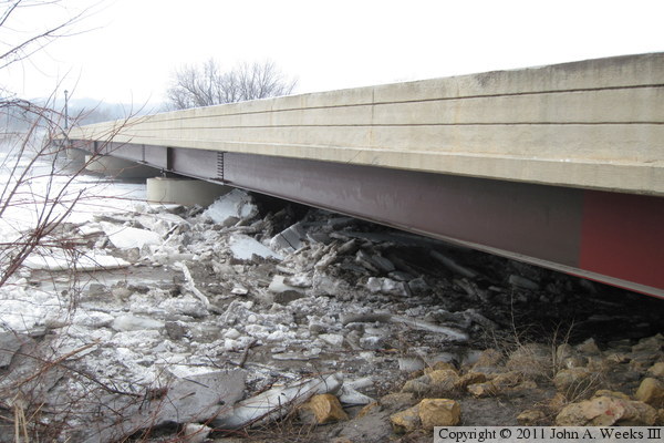
These two photos show the ice already starting to pile up under the
easternmost span of the MN-19 bridge. The photo above is a wider view
that shows the entire upstream face of the bridge, while the photo below
is a close view looking under the first bridge span.


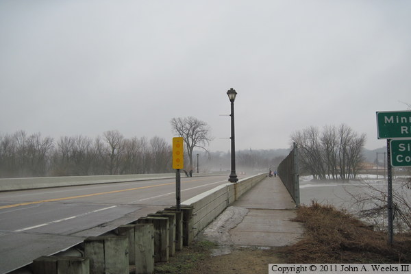
These two photos are looking west down the length of the bridge towards the
city of Henderson. The photo above is looking down the eastbound shoulder
of highway MN-19. The photo below is looking down the length of the sidewalk
on the downstream side of the structure. There was a continuous stream of
people on the bridge looking at the ice jam that afternoon. The fog in
these photos is water vapor rising up off of the snow in a process known as
sublimation where water goes directly from a solid state to vapor without
passing through the liquid water state.

The photo above is looking west across the Minnesota River along the northern
downstream side of the bridge. The photo below is a closer view of the
easternmost bridge span, which is already clogged with ice. The ice jam
reached the bridge about 3 hours after these photos were taken, at which
time the floodwalls and this highway bridge were closed.

|
