Current Weather Conditions
John A. Weeks III
Wednesday, May 8, 2024, 1:37:51 PM CDT
Home Photo Tours Rail Fan 12 Easy Steps
Aviation Spacecraft Highways & Bridges About The Author
 
Google Search
Maps   Groups   Images   Search
 
  Home
  • 12 Easy Steps
  • Aviation
  • Spacecraft
  • Highways & Bridges
    » Bridge Photography
      - MSP River Bridges
      - C & D Canal
      - Illinois River
      - Minnehaha Creek
      - Minnesota River
        › Ortonville - Odessa
        › Correll - Wegdahl
        › Granite Fls - Rdwd Fls
        › Morton - Judson
        › Mankato - Jordan
          · US-169 North Star
          · Veterans Memorial Br
          · US-14 Bridge
          · Omaha Bridge Ruins
          · MN-22 Bridge
          · Broadway Bridge
          · MN-93 Bridge
          · US-169 Bridge
          · MN-19 Bridge
          · Blakeley Bridge
          · MN-25 Bridge
          · Crvr Co 45 Scott Co 9
        › MSP West Metro
        › MSP South Metro
      - Mississippi River
      - Missouri River
      - St. Croix River
      - St. Louis River
      - Wisconsin River
      - Best Miss River Photos
      - Cable Stayed Bridges
      - McGilvray Road Bridges
      - I-35W Bridge Disaster
      - Miscellaneous Bridges
      - Madison County Bridges
      - Hist Br Weekend 2013
    » Road Geek Topics
  • Photo Tours
  • Rail Fan
  • About The Author
 
Site Search By JRank
Highways, Byways, And Bridge Photography
US-169 Bridge
Minnesota River Highway Crossing
Le Sueur, MN

US-169 Bridge (Le Sueur)

• Structure ID: NBI: 9295 (Northbound), NBI: 9295A (Southbound).
• Location: River Mile 79.4.
• River Elevation: 731 Feet.
• Highway: US-169.
• Daily Traffic Count: 6,700 (2004) Per Span, 13,400 Total.
• Bridge Type: Steel Girder, Concrete Deck.
• Length: 1,100 Feet.
• Width: 27 Feet, 2 Lanes (Per Span).
• Navigation Channel Width: Non-Navigable.
• Height Above Water: 27 Feet (Estimated).
• Date Built: 1960.
This section of the 4-lane US-169 was built in 1960. Before that time, traffic ran through Henderson and along the west side of the Minnesota River and into the west side of Le Sueur. The old route still exists today as MN-93. This bridge is one of three locations where US-169 crosses the Minnesota River, with the other two being the Bloomington Ferry Bridge and the US-169 bridge in Mankato.

As part of the 4-lane project, a pair of identical 1,100 foot steel girder concrete deck highway bridges were built. These were very modern and very functional, but looked totally utilitarian with no visual enhancements. This was very typical of the bridges built in the late 1950s and through the 1960s during the period when the highway systems were rapidly expanding.

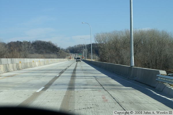
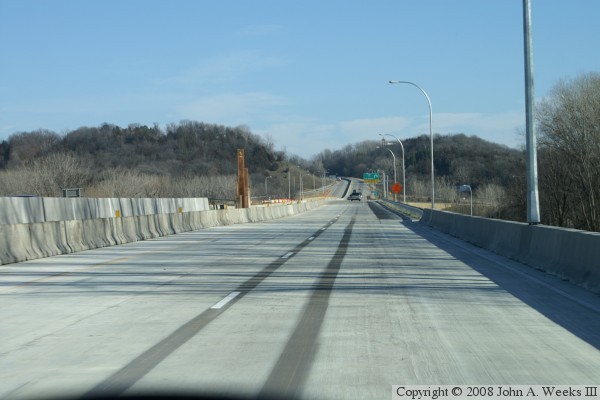
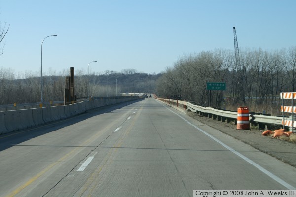
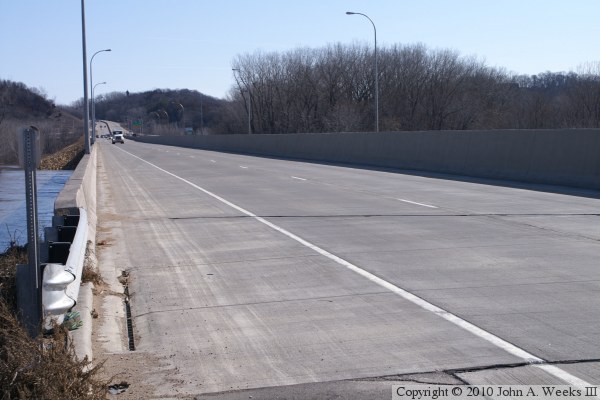
Fast forward to 2007, and these two bridge spans had become obsolete. To make matters worse, the river had carved out scour holes around the base of the support piers. Originally proposed for 2010, the bridge replacement project was moved up when bond money became available. As of late fall 2007, the northbound traffic lanes were using the new bridge span, while southbound traffic was still using the old bridge.

Note, the stats above are for the old bridges. The new bridges have not been entered into the NBI as of December, 2007.

This area of the Minnesota River Valley is known as the Valley of the Jolly Green Giant. The Green Giant was founded in Le Sueur in 1903. It introduced a variety of very large diameter peas in 1925, known as the Green Giant variety. The Green Giant mascot appeared in 1928, and the company took the name Green Giant Company in 1950. Green Giant became part of Pillsbury in 1979, and is now owned by General Mills since 2001. Most of the canning facilities once owned by Green Giant are now owned by Seneca since the mid-1990s. While Green Giant no longer has a plant or offices in Le Sueur, the enormous wooden Jolly Green Giant sign still welcomes travelers on US-169 to the valley.

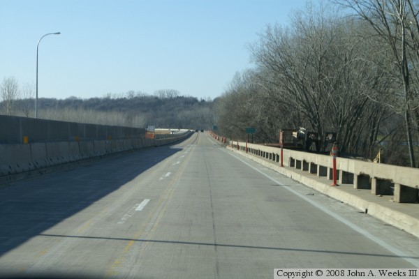
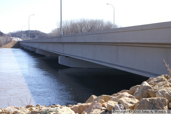
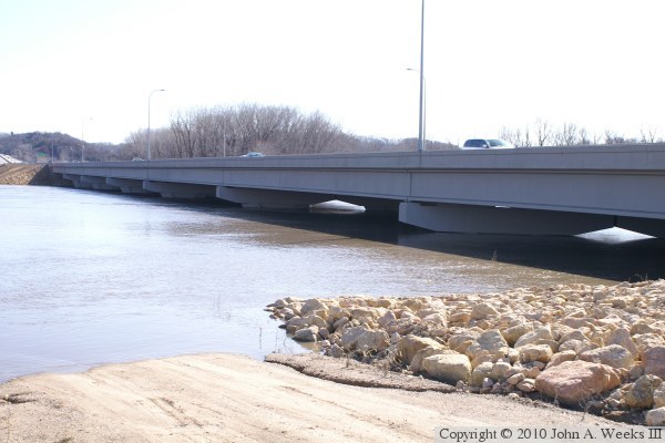
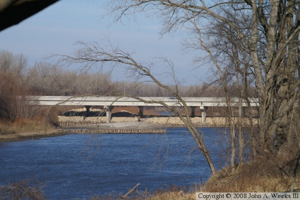
The photo above is a profile view of the new northbound span, which uses prestressed concrete girders rather than steel girders as were used in the old bridge. The cut-off stubs of the old piers are visible, as well as the piers of the old southbound bridge in the background.


US-169 Bridge (Le Sueur)
These two photos are views traveling northbound on US-169 using the new bridge span, which opened only days before these photos were taken. The photo above is approaching the southwest end of the structure, while the photo below is a view from mid-span.

US-169 Bridge (Le Sueur)
These two photos are views traveling southbound on US-169 using the remaining old 1960 bridge span. The old bridge has the distinctive open guard rails. The photo above is approaching the northeast end of the bridge, while the photo below is a view form mid-span. Remnants of yellow lines can be seen on the bridge deck. A line of K-blocks was used to divide this span into two-way traffic while the northbound span was being rebuilt.

US-169 Bridge (Le Sueur)
These two photos are views of the downriver west face of the new US-169 bridges over the Minnesota River near Le Sueur as seen during the spring flood of 2010. The photo above is from the southwest corner of the structure, while the photo below is from a service road about 100 feet downriver from the bridges.

US-169 Bridge (Le Sueur)
The photo above is a view looking north down the length of the southbound traffic lanes. The photo below is a view of the water pouring over the riverbanks into a farm field on the west side of the Minnesota River just north of the highway bridge.

US-169 Bridge (Le Sueur)

Made With Macintosh
Authored by John A. Weeks III, Copyright © 1996—2016, all rights reserved.
For further information, contact: john@johnweeks.com