Current Weather Conditions
John A. Weeks III
Saturday, July 27, 2024, 9:16:23 AM CDT
Home Photo Tours Rail Fan 12 Easy Steps
Aviation Spacecraft Highways & Bridges About The Author
 
Google Search
Maps   Groups   Images   Search
 
  Home
  • 12 Easy Steps
  • Aviation
  • Spacecraft
  • Highways & Bridges
    » Bridge Photography
      - MSP River Bridges
      - C & D Canal
      - Illinois River
      - Minnehaha Creek
      - Minnesota River
        › Ortonville - Odessa
        › Correll - Wegdahl
        › Granite Fls - Rdwd Fls
        › Morton - Judson
        › Mankato - Jordan
          · US-169 North Star
          · Veterans Memorial Br
          · US-14 Bridge
          · Omaha Bridge Ruins
          · MN-22 Bridge
          · Broadway Bridge
          · MN-93 Bridge
          · US-169 Bridge
          · MN-19 Bridge
          · Blakeley Bridge
          · MN-25 Bridge
          · Crvr Co 45 Scott Co 9
        › MSP West Metro
        › MSP South Metro
      - Mississippi River
      - Missouri River
      - St. Croix River
      - St. Louis River
      - Wisconsin River
      - Best Miss River Photos
      - Cable Stayed Bridges
      - McGilvray Road Bridges
      - I-35W Bridge Disaster
      - Miscellaneous Bridges
      - Madison County Bridges
      - Hist Br Weekend 2013
    » Road Geek Topics
  • Photo Tours
  • Rail Fan
  • About The Author
 
Site Search By JRank
Highways, Byways, And Bridge Photography
MN-22 Bridge
Minnesota River Highway Crossing
Saint Peter, MN

MN-22 Bridge

• Structure ID: NBI: 40002.
• Location: River Mile 99.6.
• River Elevation: 738 Feet.
• Highway: MN-22.
• Daily Traffic Count: 9,200 (2004).
• Bridge Type: Prestressed Concrete Girder.
• Length: 643 Feet.
• Width: 47 Feet, 2 Lanes Plus Sidewalk.
• Navigation Channel Width: Non-Navigable.
• Height Above Water: ???.
• Date Built: 1998.
MN-22 leaves the city of Saint Peter heading southeast. The highway turns to the south and runs towards Mankato. This road was once highway US-169. US-169 was later moved to an alignment west of the Minnesota River, and the old US-169 was renamed MN-22.

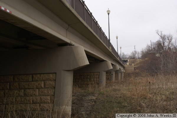
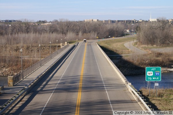
This concrete girder bridge is very typical of newer bridges that are being built by MN-DOT. It is not as exciting as the steel through truss bridge that it replaced, but it is a much more serviceable and longer lasting structure. MN-DOT dressed up the bridge a bit with the decorative stonework, iron railings, and fancy streetlights. In addition, there is very nice stonework on the bridge piers. The roadway that leads under the bridge was closed when I first visited this location, and the entire area was posted for no parking. I visited again a year later, and the road was open, allowing me to get a nice view of the underside of the bridge.

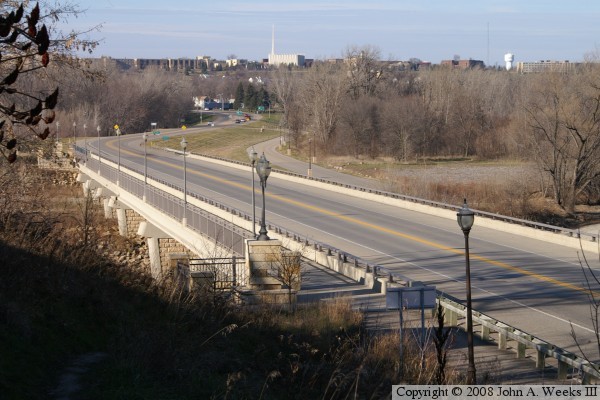
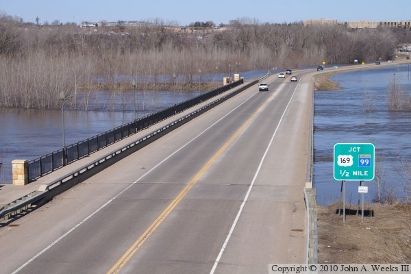
The photo above is a view looking northwest down the center line of the bridge from the Rabbit Road overpass located on top of the bluffs on the east side of the Minnesota River. The collection of buildings on top of the hill in the background of the photo is Gustavus Adolphus College. On March 29, 1998, a F3 tornado tore though the city of Saint Peter, destroying about half of the town. The college campus took a direct hit, with major damage to most of the buildings, and several building being damaged beyond repair. Tornados in March are very unusual. There were 14 confirmed tornadoes as part of that outbreak, compared to only 6 tornadoes ever recorded in the state of Minnesota during the month of March up to that date.

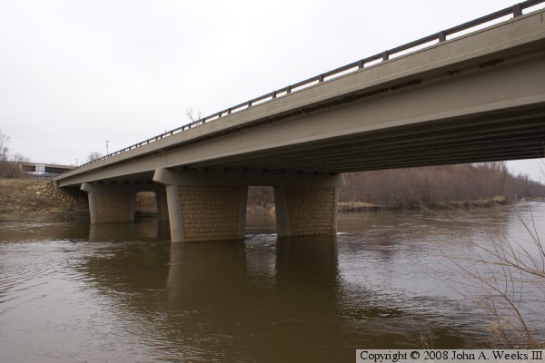
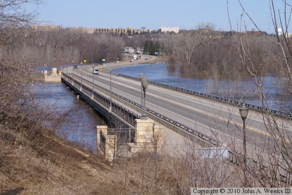
The photo below is a view looking northwest towards the city of Saint Peter from the river bluff at the south corner of the structure. Riverside Park is located on the far side of the river.


MN-22 Bridge
MN-22 Bridge
The photo above is the southwest face of the bridge as seen from Riverside Park on the west bank of the river. The river channel is at the far end of the structure. The photo below is northeast face of the spans over the river channel, also seen from Riverside Park.

MN-22 Bridge
MN-22 Bridge
The photo above is a view from the traffic level traveling westbound towards Saint Peter. The photo below is a view from a highway overpass at the south end of the MN-22 bridge as seen during the spring flood of 2010. Compare the water levels in this photo to the photo at the top of this page.

MN-22 Bridge
MN-22 Bridge
These two photos are more views from the spring flood of 2010 taken from the same highway overpass. The photo above shows the downriver side of the bridge, while the photo below shows the causeway leading south out of Saint Peter towards the MN-22 bridge. The river crossing had just been reopened the morning when these photos were taken. The river had flooded both MN-22 at this location and US-169 between Saint Peter and Mankato.

MN-22 Bridge

Made With Macintosh
Authored by John A. Weeks III, Copyright © 1996—2016, all rights reserved.
For further information, contact: john@johnweeks.com