There are two different Huey P. Long Bridges over the Mississippi River in
Louisiana. The first carries US-90 over the great river in New Orleans. The
other Huey P. Long Bridge carries US-190 over the river here in Baton Rouge.
The two Long Bridges are configured very similar to each other with the long
railroad trestles on either end of the bridge, and the scary narrow traffic
lanes hung off of the sides of the superstructure. These lanes were even
narrower prior to the mid-1990s when 4 feet was added to each side of the
bridge.
It is hard to grasp how large this structure is. It is also hard to find any
kind of vantage point to take it all in given the trees, the levees, and the
chemical plants on either side of the river. The main truss superstructure
is around 3,300 feet long. The highway approaches are 1,650 feet on the west
end of the bridge, and 870 feet on the east side of the structure. The total
length of the highway approaches and main truss closely matches the published
length of the bridge at 5,879 feet. The railroad trestle is around 3,650 feet
on the east end of the river crossing, and nearly 5,300 feet long on the west
side of the river. This gives a total elevated length of about 12,250 for
trains, which is 2-1/4 miles.
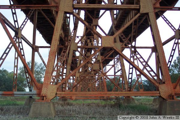
The truss superstructure has an interesting color. It is not one of the
standard silver, gray, or black bridge colors. The bridge was originally
painted blue. But dust from an aluminum plant kept coating the bridge with
orange aluminum-oxide dust. The Louisiana DOT eventually gave up trying to
keep the bridge blue and painted the structure orange to match the dust.
The Long bridge marks the spot where ocean-going ships can no longer travel up
the Mississippi River. The navigation channel is at least 49 feet deep below
the Long bridge, and often deeper than 200 feet. That is unique for a major
river. While most rivers get wider, the Mississippi stays about the same
width, but gets deeper. There are places in the Mississippi where the river
bottom is below sea level as far inland as the border with the state of
Mississippi. Above the Long bridge, the river channel is maintained at 12
feet, where it eventually drops to a 9 foot navigation channel that is
maintained all the way to the Port of Minneapolis in Minnesota. The US Army
Corps of Engineers would prefer to have the deep water channel extend further
upriver, but a rock shelf on the river bottom just north of Baton Rouge makes
it impossible to dredge the river channel.
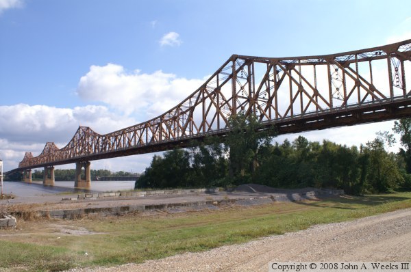
The photo above is the upriver face of the US-190 Huey P. Long Bridge looking
southeast from the west bank of the Mississippi River. The photo below
is looking west from the south side of the bridge near the Louisiana Highway
LA-1 underpass. The railroad trestle extends nearly a mile to the west before
touching down on dry land.
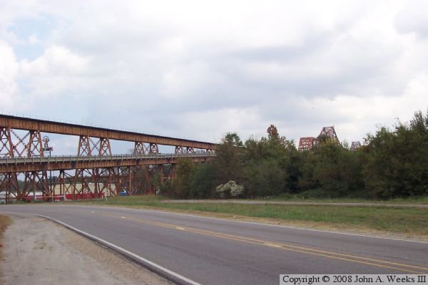
The photo above is the south face of the bridge approaches on the west end of
the structure as they pass over Louisiana Highway LA-1. The photo below is
looking east from under the approach spans where highway LA-1 passes under
the Huey P. Long Bridge.
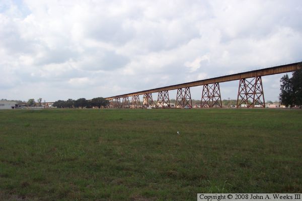
The photo above is an overview of the bridge as seen from a farm field
located southwest of the bridge. The railroad deck is nearly level while
the highway approaches climb a relatively steep grade to reach the truss
superstructure. The photo below is a view looking east from the southwest
corner of the bridge as the highway decks converge with the railroad
tracks at the west end of the truss superstructure.
These two photos are the first of a 7 photo set showing a typical river
crossing on the Huey P. Long Bridge heading eastbound into Baton Rouge. The
photo above is just entering the approach spans at the west end of the bridge.
The railroad tracks are high overhead. The photo below is climbing the incline
on the west end of the bridge heading towards the truss superstructure. Both
lanes on this side of the railroad deck travel eastbound.
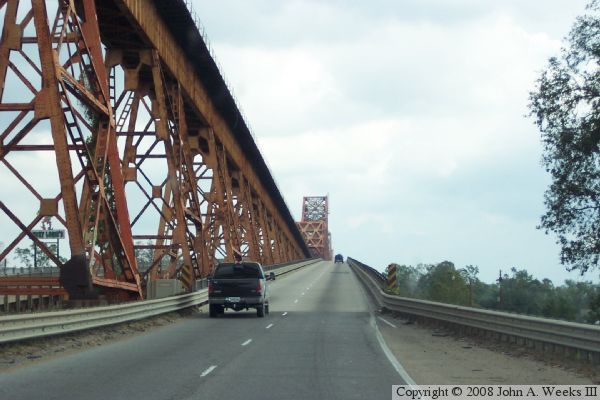
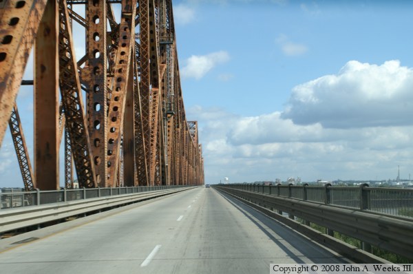
These two photos are views traveling eastbound across the river spans next to
the truss superstructure. The photo above is near the west end of the truss,
while the photo below is near the middle of the Mississippi River. Despite
the lanes having been widened, the bridge still feels narrow and has no
shoulders for breakdowns.
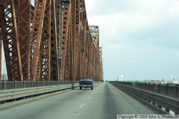
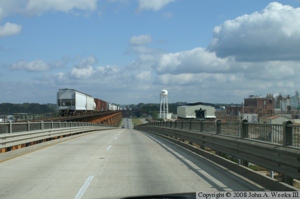
These two photos are views from the approach spans on the east side of the
river crossing after having passed through the main truss superstructure
of the Huey P. Long Bridge. The photo above is just after having exited
the truss portal. An eastbound train is also crossing the bridge, but we
have not caught up with the tail end of the train yet. The photo below
is on the downhill exiting the bridge. The railroad deck has a much
smaller slope than the highway.
The photo above is the final photo of a 7 photo set showing a typical
river crossing on the Huey P. Long Bridge heading eastbound into Baton
Rouge. In this photo, traffic is back on dry land, but the railroad
bridge remains elevated for another 1,200 feet until it curves to the
south of US-190 and lands on an earthen embankment. The photo below
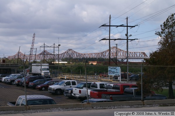
is a view looking northwest at the Long Bridge from the parking lot of
a petrochemical factor located south of the structure on the east riverbank.