The Sunshine Bridge was built as the classic bridge to nowhere, given that
there was little population or economic activity on either side of the river.
When first opened, the bridge served mostly local farm traffic and sugar
cane trucks. It was planned that the bridge would be part of a larger highway
project called the Acadian Throughway, and later, the South Central Louisiana
Tollway. Those projects never materialized, but the Sunshine Bridge has been
connected to the regional traffic grid as roads in the area have been
developed and improved. Since the bridge opened, the economy in this area
has grown by leaps and bounds, largely due to the improved transportation.
Prior to 1964, there were several ferry boat operations carrying traffic
across the Mississippi River between Baton Rouge and New Orleans. The
Sunshine Bridge replaced the ferry at Donaldsonville, and was the first
bridge over the river between the two Huey P. Long Bridges (US-190 at Baton
Rouge and US-90 at New Orleans). The Sunshine Bridge operated as a toll bridge
until 2001 when the 50 cent toll for westbound traffic was eliminated.
It was proposed that this bridge be named after Louisiana Governor James
Davis. Davis, however, requested that the bridge be named the Sunshine
Bridge rather than carry his name. In addition to being elected Governor
in 1944 and 1960, Davis was also in the music industry. The bridge name
was taken from his hit song ‘You Are My Sunshine’. Davis was
subsequently inducted into the Country Music Hall Of Fame.
Update—the Sunshine Bridge was closed for a period of time on
February 12, 2010, after a fatal head-on crash on the bridge. A tanker
truck and SUV collided after one of the vehicles crossed the center line.
Fortunately, the ammonia in the tanker did not leak.
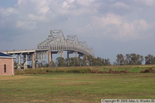
The photo above is a view looking northeast at the south face of the
massive truss span. The through truss superstructure is nearly 3,300 feet
long. The deck truss spans leading to the main truss on each side of the
bridge are also massive structures.
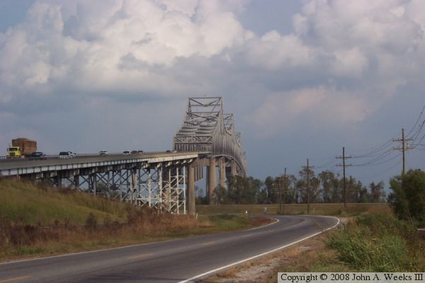
These photos are two views from the west side of the Mississippi River. The
photo above is the south face of the approaches and main truss span as seen
from the access road connecting to highway LA-18, which runs along the river
levee. The photo below is a similar view from about one-half mile to the
west where the access road for LA-18 intersects LA-70.
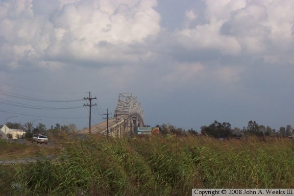
These two photos are the east approach to the Sunshine Bridge as seen
when traveling westbound on highway LA-70 towards the river crossing.
The photo above is climbing an incline to an overpass over a railroad
track and the ramps to highway LA-44. The photo below is traveling on
that overpass towards the bridge approach spans.
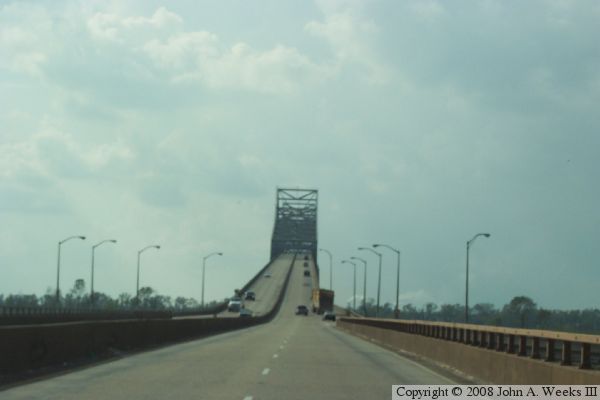
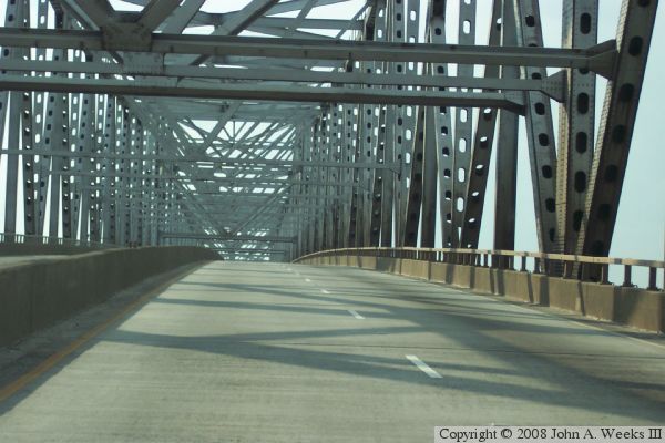
The photo above is a view crossing the bridge westbound while traveling
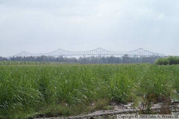
through the truss span. The photo below is looking south across a farm
field towards the north face of the Sunshine Bridge. This vantage point,
looking southeast from highway LA-18 located two miles from the bridge,
shows just how long the truss span is.