| Highways, Byways, And Bridge Photography |
John James Audubon Bridge
LA-10 Mississippi River Crossing At New Roads
New Roads, Louisiana

|
• Structure ID: |
616300000610292. |
|
• Location: |
River Mile 262 (Estimated). |
|
• River Elevation: |
10 Feet. |
|
• Highway: |
LA-10. |
|
• Daily Traffic Count: |
2,887 (2012). |
|
• Bridge Type: |
Cable Stayed Steel Girder. |
|
• Length: |
12,883 Feet Overall, 1,583 Foot Main Span. |
|
• Width: |
75 Feet, 4 Traffic Lanes. |
|
• Navigation Channel Width: |
1,463 Foot Clear Channel. |
|
• Height Above Water: |
121 Feet. |
|
• Date Built: |
Opened May 5, 2011. |
In 1989, the Louisiana State Legislature realized that they were going
to have to make some significant improvements in their transportation
infrastructure if the state was to remain competitive in the year 2010.
To meet the challenge, they established the TIMED program, which took
a 4-cent per gallon tax on every gallon of fuel and oil that was sold
in the state. This money was set aside to pay for major projects that
would otherwise not be funded. The program is slated to raise over
$4-billion during its lifetime.
The John James Audubon bridge connects New Roads, Louisiana, with Saint
Francisville, Louisiana. The project includes this 2.44-mile long cable
stayed bridge and approximately 12 miles of 2-lane highway. The cost was
originally projected to be about $350-million with a mid-2010 completion
date. The project kicked off a little later than planned, and ended up
costing about $410-million.
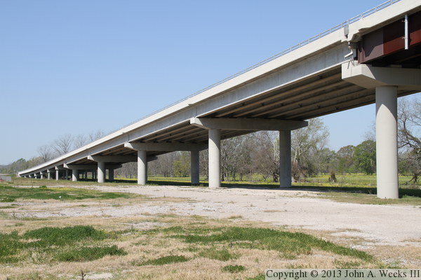
Nearly everything about this project is big. The bridge features 12,883
feet of elevated roadway including a 1,583-foot long clear span. That
span makes this a world-class bridge, and the longest such bridge in the
United States. The west approach consists of 15
spans covering 2,044 feet. The east approach has 80 spans and covers
6,780 feet. The main bridge structure is 3,186 feet long, with 5 spans,
three of which are suspended by 136 stay cables from two 520 foot tall
towers. Each tower is supported by 42 drilled shafts that extend 180 feet
into the riverbed. The tower bases are 160 feet wide by 64 feet long and
weigh 5,000 tons.
The traffic deck carries 4 lanes of traffic in 11-foot wide lanes. Each
roadway includes an 8-foot wide outside shoulder and a 2-foot wide inner
shoulder, for an overall deck width of 75 feet. The approach roads are
only two lanes, so the second lane in each direction is blocked off at each
end of the structure. Bicycles are allowed to use the shoulders on the
bridge, through there are no dedicated bicycle lanes or pedestrian walkways.
Despite the project covering over 12 miles, the price is very reasonable.
As a comparison, the new I-35W bridge in Minneapolis cost $300-million, but
has a river span that is only 1/3 as long. After a year of operation, the
bridge was carrying an average of 2,887 vehicles per day, about half of
the pre-construction projections. The bridge was expected to spur economic
development, but so far, there have been no projects that have been identified
as having been built because of the bridge. However, the recession is likely
a big factor on both counts, and as the economy improves, there will be new
development due to the bridge being in place. For example, the logging
industry in the area now has access to the other side of the river, which
will grow traffic as wood demand picks up with the rebound of the housing
industry.
The main deck steel was completed on December 29, 2010. The bridge was
not expected to open until 2012. However, a large flood threatened to shut
down the ferry operation in 2011. The bridge was far enough along that
two lanes of traffic could be safely opened, so traffic was allowed on
the bridge starting May 5, 2011, at which time, the ferry operation was
permanently suspended. Construction wrapped up on February 27, 2012.
The Audubon Bridge has 65-feet of clearance under the main span according
to US Army Corps of Engineers river charts. However, that number is at
high flood water level, where the river is nearly 50 feet above its average
level. At average levels, where the river level is between 10 and 20 feet
above sea level, the bridge deck is around 120 feet above the water. Bridges
with that kind of clearance are normally built for ocean going ship traffic,
but this bridge is north of the point where ocean going ships travel.
John James Audubon was a naturalist and artist who lived from 1785 to 1851.
His work ‘Birds of America’ is a landmark work in both the
field of ornithology and as a great work of art. Audubon has inspired
nearly everyone who has since gone bird watching or is interested in
wildlife art. Thirty-two of his paintings from Birds of America were
painted while residing in Saint Francisville in 1821.
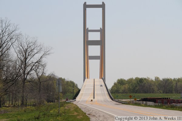
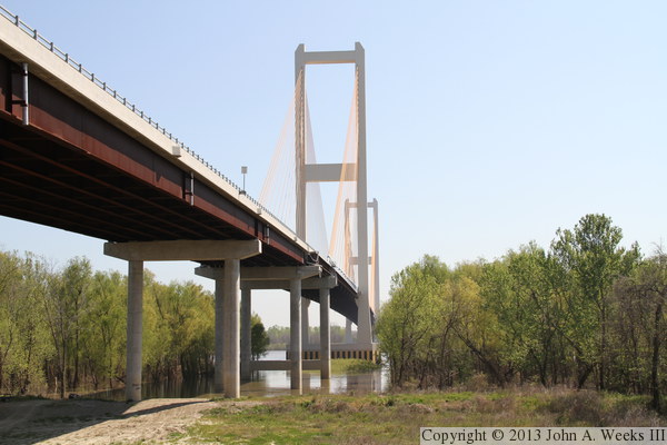
The photo above is looking east along the south face of the Audubon Bridge
as seen from the top of the levee on the west side of the Mississippi River.
The photo below is looking east towards the west approach to the structure.
A slight curve in the road allows us to look directly down the center of
the bridge deck without having to step onto the highway. As you scroll down
this page, we will visit some local scenes around the bridge, then cross the
bridge heading westbound, check out the approach spans, and then finally
take a close look at the main span. Unfortunately, trees block any profile
views of the bridge.
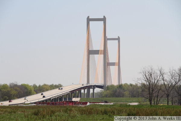
These two photos are views of the Audubon Bridge as seen from along the
side of the connector road that runs between LA-10, which crosses the
bridge, and LA-981, the road that runs along the west bank of the
Mississippi River. The photo above is a telephoto view from about a
half-mile away, while the photo below is from about a quarter of a mile
from the levee. These photos were taken at about 11 AM, meaning that
the sun was east of the river, putting the towers and bridge piers
in a shadow from these vantage points.


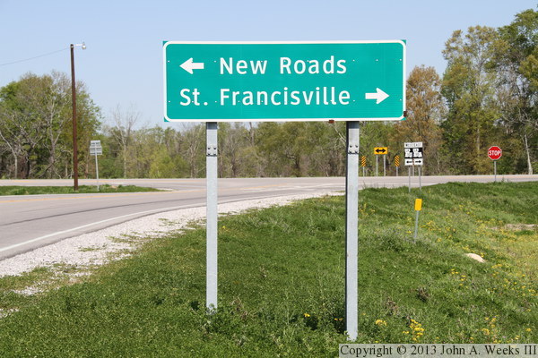
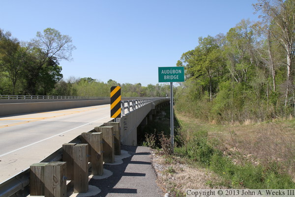
The photo above is the bridge name sign on the east end of the structure.
It is a very nondescript sign for such a monumental structure. The photo
below is a guide sign on the connector that runs between LA-10 and LA-981.
New Roads is about 3 miles west of this location, while St. Francisville
is about 6 miles from the east end of the structure.
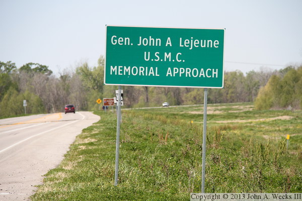
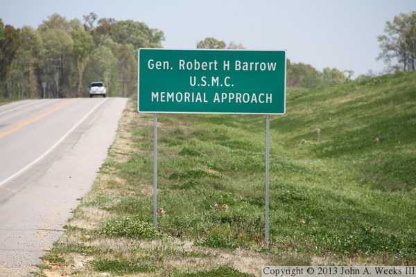
A controversy developed over the bridge name in 2011 when a bill was
proposed to the Louisiana Legislature to change the bridge name to
‘Generals John A. Lejeune-Robert H. Barrow Bridge.’ The
argument was that Audubon only spent a short period of time in Louisiana,
and there was already a bridge named after Audubon on the Ohio River.
The two generals were from the local area and both rose to serve as
Commandant of the US Marine Corps. In the end, the bridge was not
renamed, but the approaches were named after the two generals. The
photo above is the sign for General John A. Lejeune on the west approach,
while the photo below is the sign for General Robert H. Barrow on the
east approach.
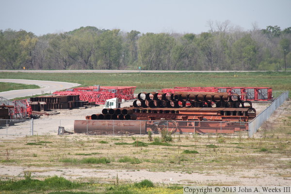
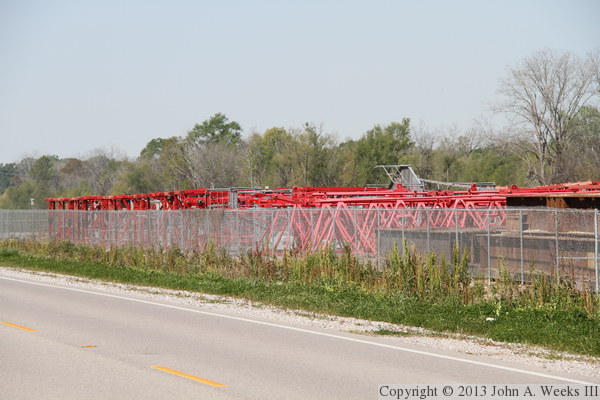
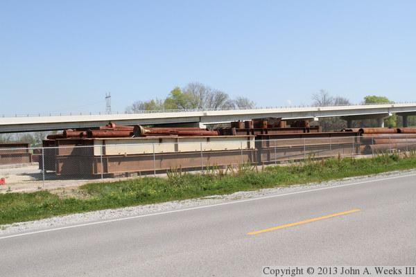
Equipment still remained on site when I visited in early 2013 despite the
bridge having been open for nearly 2 years. The red items are part of
tower crane that was used to erect the 520 foot tall main bridge towers.
The pipes are left over forms for the casings used to support the towers.
The photo above is a view of the equipment yard as seen from the top of the
levee, while the photo below is a view of the tower crane sections as
seen from the highway.

These two photos are more views of tower crane sections. The photo above
shows the jib that sits at the very top of the tower crane. I am not
sure where the piece in the photo below fits. It might be the support
that holds the cab to the tower crane.
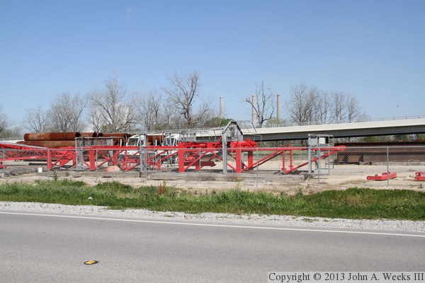
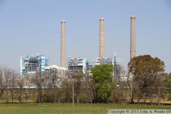
The photo above is another view of the equipment yard. This steel is
leftover from the project where it was used as temporary supports. The
photo below is the Big Cajun II powerplant located just north of the
Audubon Bridge on the west side of the Mississippi River. This three
unit powerplant generates over 1,400 megawatts of electricity.

These two photos, and the 12 that follow, show a typical crossing of
the Audubon Bridge heading westbound towards New Roads, Louisiana. The
photo above is the east end of the bridge, while the photo above shows
the bridge deck just after we have entered the east end of the
structure. Note that while the approach roads have two lanes, the
bridge itself has four lanes. If future traffic warrants an upgrade,
the approach roads can be expanded to four lanes.

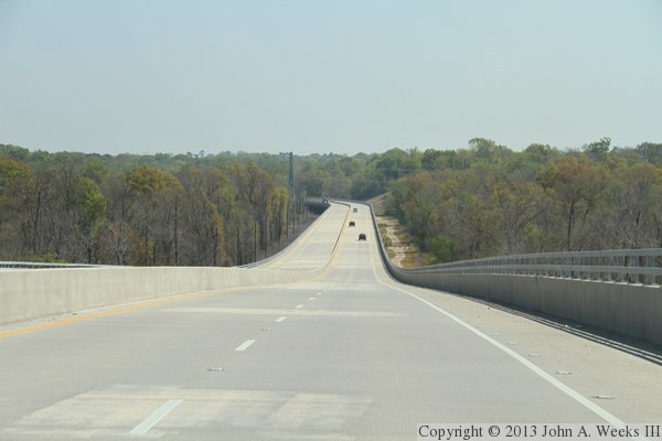
These two photos continue our westbound bridge crossing. In the photo above,
we are rounding the curve at the east end of the bridge, and we get our
first view of the bridge towers. In the photo below, we are about halfway
across the spans of the 1.2-mile long east approach.
These two photos continue our westbound bridge crossing. In the photo above,
we are climbing the small grade leading to the main suspended bridge spans.
We are just passing the first set of stay cables on the photo below.

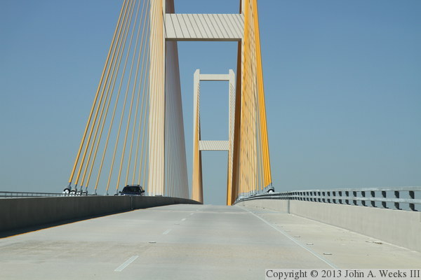
These two photos continue our westbound bridge crossing. In the photo above,
we are nearing the east main bridge tower, while in the photo below, we have
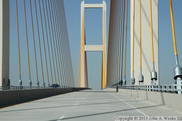
just passed the east main bridge tower.

These two photos continue our westbound bridge crossing. In the photo above,
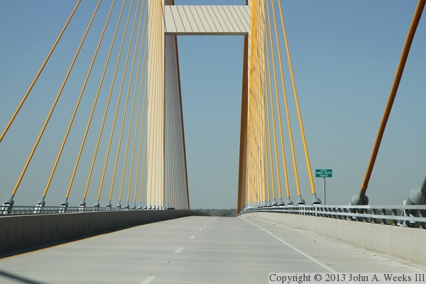
we are nearing the center of the main bridge span, which is marked with the
sign indicating that we are entering Pointe Coupee Parish. We are passing
the midpoint of the main bridge span in the photo below.
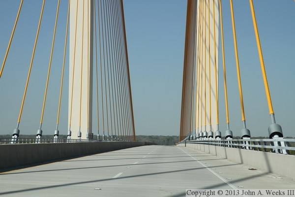
These two photos continue our westbound bridge crossing. In the photo above,
we are passing the west main bridge tower and the final set of stay cables
at the west end of the bridge. In the photo below, we are exiting the
actual cable stay bridge structure and crossing onto the west approach spans.
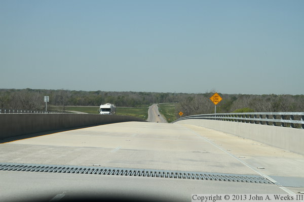
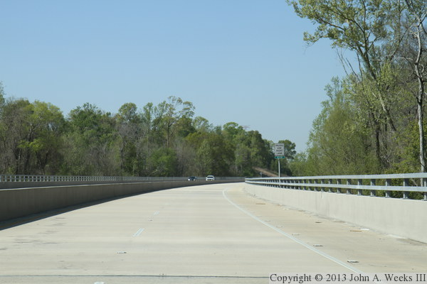
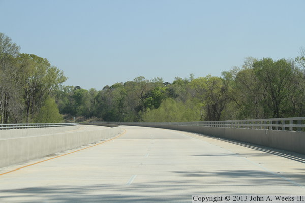
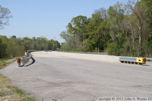
These two photos conclude our westbound bridge crossing. In the photo above,
we are descending the approach spans on the west end of the bridge to get
back to dry land. We see that traffic narrows down to a single lane at
the end of the bridge. The photo below is the highway heading towards
New Roads, Louisiana. The intersection ahead is the access road that
connects to LA-981, which runs along the levee to provide access to the
Big Cajun II generating plant.

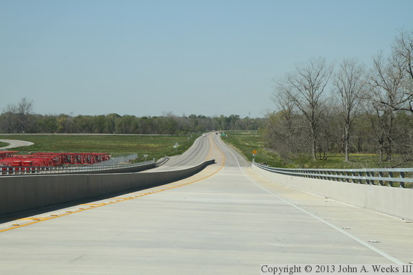
These two photos are views heading eastbound into the bright morning sun.
The photo above is approaching the west end of the structure. This shows
that the west approach spans cover a much shorter distance than the east
approach spans. The photo below is descending the grade leading away from
the cable stay bridge structure down to the east approach spans. The curve
at the east end of the bridge is visible in the distance.
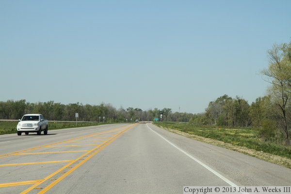
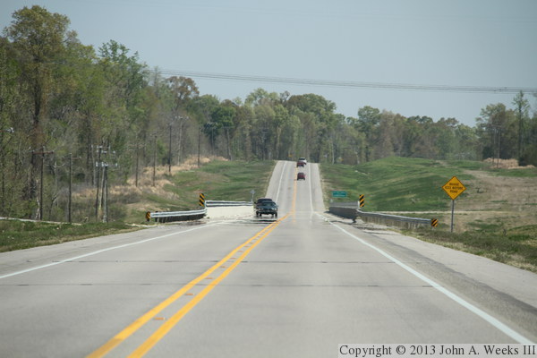
These are two additional views heading eastbound across the Audubon Bridge.
The photo above is the curve in the east approach spans near the east end
of the bridge. The photo below is the LA-10 approach road heading eastbound
towards highway US-61. The bridge ahead is known as ‘Bridge 4,’
which is one of 10 total bridges built for the project. This includes two
highway bridges west of the river, 5 east of the river, two approach
bridges, and the main cable stayed structure.
These two photos are views from the right-hand side of road at the east
end of the Audubon Bridge. The photo above shows the highway as it enters
the east approach spans. The photo below is a view looking along the
north side of the east approach spans, with the bridge sign in the center
of the photo.
These two photos are views from the left side of the road at the east
end of the Audubon Bridge. The photo above shows the eastbound lane as it
exits the east approach spans. The photo below is a view looking west along
the south side of the east approach spans. It is nice to see so much green
vegetation despite these photo being taken in March, and there still being
feet of snow on the ground in my hometown of Minneapolis.

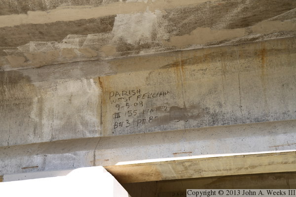
The photo above shows an access trail running along the south side of the
east approach spans. I would have liked to have hiked along this trail, but
I was pressed for time during my visit. While the trestle bents (piers) are
short at this location, the ground does drop in elevation towards the river,
and the road is higher above the ground. The photo below is some notes
written on the side of one of the type 3 prestressed concrete girders.
These two photos are views of the east bridge abutment. Note the deep blue
sky when looking to the north, with not a cloud in the sky. This is ideal
bridge hunting weather, especially when it is a little colder and the snakes
are not active.

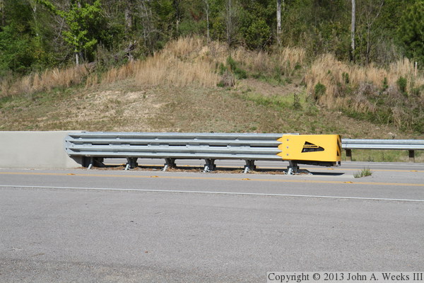
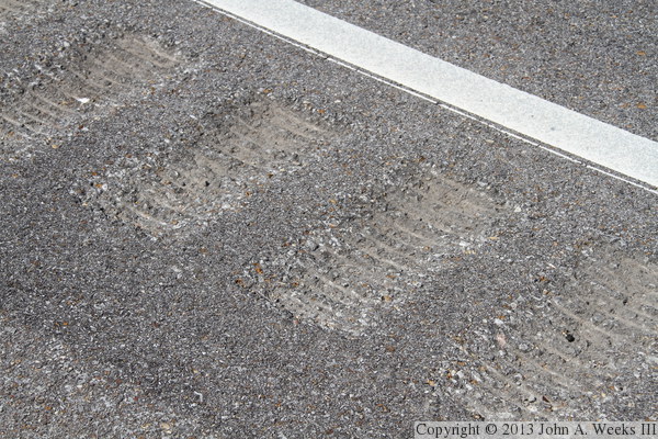
These two photos are the last two views from the east end of the Audubon
Bridge. The photo above is the shock-absorbing guardrail that protects
the center divider of the bridge. The photo below is a close view of the
rumble strip that runs along the outside of the white lines on the approach
roads leading to the bridge. These indents were cut using a rumble strip
grinder. A single grinder machine can cut between 5 and 15 miles of rumble
strip per day.
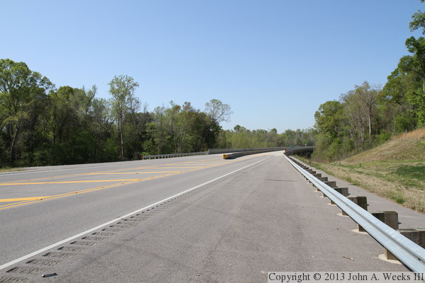
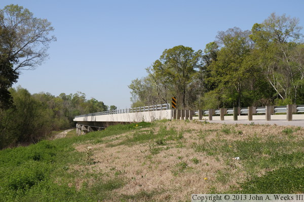
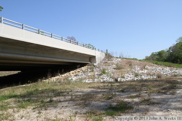
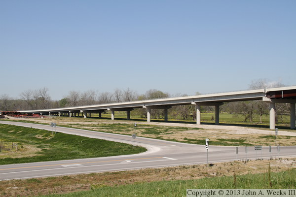
These two photos are views of the approach spans on the west end of the
Audubon Bridge. The photo above is from ground level as seen from along
highway LA-981, while the photo below is a view from the top of the levee,
both looking to the northwest. The west approach is 2,044 feet long and
consists of 15 spans. The first 7 spans are shorter and use lighter
prestressed concrete girders. The next 4 spans use larger prestressed
concrete girders. The final 4 approach spans use steel girders.

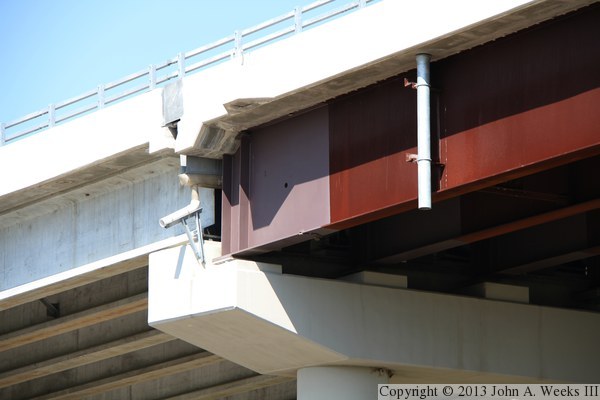
The photo above is pier #11 on the west end of the structure, where the
spans transition from concrete girders to steel girders. The photo below
is a closer view of the top of the pier as well as the girders. These
transition areas often lead to future maintenance issues, but in this
case, great care was taken to channel runoff water away from the steel
girders. In addition, the ends of the steel girders were coated with
a rust inhibitor to prevent oxidation.
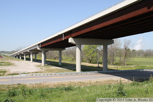
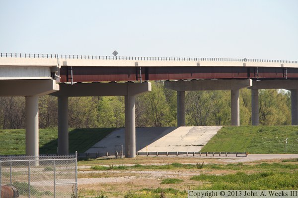
These two photos are additional views of the west approach spans as seen
from the top of the levee. The photo above shows most of the approach
spans, while the photo below is from a wider angle showing first steel
girder span plus the span crossing highway LA-981.

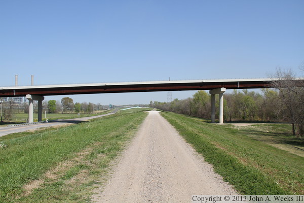
The photo above is looking north towards the steel girder approach span
that carries the Audubon Bridge over highway LA-981 and the levee that
runs along the Mississippi River. The photo below is another view of
this span, looking northeast from the connector road that runs between
LA-981 and LA-10, the highway that passes over the bridge. Note that
a concrete cap covers the levee where it passes under the bridge.

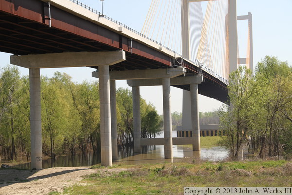
These two photos are the bridge piers on the west end (above) and east
end (below) of the west approach span #13, which passes over highway
LA-981 and the levee. The vantage point is again the top of the levee.
We see the Big Cajun II power plan in the background of the photo above.


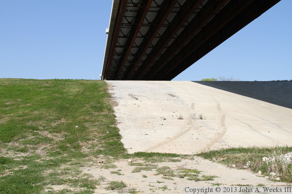
These two photos were taken while standing on top of the levee directly
under the Audubon Bridge west approach span #13. The photo above is
looking west under the approach spans, while the photo below is looking
east under the river crossing spans.

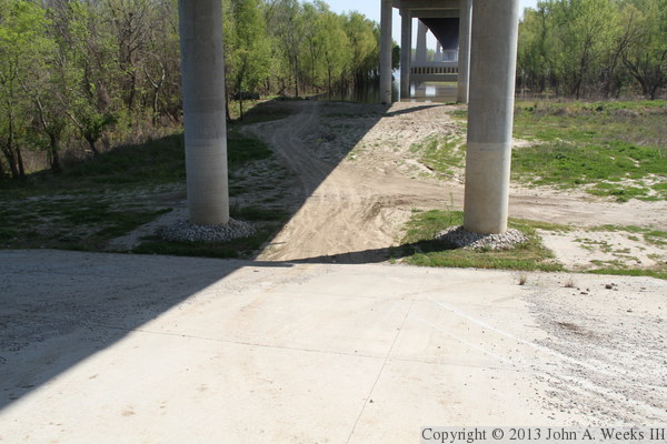
The photo above is the concrete apron covering the levee on the west
side of the Mississippi River. The photo below is looking down from
the top of the levee along the concrete apron, as well as a view of
the base of pier #13 (counting from the west). Despite how steep the
concrete apron is, a lot of vehicles use this apron to gain access to
the river. In fact, if you look close, you will see a pickup truck
with boat trailer parked to the left of pier #14 at the edge of the
river.

The photo above shows the riprap that is placed around the base of the
concrete columns for pier #13. Despite this ground being dry, it has
already been under as much as 25 feet of water during the short history
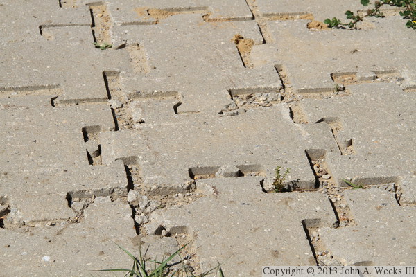
of this bridge. The photo below is a close view of the concrete mat
leading up to the apron. It was built using interlocking concrete blocks.

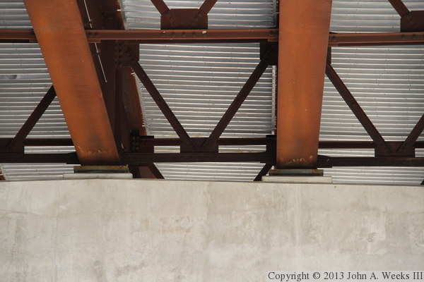
These two photos are views of the underside of the steel girder approach
spans. The deck was formed by placing a layer of steel sheeting over the
girders, and then pouring a concrete deck. In the photo above, we see
a set of cross-braces that keep the girders from twisting. The photo
below is the top of a pier, where the girders sit on high density rubber
supports. This allows the bridge to move slightly as it expands and
contracts due to temperature changes.
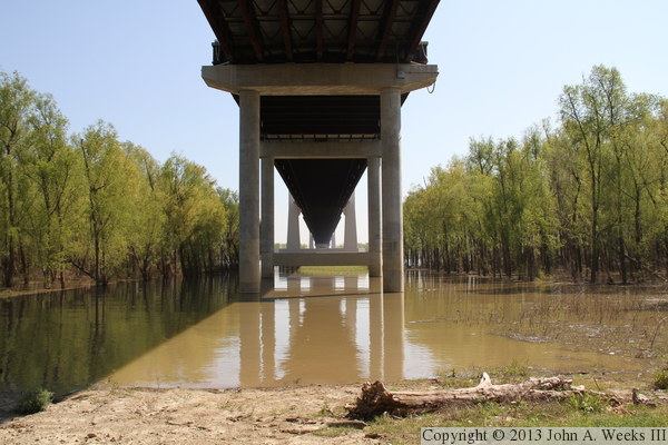
These two photos are views from along the edge of the west bank of the
Mississippi River. While the Mississippi is noted for being very muddy,
the water is actually not as muddy as these photos make it appear. The
color is largely a reflection of the trees off of the shallow water. In
the photo above, we are looking directly east under the bridge spans, while
in the photo below, we are looking east along the south face of the structure,
with the west main bridge tower visible at the edge of the main river channel.
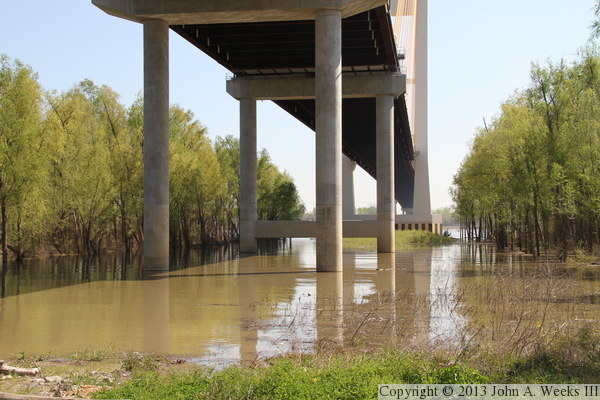

These two photos are similar to the photo above, but showing the entire
west main bridge tower. The photo above is taken from the edge of the
river, while the photo below is a view from the top of the levee.
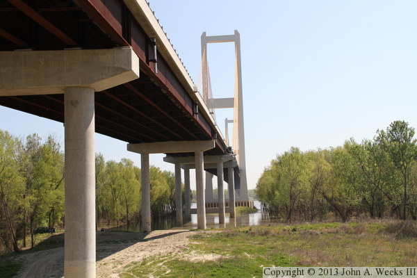
These two photos are additional views looking east along the south face of
the Audubon Bridge. The photo above is the widest angle where we can still
see both bridge towers without the trees getting in the way. The photo
below is a wider view, but the trees are blocking the main span and much of
the east bridge tower. It is unfortunate that there isn't a location that
has a clear view of the main span looking either upstream or downstream.


These two photos are views of the 15th and final west approach span
as seen from two different angles. Both views are from the top of the
west river levee.
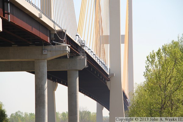
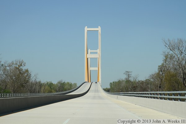
These two photos are views of the first main structure bridge span on
the west end of the cable stayed bridge. The main bridge structure
consists of 5 spans. First is a short span supported by concrete piers,
followed by a cable suspended span, followed by the main span between
the two bridge towers, followed by another cable suspended span, and
finally, a short span supported by concrete piers. The photo above
is a close view of the transition between the steel girder spans and
the main bridge, while the photo below is a nice view of that shorter
main bridge span where it transitions being cable suspended.

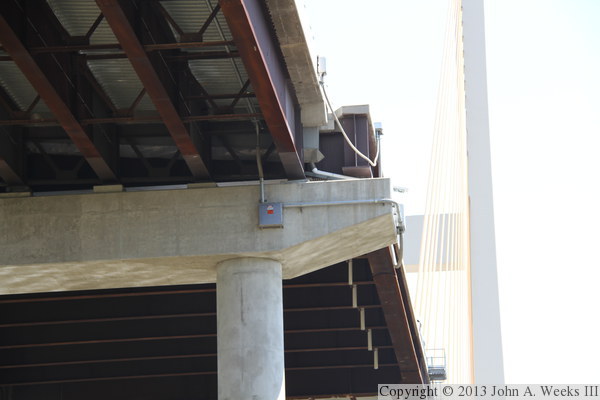
These two photos are close views of the top of the bridge piers at either
end of the short main bridge structure span that is not cable suspended.
These photos are difficult to take since the underside of the bridge is
very dark, while the top of the bridge is in bright sunlight. Note that
the main bridge deck steel is wider than the approach span steel, and also
note the walkway leading down to the top of the pier (in the photo below).

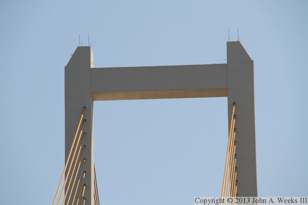
These two photos are close views of the west main bridge tower. The photo
above is the top of the bridge tower, which rises to an elevation of 520
feet above sea level, which is generally around 500 to 510 feet above the
river level. The photo below shows the concrete cross brace that is about
325 feet above the river, or about 120 feet above the bridge deck.


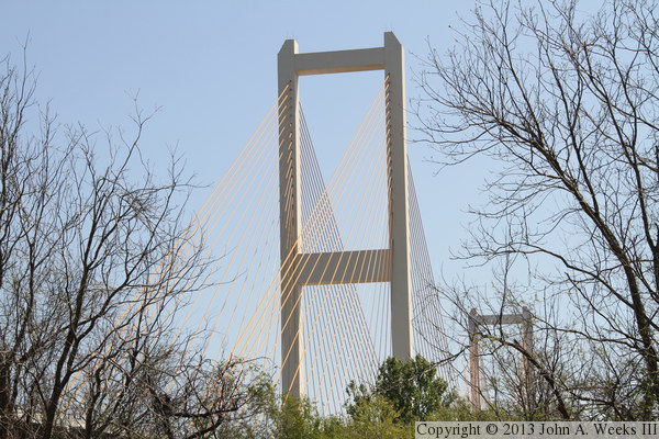
These two photos are views of the bridge towers as seen looking through the
trees from the levee on the west side of the Mississippi River. The west
main bridge tower is in the foreground, and the east main bridge tower is
in the background.
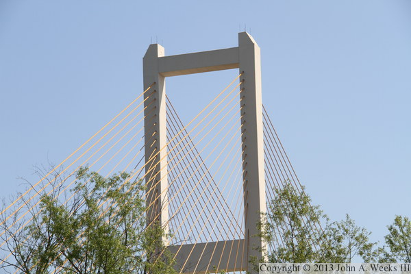
The photo above is a close view of the top of the west main bridge tower,
again, looking through the trees from the west river levee. There are a
total of 136 stay cables on the bridge, with 68 connected to the west
bridge tower, 34 per side, or 17 going each direction from each side of
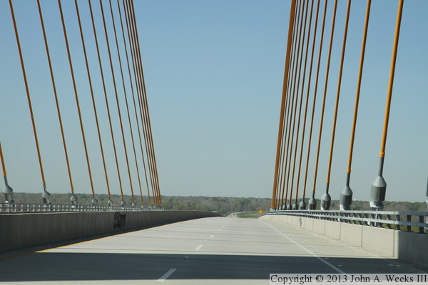
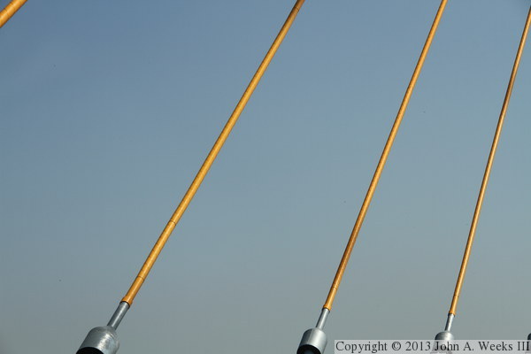
the tower. The photo below is a close view of several stay cables just
above the bridge deck. The gold color is a plastic cover over the cables
that protects the cables from damage.
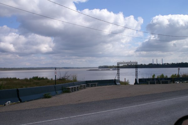
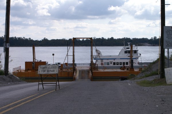
These two photos are views of the Saint Francisville New Roads Ferry, taken
several years before the Audubon Bridge construction was started. The
photo above is a view from the ferry landing looking south towards the
location of the future Audubon Bridge. Note the powerplant smokestacks on
the right side of the photo, and compare their location to the bridge photos
above. The photo below is the ferry boat. The ferry was closed
on the day that I visited, which is one of the problems with the ferry system.
Another issue is the long and winding road that leads to the ferry landing.
The ferry closed for good on May 5, 2011, the same day that the new bridge
opened.
|
