Prior to 1964, there were only two cities with highway bridges over the
Mississippi River on the lower 350 miles of the great river. The need for
traffic to cross the river was largely met by a series of ferry crossings,
some of which are private ventures, and others that are state operated.
The state of Louisiana wishes to replace many of these ferry crossings with
highway bridges, but progress is slow. A ferry boat tragedy in 1976 that
claimed 78 lives brought national attention to the problem. The I-310 Hale
Boggs Memorial Bridge was built directly as a result of the ferry accident,
and this bridge at Gramercy followed a decade later.
The bridge at Gramercy carries Louisiana highway LA-3213 over the Mississippi
River. The structure is often called the Gramercy Bridge, but its official
name is the Veterans Memorial Bridge. While economic development really took
off near Donaldson after the Sunshine Bridge was completed, the Veterans
Memorial Bridge has yet to realize its full potential. It has helped the local
farming industry avoid hauling sugar cane the long way around using another
river crossing. Beyond that, the highway going west into rural Louisiana has
never been built, leading some to refer to this structure as a bridge to
nowhere.
Update—As of June 17, 2008, the ‘Bridge To Nowhere’ is
finally connected on both ends. The stub connection on the west end of the
bridge was extended two miles to meet with LA-3127. The west end formerly
connected only to the Great River Road running along the Mississippi River.
The road extension was finished for some time before it finally opened. The
power company took months to run power lines one mile down the road to a
railroad crossing. Without the railroad crossing being completed, the road
could not be opened to highway traffic, making it a ‘Road To
Nowhere’ from the ‘Bridge To Nowhere’.
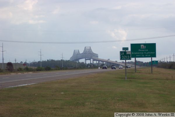
The photo above is a view looking south towards the Veterans Memorial Bridge
from a vantage point along the edge of highway LA-3213 located about a mile
and a half north of the Mississippi River. The river is 2,300 feet wide
at this location, putting the far end of the bridge truss structure about
two miles away in this view.
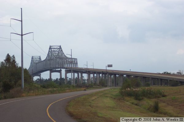
These two photos are views looking towards the bridge from vantage points
located northeast of the structure. The river runs east and west at this
location, so the bridge crosses the river in a southerly direction. The
photo above a view near the approach spans located about 2,800 feet from
the edge of the Mississippi River. The photo below is a wider view from
a vantage point located about 1,000 feet further north.
The photo above is a view of the Veterans Memorial Bridge as seen from about
a mile southwest of the bridge from a vantage point located along the road
that parallels the Mississippi River.
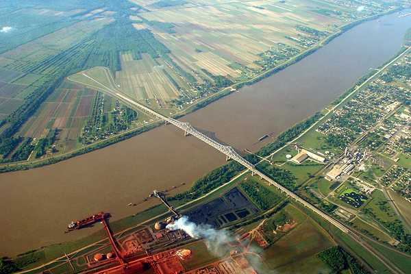
The spectacular photo below was taken by
Andy Jung from the window of an
airliner just prior to landing at New Orleans. While I normally only
use my own photography, this one was far too good to pass up. The lack
of a connecting highway on the far side of the bridge is easily seen
from this vantage point.