The Bonnet Carre Spillway is located in Norco, Louisiana, which is
about 32 miles upstream of downtown New Orleans. The spillway acts
as a relief valve for the great river in the event of a major flood.
The levees around New Orleans cannot handle the volume of water that
the Mississippi River can potentially carry. In addition, we know
that is not a good idea to stress the levee system, let alone press
it to its limits. During periods of high water, the spillway is
opened, allowing a large fraction of the Mississippi River water
to flow into Lake Pontchartrain upstream of New Orleans. This
reduces the amount of water that has to flow past New Orleans,
which reduces the chance of a levee failure and flood in the urban area.
A secondary function of the Bonnet Carre Spillway is to prevent the
Mississippi River from changing course. Both the Mississippi River
and Lake Pontchartrain are at sea level, and the majority of the land
in the area varies between one and three feet above sea level. The
only thing holding back the Mississippi River is a ridge that runs
along the east bank of the river that is 12 to 16 feet high. That
ridge and the levee system are all that keeps the great river in
check. In fact, in past floods, the Mississippi River would overflow
this ridge and drain part of its flow into Lake Pontchartrain. In
the mid-1800's, the Mississippi River flowed into the Lake for
6 months following a flood. The result is that a number of small
channels had been cut over the years between the river and the lake.
The spillway normally blocks the Mississippi River from flowing into Lake
Pontchartrain, but provides a controlled outlet for this water when needed.
Update—the Bonnet Carre Spillway was opened on Friday, April
10, 2008, at shortly after noon due to high water in the Mississippi
River channel. This was the first time that the spillway has been
opened since 1997, and only the 9th time in history that the spillway
has been used. The first time was in 1937. In the 2008 opening, 160 of 350
bays of the spillway were opened, with the structure remaining open for
31 days.
Update—the Bonnet Carre Spillway was opened again on Monday, May 9,
2011, as 28 gates opened. 44 gates were opened by the end of the day on
Tuesday, with 330 gates in operation by May 18. Due to the advance notice
that the structure was opening, spectators crowded the observation deck at
the south end of the structure to watch the spillway being opened.
The photo above is the east face of the spillway looking towards the
southwest. The spillway runs east and west, with the west end being
upriver, and the east end being downriver. The water flows north when
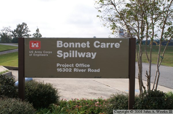
exiting the Mississippi River. The photo below is the US Army Corp of
Engineers project sign.
The photo above is a close view of several of the spillway gates. The gates
are made out of pressure treated wood. To open the spillway, a crane lifts
each wooden plank out and puts it on top of the structure for storage.
The gap in the middle of each gate allows a small flow of water through
the spillway in the event of moderately high (but not flood level) water.
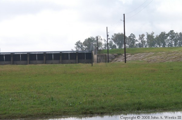
The photo below is the northern end of the spillway structure. The structure
connects into the levee system that follows both sides of the river.
The photo above is the front side of the spillway structure taken from
the south end, while the photo below is the rear side of the structure.
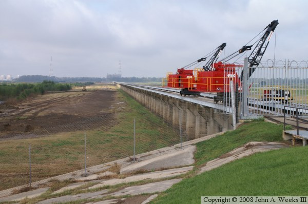
These cranes travel the top of the structure and are used to remove and
reinstall the timbers that form the gates. There are 7,000 timbers in
all, filling 350 bays. It can take 36 hours for these two cranes working
in concert to fully open the spillway.
The row of concrete blocks running parallel to the spillway are in
place to calm the flow of water. Normally, water rushing through the
spillway and falling ten feet would cause a lot of turbulence, which
could lead to scour holes and failure of the dam. The blocks calm the
water, preventing the turbulence.
The photo above is looking towards the Mississippi River. The spillway is
located in a natural swale depression in the terrain. Notice that the
levee that normally runs along the river does not exist in this area. As
a result, when the river level rises, water is free to flow up to the
spillway structure.
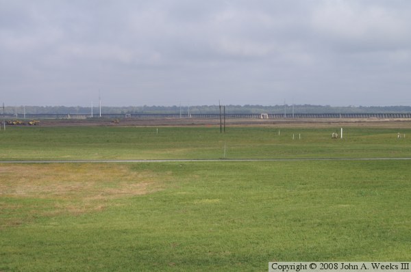
The photo below is looking east towards Lake Pontchartrain, which is nearly
six miles in the distance. When not in operation, the spillway is used as
a recreation area. Given that it is used about once every 10 years, there
is no other use for the land. A railroad crossing can be seen in the
distance. In addition, US-61 crosses the spillway just past the railroad,
and I-10 crosses further east right along the edge of the lake. Both
highways are on elevated structures.