| Highways, Byways, And Bridge Photography |
Lake Superior Water Pipeline Bridge
Saint Louis River Pipeline Crossing
Cloquet, MN
|
• Structure ID: |
N/A |
|
• Location: |
River Mile 34.2 |
|
• River Elevation: |
1,121 Feet |
|
• Pipeline Operator: |
City Of Cloquet |
|
• Bridge Type: |
??? |
|
• Bridge Length: |
235 Feet (Estimated), 88 Foot Longest Span (Estimated) |
|
• Bridge Width: |
4 Feet (Estimated) |
|
• Navigation Channel Width: |
Non-Navigable |
|
• Height Above Water: |
??? Feet |
|
• Date Built: |
1969 (Unconfirmed) |
Note—I have not yet visited this structure as of August, 2010.
Paper mills use large volumes of water. The water is used both in the
manufacturing process as well as for mechanical power. It is not surprising
that paper mills are most often located next to a dam to take advantage of
the power of falling water. That was a major consideration when the Potlatch
Corporation originally built this paper mill in Cloquet in 1899.
The city of Cloquet also drew water from the Saint Louis River for its
municipal water supply. This was recognized as a hazard in the mid-1900s
due to decades of industrial pollution. The impact to water flow rates in
the river was also not desirable. As a result, the city of Cloquet developed
a plan to draw water from Lake Superior and pipe it up the hill for use by
the city and the Potlatch mill. Several other local cities joined the
project so they could share this water. The pipeline went into service
around 1969 or 1970. It operates under DNR permit 78-2147.
The water pipeline runs generally east and west for 20 miles. It starts under
75 feet of Lake Superior water about a mile and a half off shore of Park Point
just east of the Sky Harbor airport on Minnesota Point. The first of two pump
stations is located on Minnesota Point, the Walter Stock Pump Station #1. The
pipe crosses the bay just south of Barkers Island, passes under the city of
Superior water treatment plant, then runs along 18th Avenue East. The pipe
runs west along North 28th Street, then Billings Drive, where it passes back
underwater in a small park just north of White Birch Trail. The pipe
emerges from underwater in Gary New Duluth and runs parallel to and about a
block south of North 85th Avenue West. The pipe starts to climb Thompson
Hill, passing under the state trail and under Knowlton Creek Boulevard. At
this point, it connects to the Paul Wagtskjold Pump Station #2, and into
the Paul Wagtskjold Reservoir.
The water pipe continues its journey west by climbing to the top of Thompson
Hill skirting the north side of Spirit Mountain, and passing just behind the
McDonald's at I-35 and Boundary Avenue. I am not sure of the path that the
pipe takes from this location. It may run along the south side of I-35,
or it might cross I-35 at this location. At any rate, it ends up at the
Mace Harris Reservoir located one mile northeast of the interchange of I-35
and Midway Road. This reservoir marks the high point of the pipeline at
1426 feet, some 824 feet above Lake Superior. From the reservoir, the pipe
heads southwest to near the interchange of I-35 and highway 61. The pipe
passes under 61, then crosses 61 again to run along the north edge of Esko.
A branch of the pipe feeds the city of Esko. The pipe continues west
northwest directly to the Sappi Paper Mill, where it crosses the Saint Louis
River on a bridge located above the waterline.
In recent years, the city of Cloquet has converted to using wells for public
drinking water. As a result, the city no longer uses the pipeline under
routine circumstances. The pipeline water is available for use in
emergencies for fire fighting. The cities of Thomson and Carlton also use
the pipeline water for fire fighting. The major water user remains the Sappi
Paper Mill, who purchased the Potlatch Mill in 2002. As of 2010, Sappi is
planning to install an additional paper machine. This machine would increase
water demands from the recent 11.5-million gallons of water per day up to
15-million gallons of water per day. Engineers have confirmed that the
water pipeline, pump stations, and reservoirs can provide over 17-million
gallons per day. Sappi has prepared a extensive environmental impact
statement as part of their application for a building permit. In reading
this document, it is clear that Sappi has taken this process seriously and
is very committed to running a clean plant and minimizing their environmental
impact.
The water pipeline was originally built with concrete pipe. I have seen
reports that it was approximately 38 inches in diameter, but I have not yet
confirmed that number. Much of the original concrete pipe has since been
replaced with ductile iron pipe. The section near I-35 and highway 61,
including the pipeline that crosses under I-35, was replaced in the mid-2000s
with 54 inch diameter pipe.
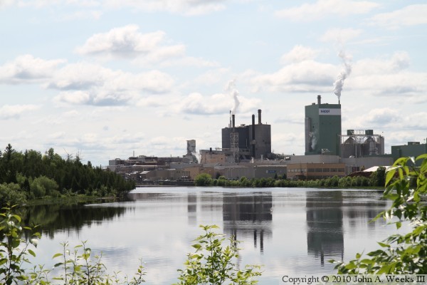
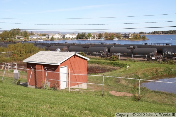
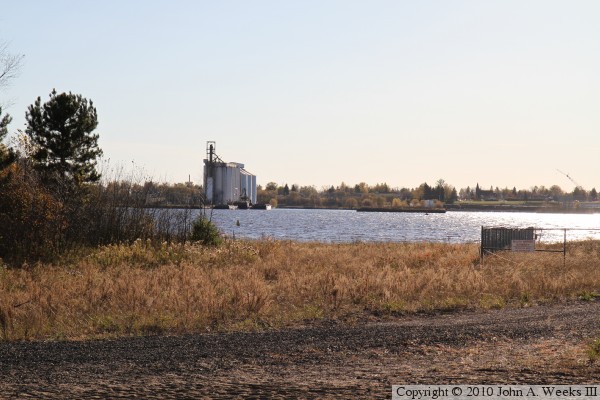
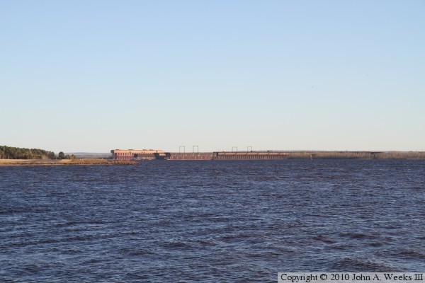
The photo above is looking south across the Saint Louis River into the
morning sun towards the Sappi paper mill in Cloquet. The pipeline is about
a quarter mile downstream in an area that is not accessible by the public.
This vantage point is located just upstream of the Cloquet Dam, and just
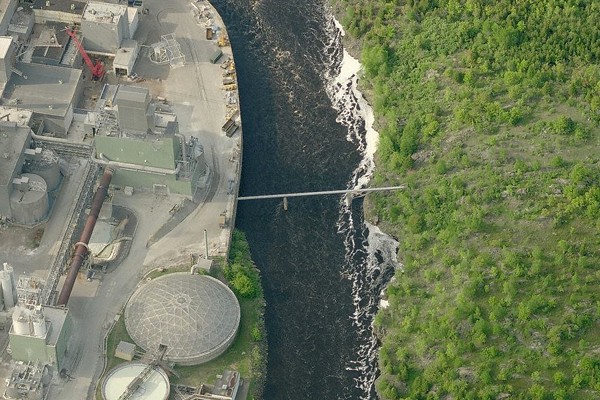
downstream of the Knife Falls Dam. The image below is clipped from the Bird's
Eye view in Bing Maps. The river is flowing from top to bottom. Water in the
pipeline flows from right to left towards the mill.
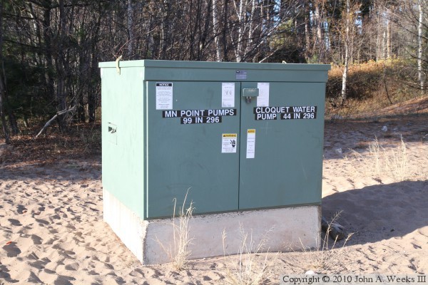
These two photos show where the water pipe crosses the bay between Park Point
in Duluth and the city of Superior. Park Point is in the distance, with Lake
Superior beyond the sandbar. The water intake is located about 1-1/2 miles
offshore approximately 75 feet below the surface of the lake. The pipe passes
under the gap in the trees. The building located in the gap is the
Minnesota Point Pump, part of the City of Superior water system. The Walter
Stock Pump Station is in the trees just to the right of the gap. The pipe
crosses to the right of the island on the right side of the photo above, or
about in the center of the photo below.
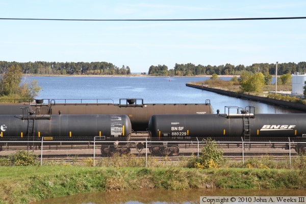
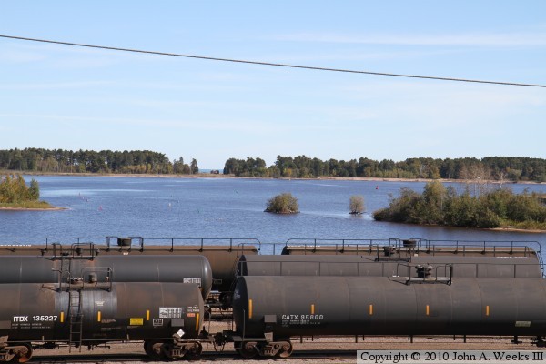
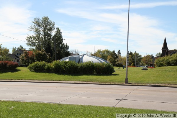
The water pipe passes under these settling ponds (above) along highway US-53
in Superior. The southern tip of Barker's Island is visible just beyond the
railroad tank cars. After crossing under US-53, the pipe passes through the
city of Superior water treatment plant. The photo below shows the top cap
of one of the underground reservoirs at the facility.
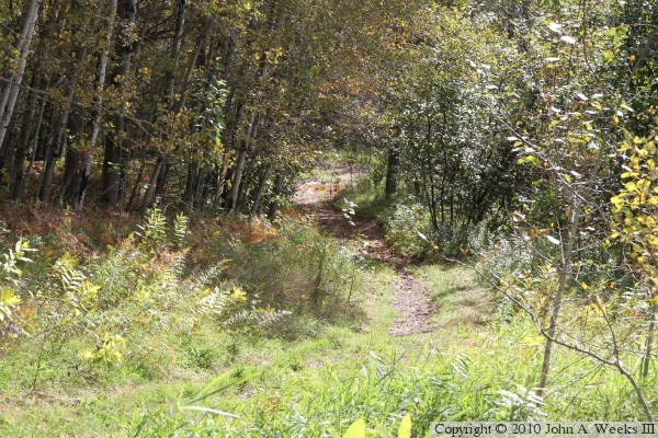
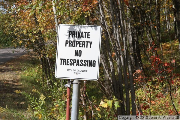
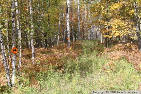
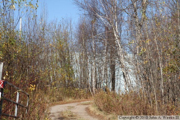
These two photos were taken along Knowlton Creek Boulevard in the Fairmont
Park neighborhood of Duluth. The photo above shows the path where the water
pipe is buried as it climbs a particularly steep grade. The photo below is
the No Trespassing sign on the driveway leading to the the
Paul Wagtskjold Pump Station and Reservoir. The City of Cloquet notation
confirms that this facility is part of the Lake Superior Water Pipeline.
While the driveway to the water pump station is posted for No Trespassing,
there happens to be a public trail located at the edge of the site, as seen
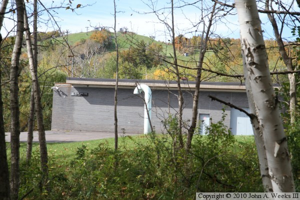
in the photo above. The photo below is a view looking though a gap in the
trees of the Paul Wagtskjold Pump Station. The Spirit Mountain Ski Area is
located in the background.
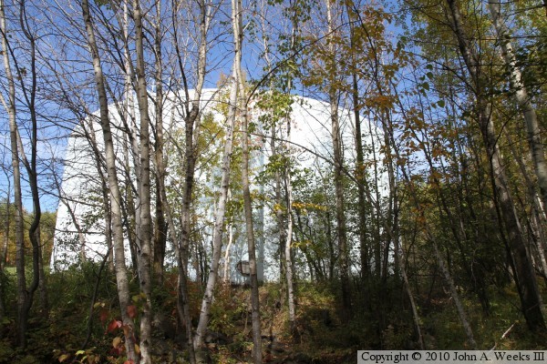
The photo above is the Paul Wagtskjold Reservoir, also seen looking through
the trees from the public trail. The photo below is a view of the Paul
Wagtskjold Reservoir looking to the north from an overlook on Skyline Parkway.
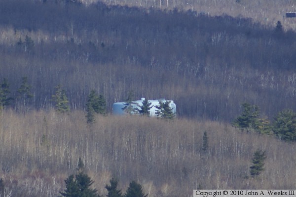
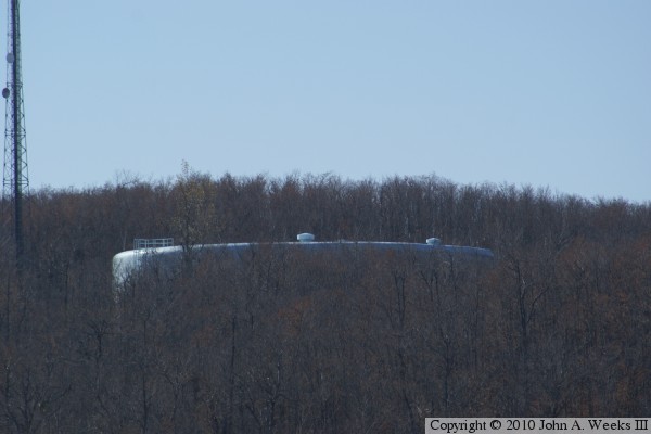
These two photos are views of the Mace Harris Reservoir, located on Maple
Hill Road about 3/4 mile north of Interstate highway I-35 and 1/2 mile east
of Midway Road. Maple Hill Road was cut in half when this reservoir was
built. The approach from the west is marked for no trespassing. One can
get with 350 feet of the reservoir approaching from the east, as shown in
the photo above. Since the reservoir is tucked in behind the peak of the
hill, and it is surrounded by trees, there is no good public view. In fact,
the photo below, a telephoto shot from a half-mile away, is the only view
that I could find from a public road. The tank was well hidden until the
leaves dropped from the trees in this autumn view.
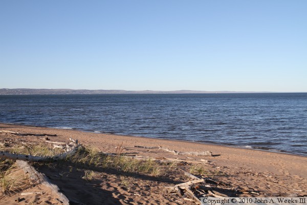
I had a chance to visit Park Point in the fall of 2010 to check out the site
of the water pipe intake. Park Point is a large sand bar located at the
western tip of Lake Superior. The photo above is looking northeast into
Lake Superior. The water pipe goes out into the lake below this vantage
point. The water pipe heads northeast of this location, with the intake being
located about a mile and a half offshore in 75 feet of water. The photo below
is looking east across Park Point. A short white pole near the right side of
the photo marks the path of the water pipe. The small building is the
Minnesota Point Pump, part of the City of Superior water system. The Walter
Stock pump is behind the trees on the right side of the photo.
The photo below, looking into the bright afternoon sun, is looking across the
bay between Park Point and the City of Superior. The water pipeline runs
through the gap between the fence and the trees, crosses under the bay, and
lands on the far shore near the construction crane located on the right edge
of the photo. The photo below is looking south across the bay where the
water pipeline crosses between Park Point (on the left) to Superior (on the
right). The runway for Sky Harbor airport is visible on the right. The
water pipeline is located at the far end of this runway. The structures
in the distance are the BNSF taconite docks.
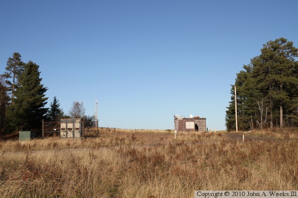
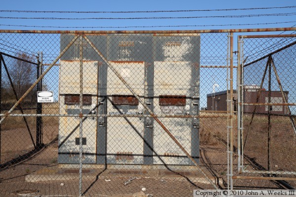
These two photos are close views of the electrical cabinets that feed the two
pump houses. It is interesting to note that the MN Point Pump has a backup
electrical generator, but the Walter Stock Pumping Station does not. The
two reservoirs on the water pipeline can continue to feed water through
small interruptions in power at the intake pump.
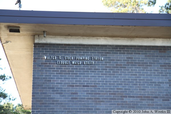
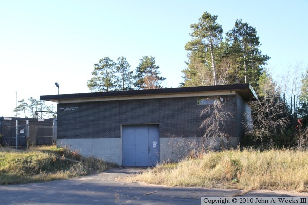
The two photos are the south face of the Walter Stock Pumping Station. The
photo above is a close view of the name on the building, while the photo
below is a wider view.
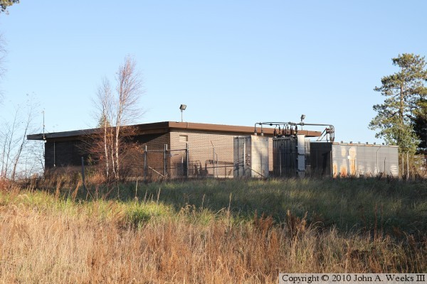
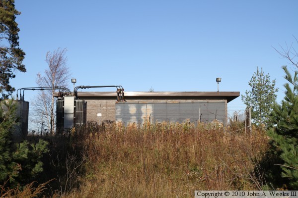
These two photos are additional views of the Walter Stock Pumping Station.
The photo above is looking southeast, while the photo below is looking east.
Lake Superior is located just beyond the far side of the building.
|
