The Duluth & Northeastern was primarily a logging railroad. It was
chartered in 1898 by the Potlatch Corporation, which ran the Potlatch
Paper Mill in Cloquet. The railroad brought logs to the mill, hauled
supplies back out to the logging camps, and handled common carrier
freight as needed. The railroad once ran 58 miles to Hornby, MN, but
in recent years, it ran only to Saginaw, MN, which is about 11 miles
north of Cloquet. The D&NE interchanged with the DM&IR and
CN at Saginaw.
The D&NE ceased operations around the year 2000. The track was
abandoned and removed. Four miles of track remain in Cloquet. It
is operated by the Cloquet Terminal Railroad, which switches cars
between a few local factories and the BNSF mainline. The CTRR
began operations on May 13, 2002, at which time the D&NE went
out of existence. It was the last logging railroad to operate in
the state.
There are two railroad bridges as part of the D&NE Saint Louis River
crossing. The bridge described on this page is the downstream bridge,
which connects the south side of the river at Cloquet to Dunlap Island,
which is a large island that sits in the middle of the river. This
bridge, which is still in operation, allows trains to move between the
Sappi Mill (former Potlatch Mill) on the south side of the river and the
CTRR yard on Dunlap Island.
Beyond that, I have no real information on the bridge. Based on aerial
photography, I estimated the length and width of the structure. It is
possible that this is the original 1898 structure, but it might also have
been upgraded when the railroad converted to diesel locomotives after WWII.
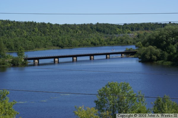
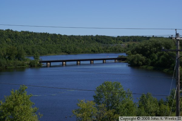
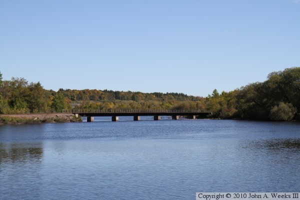
The photo above and below are each taken from the sidewalk on the nearby MN-33
Bridge over the south channel of the Saint Louis River. This view is looking
downstream towards the east. The land on the left end of the bridge is the
tip of Dunlap Island. The photo above would be a near perfect shot if it
wasn't for the electrical wires in the way. This is another case where a
chainsaw would come in very handy.
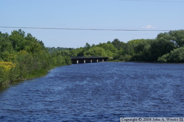
The photo above is looking downstream on the south river channel towards the
south side of the Lower Dunlap Island Railroad Bridge. The vantage point
is the sidewalk on the Main Street Bridge, looking through one of the main
river spans of the MN-33 Bridge. The photo above is a peek at the north
side of the railroad bridge as seen from the shore on the north side of
Dunlap Island.
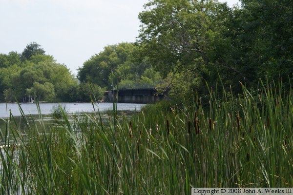
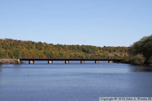
I had a chance to visit this bridge again in the early fall of 2010. The
photo above is looking east towards the upriver face of the Lower Dunlap
Island Railroad Bridge. The vantage point is the edge of the river on the
south shore of the Saint Louis River near the south span of the MN-33
highway bridge. The photo below is a closer view from a spot on the south
river bank located a few hundred feet downstream of the MN-33 bridge.
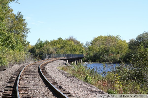
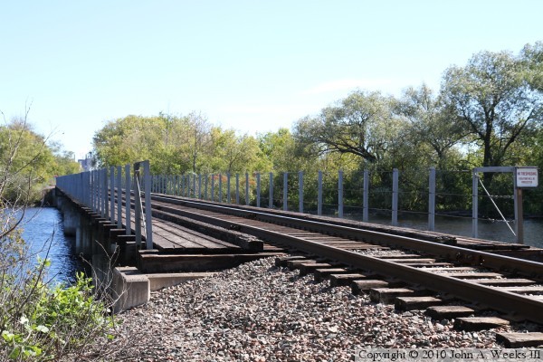
These two photos are views looking east down the railroad tracks towards the
west end of the bridge. The photo above is view looking around the curve
at the west end of the bridge and looking down the south face of the bridge.
The photo below is a view of the bridge from near the southwest corner of the
structure.
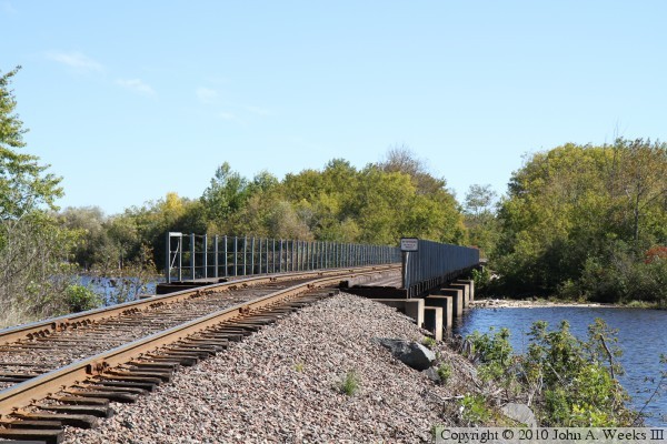
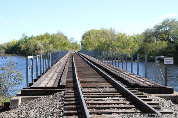
The photo above is a view of the Lower Dunlap Island Bridge as seen from the
northwest corner of the structure. The photo below is looking east down the
length of the bridge deck. This view is looking towards the south bank of the
river from Dunlap Island.