Current Weather Conditions
John A. Weeks III
Thursday, September 2, 2010, 9:01:28 PM CDT
Home 12 Easy Steps Random Topics About The Author Portal
Aviation Spacecraft Highways & Bridges Photo Tours Rail Fan

Google Search

 Maps  Groups
 Images  Search
  Home
  • 12 Easy Steps
  • Aviation
  • Spacecraft
  • Highways & Bridges
    » Bridge Photography
      - MSP River Bridges
      - C & D Canal
      - Illinois River
      - Minnehaha Creek
      - Minnesota River
      - Mississippi River
      - Missouri River
      - St. Croix River
      - St. Louis River
        › St. Louis Headwaters
        › Upper St. Louis River
        › Forbes - US-53 Area
        › Up Mid St. Louis River
        › Lw Mid St. Louis River
        › Fond du Lac Reservatn
        › Cloquet - Scanlon
          · Upper Dunlap Is RR
          · Main Street Bridge
          · MN-33 Br (N Span)
          · MN-33 Br (S Span)
          · Lower Dunlap Is RR
          · Knife Falls Dam
          · Cloquet Dam
          · Sappi Water Pipeline
          · Scanlon Dam
          · CSAH-61 Bridge
          · I-35 Bridges
        › Jay Cooke State Park
        › Twin Ports Harbor
      - Wisconsin River
      - Cable Stayed Bridges
      - McGilvray Road
      - I-35W Bridge Disaster
      - Miscellaneous Bridges
    » Road Geek Topics
  • Random Topics
  • Photo Tours
  • Rail Fan
  • About The Author
  • John's Portal
 
Site Search By JRank
Highways, Byways, And Bridge Photography
Main Street Bridge
Main Street Saint Louis River Highway Crossing
Cloquet, MN

Main Street Bridge

• Structure ID: NBI 09517
• Location: River Mile 36.3
• River Elevation: 1,179 Feet
• Highways: Main St, MSAS-105
• Daily Traffic Count: 850 (2002)
• Bridge Type: Prestressed Concrete Girder, Concrete Deck
• Bridge Length: 200 Feet, ??? Foot Longest Span
• Bridge Width: 38 Feet, 2 Lanes
• Navigation Channel Width: Non-Navigable Feet
• Height Above Water: ??? Feet
• Date Built: 1995
The Main Street Bridge in Cloquet, Minnesota, connects the central downtown area of the city to Dunlap Island, and area shared by heavy industry and parks. The current bridge is very new, having been built in 1995. It replaced and older bridge that was located one block to the north, just upstream from the current bridge location. The new location eliminates a jog in main street. This is a welcome fix given that Dunlap island sees both truck traffic for the industry and long RVs and motorhomes that use the campground.

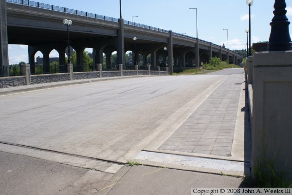
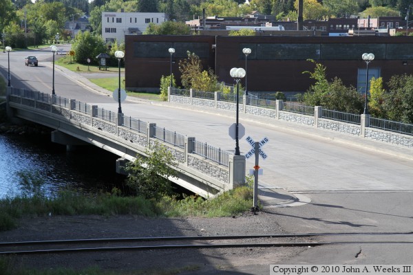
The huge MN-33 expressway bridge sits very close to the Main Street bridge. While the MN-33 bridge soars high over the water, the Main Street bridge is very low to the water. This is an interesting side by side contrast. The reason is that the heavily traveled MN-33 expressway goes over the top of the railroad tracks to avoid having through traffic stop for trains. The much less used Main Street bridge is at the same grade level as the railroad tracks. Since railroads are very sensitive to elevation and grades, the rail tracks cannot easily be raised or lowered. As a result, the elevation of Main Street was determined by the railroad tracks.

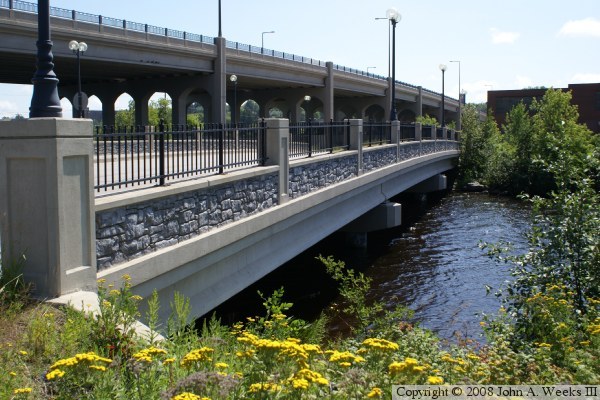
The bridge is a prestressed concrete girder bridge with a reinforced concrete deck. That is pretty typical of a rural Minnesota bridge. What is not as typical is the extensive use of decorative elements on the bridge. We see cobblestone on the side of the bridge, paver stones on the walkways, wrought iron guardrails, and fancy retro-style street lights. While I am sure that these features added to the cost of the bridge, a bridge sitting in a location such as this that has both the natural beauty of the Saint Louis River and the history of the City of Cloquet simply has to be a signature structure. The bridge designers really hit a home run with this landmark bridge.
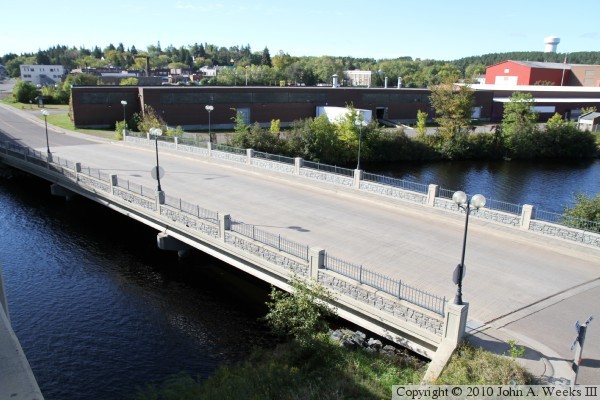
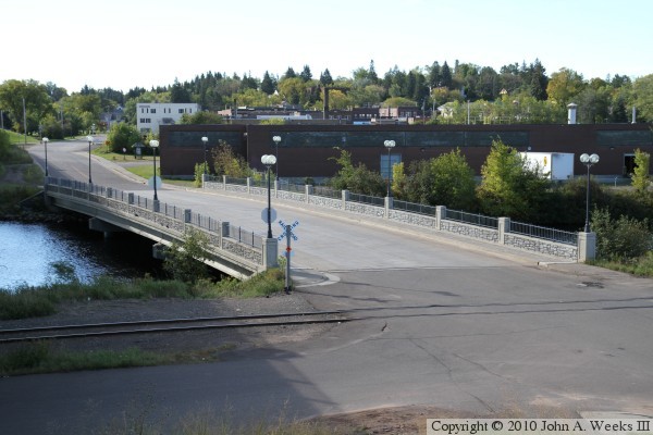
The final two photos below show the remains of the old bridge that once crossed the north channel of the Saint Louis River. That bridge would have been used along with the old Main Street Bridge as the one and only Saint Louis River crossing in the city of Cloquet. I have not yet learned the dates when this bridge was in use. It appears that the current MN-33 expressway bridges are replacements for earlier bridges on the same alignment, so these bridge remains would have been from and even older time period.


Made With Macintosh
Authored by John A. Weeks III, Copyright © 1996—2010, all rights reserved.
For further information, contact: john@johnweeks.com