A mill dam was built in Cloquet in 1899, and the Thomson water project
was built in 1907. This left a 5.3 mile segment of the Saint Louis River
with a 70 foot drop that was prime for development of hydro power. The
city of Scanlon felt that having a city-owned source of hydro power would
give them a competitive edge. An ideal spot was located on a rapids just
a mile and a half south of the Cloquet dam.
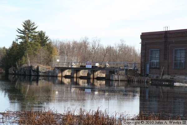
At that spot, the river divided into two channels and fell over a small
rapids. A set of gates and a power house was installed on the west
channel, and a set of gates and an overflow spillway were installed on
the east channel. Two additional plug dams were installed to block
natural channels in the rock between the two main dam segments. The
east channel dam is visible from the CSAH-61 bridge, while the west
channel dam is visible from a trail that runs north along the river
from the whitewater kayak park in Scanlon.
The resulting powerplant is able to generate 1.6-megawatts of power
on an ongoing basis. Since the dam does not have a large storage pool,
it operates as a run-of-the-river plant. That is, all water that flows
downriver passes through the dam. If there is not enough water flowing,
there is no reservoir to draw from. The dam structure is reinforced
concrete. It sits on pilings driven into the rock in the rapids. The
dam depends on its weight to keep it anchored in place.
Shortly after the dam was built, control was passed onto Minnesota
Power, who operates the dam to this day under the Allete family of
companies.
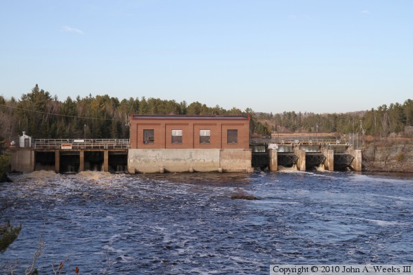
The photo above is looking northeast from the trail that runs along the
west side of the river north of the Whitewater Kayak Park in Scanlon.
This is the west channel dam. There is a control structure on the east
channel on the other side of the rock formation at the right side of this
photograph.
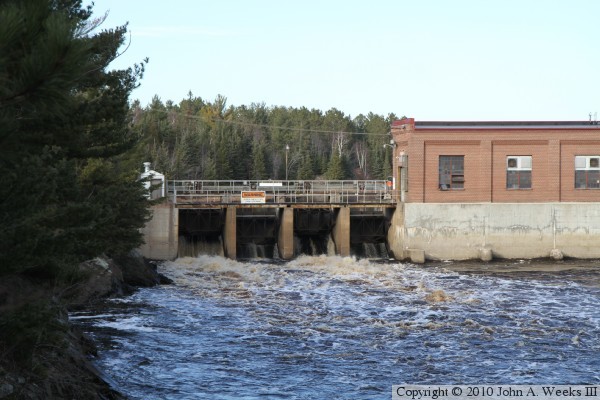
The photo above is a closer view of the west side of the west channel control
structure, while the photo below is the east side of the west channel control
structure. The water flow is relatively high for an autumn day. This is due
to an early snow followed by a very warm spell, which caused the snow to melt
very quickly. The Saint Louis River ran very high for about a week. This is
the tail end of that runoff.
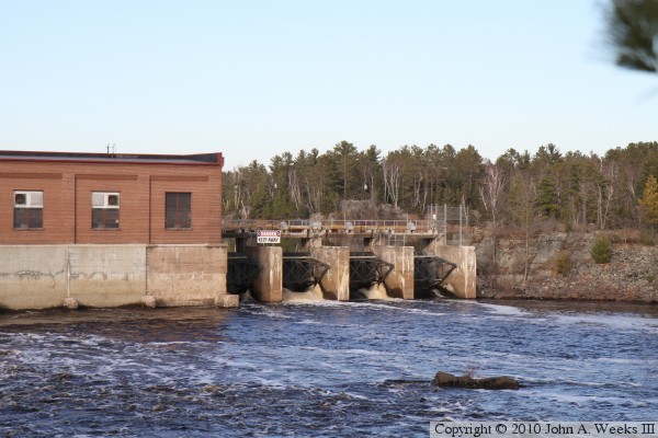
The photo above is looking east across the river just behind the Scanlon Dam.
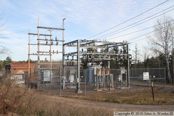
The photo below is the power substation located west of the dam. While this
substation is very small, it does handle enough electricity to power 1,500
homes.
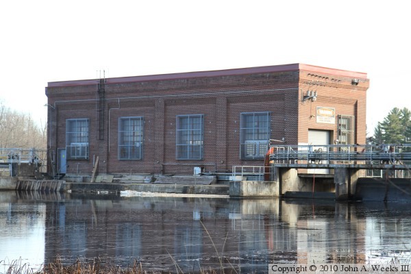
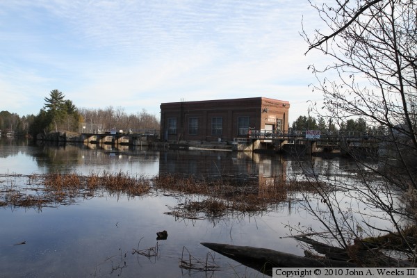
The photo above is the upstream side of the power house. There is a thin
skin of ice on the water due to low overnight temperatures. Some of that
ice has piled up against the power house foundation. The photo below is the
back side of the control gates on the east side of the power house.
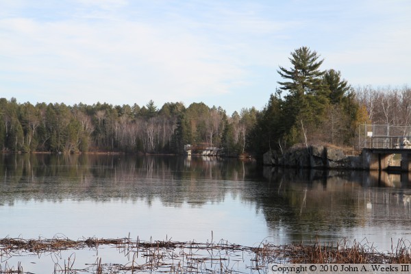
These two photos are views of the dam pool on the upstream side of the
structure. The east channel control gates are visible in the distance on
the photo above. The two channels are separated by a ridge of rock that
forms an island between the two river channels.
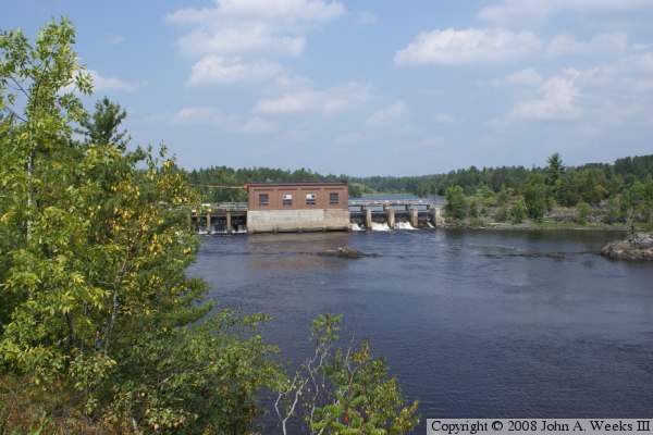
The photo above is a summer view of the Scanlon Dam as seen from the trail
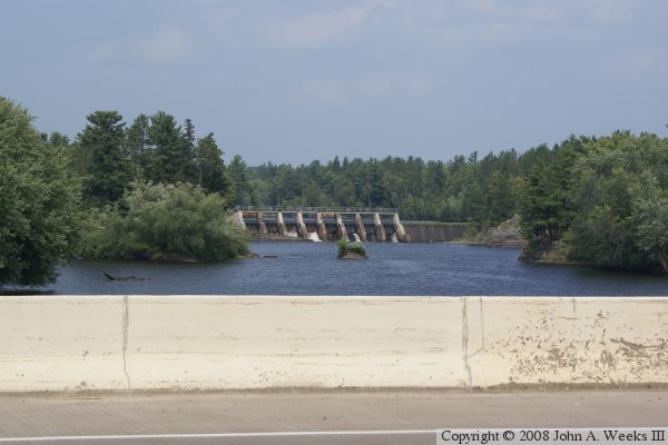
that runs along the west side of the river. The photo below is the east
channel control dam as seen from the Highway 61 bridge located just downriver
from the structure.