Current Weather Conditions
John A. Weeks III
Thursday, September 2, 2010, 9:25:17 PM CDT
Home 12 Easy Steps Random Topics About The Author Portal
Aviation Spacecraft Highways & Bridges Photo Tours Rail Fan

Google Search

 Maps  Groups
 Images  Search
  Home
  • 12 Easy Steps
  • Aviation
  • Spacecraft
  • Highways & Bridges
    » Bridge Photography
      - MSP River Bridges
      - C & D Canal
      - Illinois River
      - Minnehaha Creek
      - Minnesota River
      - Mississippi River
      - Missouri River
      - St. Croix River
      - St. Louis River
        › St. Louis Headwaters
        › Upper St. Louis River
        › Forbes - US-53 Area
        › Up Mid St. Louis River
        › Lw Mid St. Louis River
        › Fond du Lac Reservatn
        › Cloquet - Scanlon
          · Upper Dunlap Is RR
          · Main Street Bridge
          · MN-33 Br (N Span)
          · MN-33 Br (S Span)
          · Lower Dunlap Is RR
          · Knife Falls Dam
          · Cloquet Dam
          · Sappi Water Pipeline
          · Scanlon Dam
          · CSAH-61 Bridge
          · I-35 Bridges
        › Jay Cooke State Park
        › Twin Ports Harbor
      - Wisconsin River
      - Cable Stayed Bridges
      - McGilvray Road
      - I-35W Bridge Disaster
      - Miscellaneous Bridges
    » Road Geek Topics
  • Random Topics
  • Photo Tours
  • Rail Fan
  • About The Author
  • John's Portal
 
Site Search By JRank
Highways, Byways, And Bridge Photography
I-35 Bridges
I-35 Saint Louis River Highway Crossing
Scanlon, MN

I-35 Bridges

Northbound Span
• Structure ID: NBI: 09808
• Length: 486 Feet, ??? Foot Longest Span
• Width: 40 Feet, 2 Traffic Lanes
 
Southbound Span
• Structure ID: NBI: 09807
• Length: 486 Feet, ??? Foot Longest Span
• Width: 40 Feet, 2 Traffic Lanes
 
Statistics Common To Both Spans
• Location: River Mile 32.3
• River Elevation: 1,100 Feet
• Highways: I-35
• Daily Traffic Count: 27,600 (2006)
• Bridge Type: Steel Girder, Concrete Deck
• Navigation Channel Width: Non-Navigable
• Height Above Water: ??? Feet
• Date Built: 1971
Interstate highway I-35 was finished between Hinkley and Duluth in 1971. That section of road replaced US-61 in many areas. Here in Scanlon, I-35 used a new road alignment that ran parallel to and just south of US-61. As a result, US-61 (since downgraded to be a county road) crosses the Saint Louis River just 1,600 feet upstream of I-35.

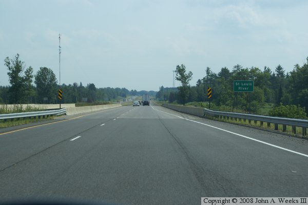
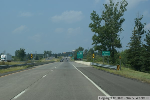
The I-35 bridges are two identical 486-foot long steel girder bridges. The girders are constructed from a series of very large steel I-beams. They sit on piers that are large pilings topped off with concrete pier caps. The deck and guardrails are reinforced concrete. These bridges were built at a time when the Interstate highway system was rapidly expanding. The key design features were economics and time to build. It had to be quick and cheap. As a result, the bridges a devoid of any decorative features. They do, however, serve their purpose very well. One hardly even realizes that they are crossing the dangerous Saint Louis River as they motor past at 70 miles per hour.

The river elevation at the I-35 bridges is 1,100 feet. For this point, it is a 500 foot vertical drop to Lake Superior. The river will drop this distance in just 6 miles (as the crow flies).
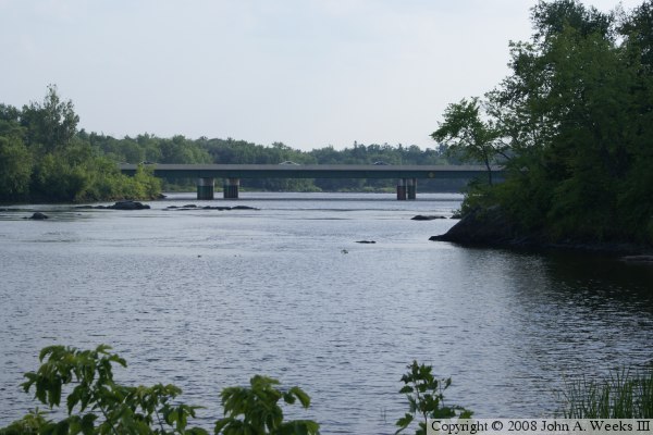
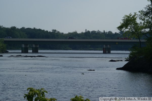
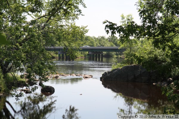
The top and bottom photos were taken from the canoe landing just south of the CSAH-61 bridge. The photo below is crossing the northbound span, while the third photo is crossing the southbound span.


I-35 Bridges
I-35 Bridges
I-35 Bridges
I-35 Bridges

Made With Macintosh
Authored by John A. Weeks III, Copyright © 1996—2010, all rights reserved.
For further information, contact: john@johnweeks.com