Current Weather Conditions
John A. Weeks III
Sunday, May 5, 2024, 11:35:40 AM CDT
Home Photo Tours Rail Fan 12 Easy Steps
Aviation Spacecraft Highways & Bridges About The Author
 
Google Search
Maps   Groups   Images   Search
 
  Home
  • 12 Easy Steps
  • Aviation
  • Spacecraft
  • Highways & Bridges
    » Bridge Photography
      - MSP River Bridges
      - C & D Canal
      - Illinois River
      - Minnehaha Creek
      - Minnesota River
      - Mississippi River
        › Lake Itasca Area
        › Bemidji Area
        › Cass Lake - Ball Club
        › Grand Rapids Area
        › Blackberry - Crosby
        › Brainerd Lakes Area
        › Little Falls Area
        › St. Cloud Area
        › North Metro Area
        › Port Of Minneapolis
        › St. Anthony Falls Area
        › Mississippi Rvr Gorge
        › St. Paul Area
        › S St. Paul - Hastings
        › Red Wing - Winona
        › La Crosse Area
        › Lansing - Clinton
          · Lock & Dam #8
          · Black Hawk Bridge
          · Big Slough Bridge
          · Stevens Slough Br
          · Henderson Slough Br
          · Winneshiek Slough Br
          · Lock & Dam #9
          · Washington Street
          · Blackhawk Avenue
          · Twin Suspension Br
          · Marquette-Joliet Br
          · East Channel Bridge
          · WI Street Bridge
          · Iowa Street Bridge
          · St. Feriole Is RR
          · Lock & Dam #10
          · Lock & Dam #11
          · Eagle Point Bridge
          · Dubuque-Wisconsin
          · City Island Bridge
          · 16th Street Bridge
          · CN RR Bridge
          · Julien Dubuque Br
          · Lock & Dam #12
          · Savanna-Sabula Br
          · Running Slough Br
          · Sabula Rail Bridge
          · Lock & Dam #13
          · Lyons-Fulton Bridge
          · Gateway Bridge
          · Sunfish Slough Br
          · C&NW Clinton Br
          · C&NW IL Ch RR
          · C&NW Sunfish Sl
        › Quad Cities Area
        › Muscatine - Louisiana
        › St. Louis Area
        › Chester - Cairo
        › Miss - Tenn - Ark
        › Ark - Miss - Louisiana
        › Louisiana Structures
      - Missouri River
      - St. Croix River
      - St. Louis River
      - Wisconsin River
      - Best Miss River Photos
      - Cable Stayed Bridges
      - McGilvray Road Bridges
      - I-35W Bridge Disaster
      - Miscellaneous Bridges
      - Madison County Bridges
      - Hist Br Weekend 2013
    » Road Geek Topics
  • Photo Tours
  • Rail Fan
  • About The Author
 
Site Search By JRank
Highways, Byways, And Bridge Photography
Wisconsin Street Bridge
US-18 Mississippi River Crossing At Prairie du Chien
Prairie du Chien, Wisconsin

Wisconsin Street Bridge

• Structure ID: NBI B12003000000000.
• Location: River Mile 635.2.
• River Elevation: 611 Feet.
• Highway: US-18.
• Daily Traffic Count: 4,800 (2001).
• Bridge Type: Concrete Girder, Concrete Deck.
• Length: 442 Feet Overall, 88 Foot Longest Span.
• Width: 37 Feet, 2 Lanes.
• Navigation Channel Width: Non-Navigable.
• Height Above Water: 21 Feet.
• Date Built: Opened 1974, Rebuilt 1991.
The Prairie du Chien river crossing crosses three river channels. The final channel crossing on the east side from Saint Feriole Island to the Wisconsin mainland is divided between two bridges, the east bound Iowa Street Bridge, and the westbound Wisconsin Street Bridge.

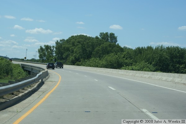
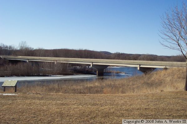
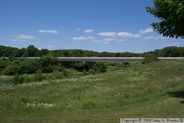
The two approach bridges are nearly identical using concrete girders and a concrete deck. The only real differences are that the Wisconsin Street Bridge is slightly longer, and it has a bit of a slant, while the Iowa Street Bridge is just slightly shorter but is built relatively level.

The Wisconsin Welcome Center is located on the east end and between these two bridges. That provides a safe and convenient place to park and photograph these two bridges.


Wisconsin Street Bridge

Made With Macintosh
Authored by John A. Weeks III, Copyright © 1996—2016, all rights reserved.
For further information, contact: john@johnweeks.com