Current Weather Conditions
John A. Weeks III
Friday, April 19, 2024, 5:15:04 AM CDT
Home Photo Tours Rail Fan 12 Easy Steps
Aviation Spacecraft Highways & Bridges About The Author
 
Google Search
Maps   Groups   Images   Search
 
  Home
  • 12 Easy Steps
  • Aviation
  • Spacecraft
  • Highways & Bridges
    » Bridge Photography
      - MSP River Bridges
      - C & D Canal
      - Illinois River
      - Minnehaha Creek
      - Minnesota River
      - Mississippi River
        › Lake Itasca Area
        › Bemidji Area
        › Cass Lake - Ball Club
        › Grand Rapids Area
        › Blackberry - Crosby
        › Brainerd Lakes Area
        › Little Falls Area
        › St. Cloud Area
        › North Metro Area
        › Port Of Minneapolis
        › St. Anthony Falls Area
        › Mississippi Rvr Gorge
        › St. Paul Area
        › S St. Paul - Hastings
        › Red Wing - Winona
        › La Crosse Area
        › Lansing - Clinton
        › Quad Cities Area
          · Fred Schwengel Mem
          · Le Claire Canal
          · Smith's Island Foot
          · LD #14 Entrance Br
          · Lock & Dam #14
          · Campbell's Island Br
          · Iowa-Illinois Mem Br
          · Moline-Arsenal Br
          · Sylvan Slough Canal
          · Moline Power Plant
          · Sylvan Island RR
          · Sylvan Island Wagon
          · Sylvan Slough RR
          · Arsenal Power Plant
          · Sylvan Slough Via
          · Government Bridge
          · Lock & Dam #15
          · Centennial Bridge
          · Crescent RR Br
          · Sgt. John F. Baker Br
        › Muscatine - Louisiana
        › St. Louis Area
        › Chester - Cairo
        › Miss - Tenn - Ark
        › Ark - Miss - Louisiana
        › Louisiana Structures
      - Missouri River
      - St. Croix River
      - St. Louis River
      - Wisconsin River
      - Best Miss River Photos
      - Cable Stayed Bridges
      - McGilvray Road Bridges
      - I-35W Bridge Disaster
      - Miscellaneous Bridges
      - Madison County Bridges
      - Hist Br Weekend 2013
    » Road Geek Topics
  • Photo Tours
  • Rail Fan
  • About The Author
 
Site Search By JRank
Highways, Byways, And Bridge Photography
Centennial Bridge
US-67 Mississippi River Crossing At Davenport
Davenport, Iowa

Centennial Bridge

• Structure ID: NBI 000081990517767 (IL), 000000000047020 (IA).
• Location: River Mile 482.1.
• River Elevation: 545 Feet.
• Highway: US-67.
• Daily Traffic Count: 31,000 (2005).
• Bridge Type: 5 Span Steel Arch W/Suspended Deck.
• Length: 4,447 Feet, 538 Foot Longest Span.
• Width: 46 Feet, 4 Lanes.
• Navigation Channel Width: 517.1 Feet (Illinois Channel), 515.6 Feet (Iowa Channel).
• Height Above Water: 66 Feet.
• Date Built: Opened June 5, 1940.
The Centennial Bridge was first proposed in 1937 by Robert Galbraith, the Mayor of the City of Rock Island, Illinois. The mayor made over 60 trips to the state and national capital to secure permission to build the bridge, and to arrange bonding to cover the costs. No government funds were used in the construction, rather, it was to be funded from toll revenue.

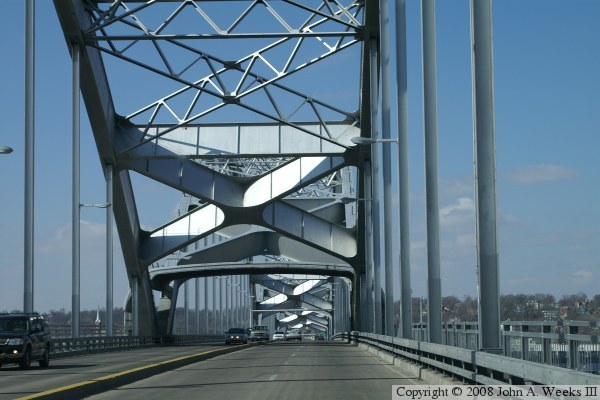
Work on the bridge began on March 13, 1939. Construction started from both ends and worked towards the center. The first use of the bridge was on June 5, 1940, but the dedication ceremony did not occur until July 13, 1940. 57,000 vehicles and 20,000 pedestrians crossed the bridge in the first 8 hours following the ribbon cutting. The bridge was the first tied-arch span and the first 4-lane bridge across the Mississippi River. Construction required 9,750 tons of steel.

This bridge was originally to be named after Mayor Galbraith, but only days before the bridge was set to open, Galbraith requested that the name be changed to the Rock Island Centennial Bridge in commemoration of the 100th anniversary of the cities founding.

The bridge was operated by the Rock Island Centennial Bridge Commission. It opened as a toll bridge, charging pedestrians 5 cents and automobiles 10 cents, with trucks paying more. The toll for automobiles eventually reached 50 cents, having been raised to 15 cents in 1979, 25 cents in 1981, and 50 cents in 1991. Trucks paid as much as $2.30.

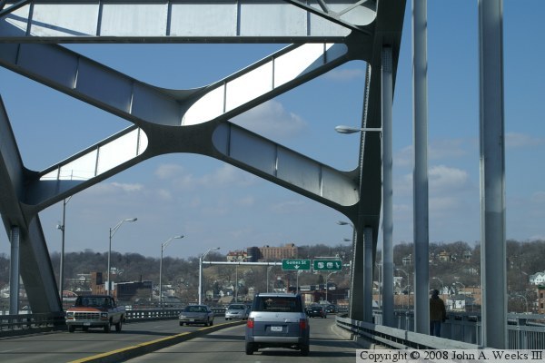
A 1998 study of the quad cities bridges found that the I-74 bridges were vastly over capacity while the Centennial bridge was underused, mainly due to the tolls. An agreement was worked out in late 2001 where the bridge would be transferred from the bridge commission to being owned jointly by the two states. As part of the deal, the entrance ramps to the bridge would need to be reconfigured and the toll booths removed. Contracts for this work was let in December of 2002, and work was finished on June 23, 2005, about 9 months behind schedule. The bridge was officially transferred to state ownership on July 13, 2005. The study turned out to be accurate. Late 1990s traffic of 16,000 vehicles per day grew almost overnight to 31,000 vehicles per day before the end of 2005.

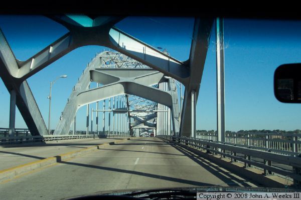
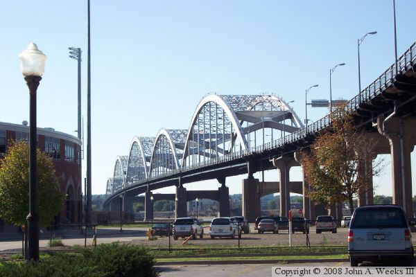
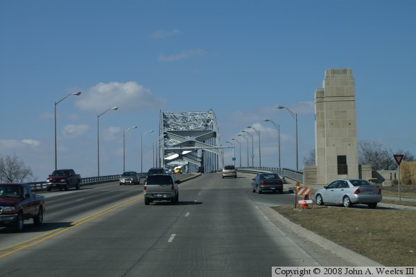
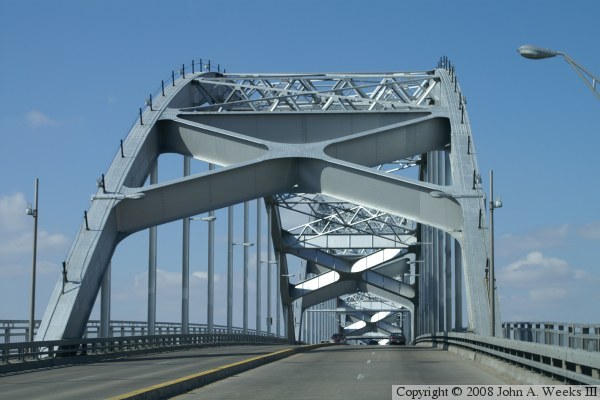
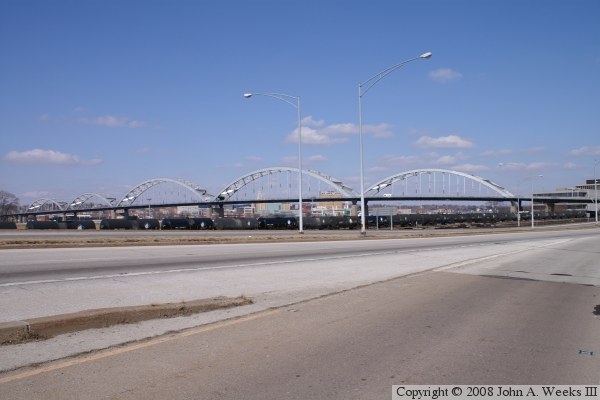
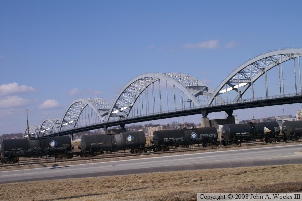
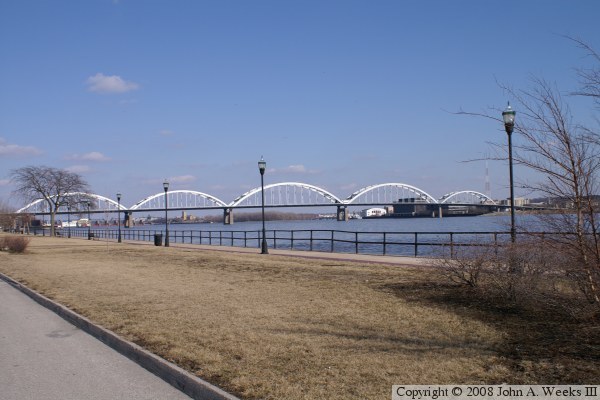
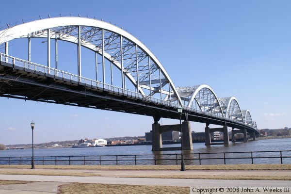
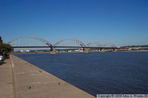
Of all the iron bridges on the Mississippi, this one certainly has the most graceful curves. In the third photo, an optical illusion makes the 2nd span look oddly shorter than the rest of the spans. In reality, the first two spans are smaller than the 3rd and 4th span, with the 5th span being smaller again. As a note of trivia, the first vehicle to pay a toll to cross the Centennial Bridge was owned by Dohrn Transfer, a company local to Rock Island. When the tolls were removed, the last vehicle to have to pay a toll to cross the bridge was again owned by Dohrn Transfer.


Centennial Bridge
Centennial Bridge
Centennial Bridge
Centennial Bridge
Centennial Bridge
Centennial Bridge
Centennial Bridge
Centennial Bridge
Centennial Bridge
Centennial Bridge

Made With Macintosh
Authored by John A. Weeks III, Copyright © 1996—2016, all rights reserved.
For further information, contact: john@johnweeks.com