Current Weather Conditions
John A. Weeks III
Thursday, May 2, 2024, 7:56:14 PM CDT
Home Photo Tours Rail Fan 12 Easy Steps
Aviation Spacecraft Highways & Bridges About The Author
 
Google Search
Maps   Groups   Images   Search
 
  Home
  • 12 Easy Steps
  • Aviation
  • Spacecraft
  • Highways & Bridges
    » Bridge Photography
      - MSP River Bridges
      - C & D Canal
      - Illinois River
      - Minnehaha Creek
      - Minnesota River
      - Mississippi River
        › Lake Itasca Area
        › Bemidji Area
        › Cass Lake - Ball Club
        › Grand Rapids Area
        › Blackberry - Crosby
        › Brainerd Lakes Area
        › Little Falls Area
        › St. Cloud Area
        › North Metro Area
        › Port Of Minneapolis
        › St. Anthony Falls Area
        › Mississippi Rvr Gorge
        › St. Paul Area
        › S St. Paul - Hastings
        › Red Wing - Winona
        › La Crosse Area
        › Lansing - Clinton
        › Quad Cities Area
          · Fred Schwengel Mem
          · Le Claire Canal
          · Smith's Island Foot
          · LD #14 Entrance Br
          · Lock & Dam #14
          · Campbell's Island Br
          · Iowa-Illinois Mem Br
          · Moline-Arsenal Br
          · Sylvan Slough Canal
          · Moline Power Plant
          · Sylvan Island RR
          · Sylvan Island Wagon
          · Sylvan Slough RR
          · Arsenal Power Plant
          · Sylvan Slough Via
          · Government Bridge
          · Lock & Dam #15
          · Centennial Bridge
          · Crescent RR Br
          · Sgt. John F. Baker Br
        › Muscatine - Louisiana
        › St. Louis Area
        › Chester - Cairo
        › Miss - Tenn - Ark
        › Ark - Miss - Louisiana
        › Louisiana Structures
      - Missouri River
      - St. Croix River
      - St. Louis River
      - Wisconsin River
      - Best Miss River Photos
      - Cable Stayed Bridges
      - McGilvray Road Bridges
      - I-35W Bridge Disaster
      - Miscellaneous Bridges
      - Madison County Bridges
      - Hist Br Weekend 2013
    » Road Geek Topics
  • Photo Tours
  • Rail Fan
  • About The Author
 
Site Search By JRank
Highways, Byways, And Bridge Photography
Moline-Arsenal Bridge
Rodman Avenue Mississippi River Crossing At Moline
Moline, Illinois

Moline-Arsenal Bridge

• Structure ID: NBI 000000000819909.
• Location: River Mile 485.7.
• River Elevation: 561 Feet.
• Highway: Rodman Avenue.
• Daily Traffic Count: 8,900 (2003).
• Bridge Type: Steel Girder, Concrete Deck.
• Length: 1,344 Feet Overall, 230 Foot Longest Span.
• Width: 42 Feet, 2 Lanes.
• Navigation Channel Width: 220 Feet.
• Height Above Water: 28 Feet.
• Date Built: Opened April 1982.
This bridge is one of three highway bridges serving the Rock Island Arsenal. Prior to 9/11, one could simply drive across the bridge and tour the Arsenal. Today, security is high, and one has to have a need to enter the island. There is an Army museum, National River Visitors Center, Lock and Dam #15 overlook, National Cemetery, and a historical driving tour, all of which are good reasons to take a tour of the island.

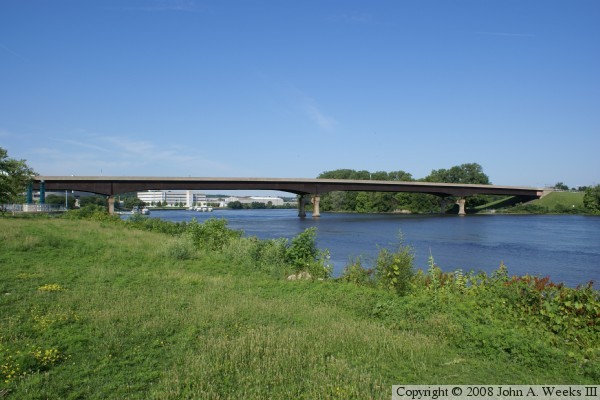
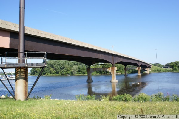
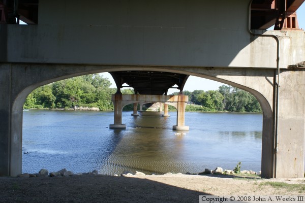
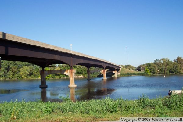
This is a very historic river crossing. The first structure here was a dam built in 1837. It was used by pedestrians, and was wide enough for wagons to cross. That dam survived until 1868. A wooden bridge was built by the City of Moline in 1860, but it was destroyed by ice in 1867. An iron bridge was built in 1873, and was replaced by a concrete arch bridge in 1932. That bridge was built with substandard concrete, and it gradually crumbled under its own weight. It was closed in 1981, and replaced with the current modern steel girder bridge.


Moline-Arsenal Bridge

Made With Macintosh
Authored by John A. Weeks III, Copyright © 1996—2016, all rights reserved.
For further information, contact: john@johnweeks.com