Current Weather Conditions
John A. Weeks III
Monday, May 13, 2024, 11:58:45 AM CDT
Home Photo Tours Rail Fan 12 Easy Steps
Aviation Spacecraft Highways & Bridges About The Author
 
Google Search
Maps   Groups   Images   Search
 
  Home
  • 12 Easy Steps
  • Aviation
  • Spacecraft
  • Highways & Bridges
    » Bridge Photography
      - MSP River Bridges
      - C & D Canal
      - Illinois River
      - Minnehaha Creek
      - Minnesota River
      - Mississippi River
        › Lake Itasca Area
        › Bemidji Area
        › Cass Lake - Ball Club
        › Grand Rapids Area
        › Blackberry - Crosby
        › Brainerd Lakes Area
        › Little Falls Area
        › St. Cloud Area
        › North Metro Area
        › Port Of Minneapolis
        › St. Anthony Falls Area
        › Mississippi Rvr Gorge
        › St. Paul Area
        › S St. Paul - Hastings
        › Red Wing - Winona
        › La Crosse Area
        › Lansing - Clinton
        › Quad Cities Area
          · Fred Schwengel Mem
          · Le Claire Canal
          · Smith's Island Foot
          · LD #14 Entrance Br
          · Lock & Dam #14
          · Campbell's Island Br
          · Iowa-Illinois Mem Br
          · Moline-Arsenal Br
          · Sylvan Slough Canal
          · Moline Power Plant
          · Sylvan Island RR
          · Sylvan Island Wagon
          · Sylvan Slough RR
          · Arsenal Power Plant
          · Sylvan Slough Via
          · Government Bridge
          · Lock & Dam #15
          · Centennial Bridge
          · Crescent RR Br
          · Sgt. John F. Baker Br
        › Muscatine - Louisiana
        › St. Louis Area
        › Chester - Cairo
        › Miss - Tenn - Ark
        › Ark - Miss - Louisiana
        › Louisiana Structures
      - Missouri River
      - St. Croix River
      - St. Louis River
      - Wisconsin River
      - Best Miss River Photos
      - Cable Stayed Bridges
      - McGilvray Road Bridges
      - I-35W Bridge Disaster
      - Miscellaneous Bridges
      - Madison County Bridges
      - Hist Br Weekend 2013
    » Road Geek Topics
  • Photo Tours
  • Rail Fan
  • About The Author
 
Site Search By JRank
Highways, Byways, And Bridge Photography
Sylvan Slough Railroad Bridge
Mississippi River Crossing At Rock Island
Rock Island, Illinois

Sylvan Slough Railroad Bridge

• Structure ID:  
• Location: River Mile 484.1.
• River Elevation: 545 Feet.
• Railroad: Iowa Interstate Railroad.
• Daily Traffic Count: 3 Trains Per Day (Estimated).
• Bridge Type: Pony Plate Girder.
• Length: 602 Feet Overall, 90 Foot Longest Span.
• Width: 2 Tracks.
• Navigation Channel Width: Non-Navigable.
• Height Above Water:: 22 Feet.
• Date Built: Completed 1924.
This bridge is the secondary river crossing over Sylvan Slough that is part of the same Mississippi River crossing as the Government Bridge located just to the north. This is the site of the first full crossing of the Mississippi River, and the site of several earlier crossings to Arsenal Island. This includes an 1854, which was destroyed by ice, an 1870 iron bridge, and an 1894 steel truss bridge.

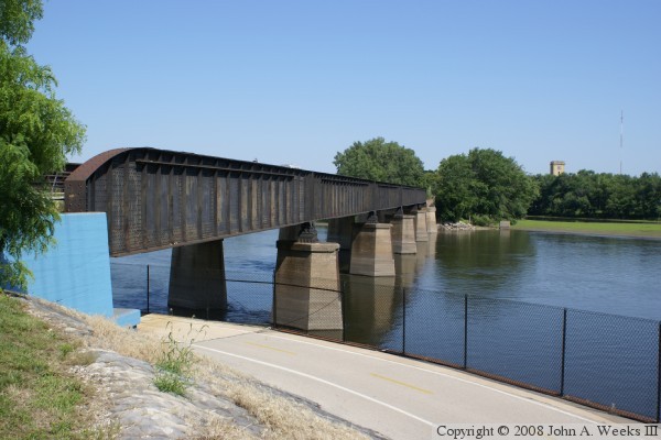
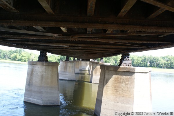
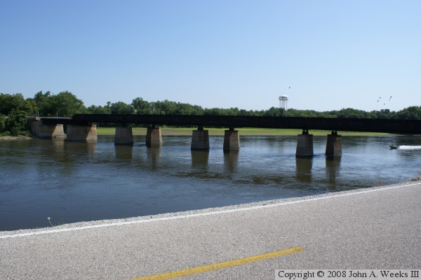
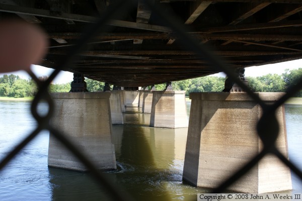
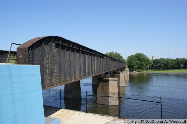
This bridge consists of six pony plate girder spans of 105 feet each, plus a single deck plate girder span of 75 feet. The bridge appears to be relatively light in structure compared to the massive Government Bridge that is part of the same crossing.


Sylvan Slough Railroad Bridge

Made With Macintosh
Authored by John A. Weeks III, Copyright © 1996—2016, all rights reserved.
For further information, contact: john@johnweeks.com