Lake Superior is a relatively new lake, having been created about 10,000
years ago at the end of the ice age. It was once much deeper, but lower
water levels in Lakes Michigan and Huron resulted in Lake Superior draining
until a rapids formed at Sault Ste Marie. The lake remains the largest
freshwater lake in the world (by surface area), and it contains about one
tenth of all fresh water on the planet.
The second largest tributary of Lake Superior is the Saint Louis River. The
Saint Louis is 179 miles long, and is almost entirely contained within Saint Louis
County, Minnesota. The river widens into a large bay and freshwater
estuary near Lake Superior. The bay is separated from the lake by the
largest sand bar in the world, which extends 12 miles between the twin
ports cities of Duluth and Superior.
The sandbar had one natural opening to allow the outflow of the Saint Louis
River. First charted in 1861, the opening was as wide as 1500 feet, and
4 to 16 feet deep. Since then, the Superior Entry has been modified a
number of times to meet the needs of ever bigger ships. The entry was
dredged in 1871. Wood cribbing and a beacon were installed in the early
1880s. By 1885, a large installation was established on the north side
of the entry by the Coast Guard. A steam powered fog signal was established
in 1893. A second light was added in 1898. Concrete piers were added
in 1905, and concrete breakwaters were completed in 1910. By 1912, a
new lighthouse was built on the south breakwater. It featured an air
powered fog signal and light with a fourth-order Fresnel lens. The
air powered fog signal was retired in 1937 and replaced with a diaphone,
which is a two-tone fog signal that works much like a pipe organ. The
light station was automated in 1970.
Water levels in Lake Superior are impacted by a phenomena known as a seiche.
That is, water sloshes back and forth across the lake, alternately piling up
on either the east or west side of the lake. These seiches have a period
of 7.9 hours. Water will flow east for 7.9 hours, then reverse and flow
west for 7.9 hours. The water level in the harbor and bay rises and falls
based on these seiches. The harbor has its own seiche on top of the Lake
Superior seiche. The result is that water flow reverses direction at the
Superior Entry every 2 hours and 6 minutes, alternately flowing out to the
lake and back into the bay.
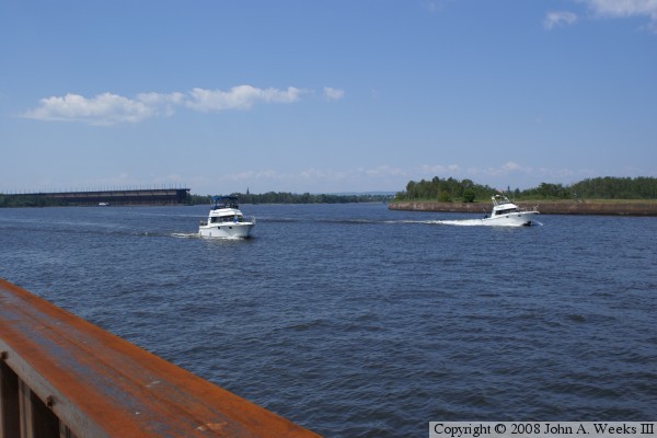
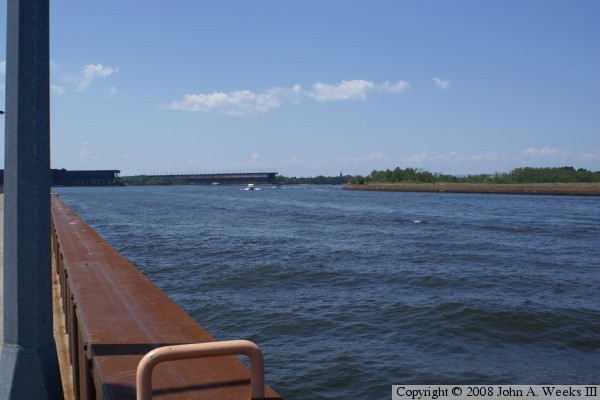
The photo above is looking northwest towards the Superior Harbor as two
small craft pass through the Superior Entry towards the lake. Northern
Pacific dock #1 is visible in the background. The photo below is the
official state historical marker located on the Wisconsin side of the entry.
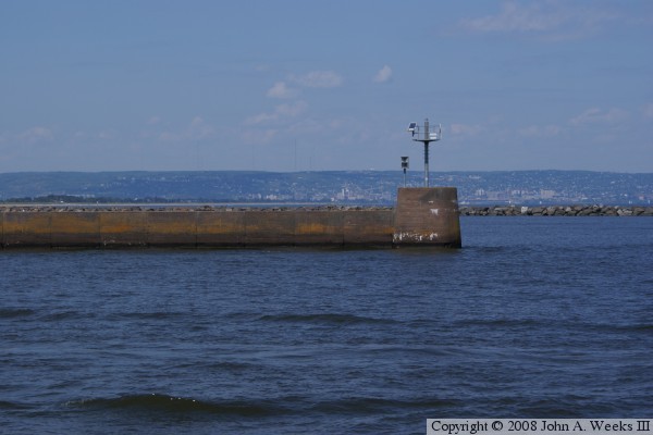
The photo above is looking east out towards Lake Superior. The entry
has a concrete wall on each side of the channel, and rock breakwaters
extending a distance out into the lake. The photo below is a close
view of the east end of the north wall. The end of the wall is marked
with a solar-powered beacon.
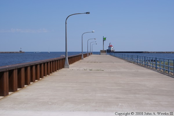
The photo above is looking east down the length of the wall on the
south side of the entry channel. This wall had a wide concrete platform.
The side of the wall facing the channel is lined with sheet pile. The
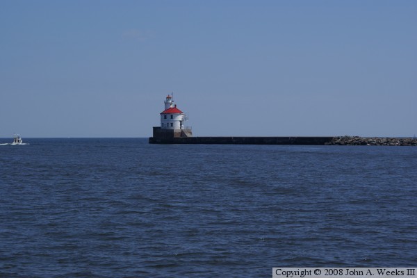
photo below is the east end of the south breakwater. The Wisconsin Point
Lighthouse is located at the end of the breakwater. While a light has
been located on Wisconsin Point since 1856, this building was constructed
in 1912. It housed a pair of 22-horsepower air compressors, two 6-inch
air sirens, and a rotating 4th-order Fresnel lens with a 2,900 candlepower
lamp. The light was reported to be visible for 16 miles. The air siren
was replaced by a diaphone fog signal in 1937, which was augmented with
a radio beacon in 1938.
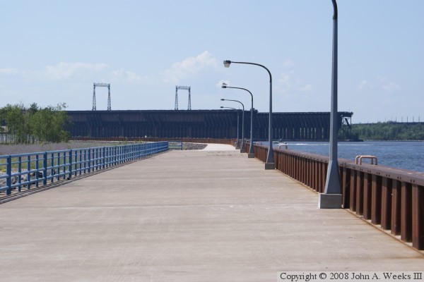
These two photos are looking west towards the Wisconsin mainland. The large
structures in the photo below are the giant BNSF ore docks in the Superior
harbor. The Northern Pacific dock #1 is on the very far right side of the
photo behind the trees. Note the light poles sticking up in the distance in
the photo above. The large docks in the center of the photo below are the
Great Northern dock #1 (right) and GN dock #2 (left). GN dock #3 no longer
exists, and GN dock #4, as well as Burlington Northern dock #5, are out of the
photo to the left. The GN and NP merged in 1970 to become Burlington Northern,
which has since become the BNSF. The NP and GN docks are no longer connected
to the rail lines due to their low and narrow bridges over US-2 and US-53
having been removed. The BN dock is still functional and did load taconite in
2007, but its future is cloudy given the recent mine shutdowns. The taconite
is stored in a huge mile-long pile located west of the city of Superior. A
conveyor belt brings the taconite to the to the loader. The ill-fated Edmund
Fitzgerald loaded at the GN dock #1 in November, 1975, before it set out on
its final voyage.