The Arrowhead Bridge connected the twin port cities of Duluth, Minnesota,
and Superior, Wisconsin. The Duluth side connected to Lesure Street,
while the Superior end connected to Belknap Street. It was built to offer
a second harbor crossing at a time when the Interstate bridge was reaching
its capacity due to the advent of the automobile. It opened as a toll
bridge. The new High Bridge opened in 1961 as a high bridge, so there
was pressure to remove the tolls from the Arrowhead Bridge. The tolls
were removed in 1963.
The Arrowhead Bridge was built mostly as a wooden trestle, with wooden
support piers driven into the muddy bottom of the Saint Louis Bay. The
trestles started very near water level, and rose up to about 25 feet
above water level to align with the central span. That central span
consisted of a draw bridge with two steel spans that would tip up into
the air, allowing room for ships to pass through the opening. The
draw bridges were very simple in design, consisting of a truss that
held the roadway, a pivot point, and a large weight. A small motor
and several gears were enough to open and close the spans. The
bridge also had a earthen causeway on the Duluth side, which was also
the location of the toll booth.
Little of the Arrowhead Bridge remains. The major artifact is the
first section of trestle on the Superior side, which is now a fishing
pier. A short bit of the pavement still exists on the Duluth side,
including the concrete footings for the canopy over the toll booth.
A much longer section of the causeway existed on the Duluth side into
the mid-1990s, when it was removed to reclaim several acres of wetlands.
That section of causeway is now basically a ditch along a gravel loading
operation.
The Arrowhead Bridge is named after the Arrowhead Region of Minnesota.
The Arrowhead Region refers to the north shore area. It was named via
a newspaper contest in the mid-1920s as a way to promote tourism.
Update—the remaining section of the Arrowhead Bridge on the Superior,
Wisconsin, side of the bay was removed in 2010. Photos of the new fishing
pier are included below.
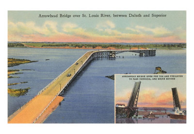
The image above is a scan of a period postcard showing the arrowhead bridge
from the Duluth side of the bay looking towards Superior on the far shore.
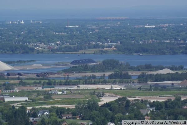
The photo above was taken from Thompson Hill near the Minnesota Rest Stop on
I-35. The vantage point is a parking area along a service road between the
rest stop and US-2 that has a fantastic view of the Twin Ports area. The
Duluth end of the US-2 causeway would have run from the large gravel pile on
the very left of the photo along that pier past the black pile of material.
The bridge would have then been a trestle as it crossed the bay. The main
channel was crossed with a drawbridge, and then a trestle with a sweeping
curve carried the highway back to ground level on the far side of the
bay. The remaining section of trestle can be seen on the far side of the bay
about one-fourth of the way from the right side of the photo.
The image below was clipped from the Minnesota state DNR aerial photo database.
In this 1939 view, Duluth is on the left, and Superior is on the right. The
straight bridge is the Northern Pacific (now BNSF) Grassy Point Bridge. The
Arrowhead Bridge is near the center of the photo.
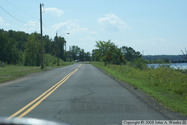
The photo above shows Blatnik Avenue heading west towards the Wisconsin
end of the Arrowhead Bridge. Saint Louis Bay is visible to the right, and
the remaining section of trestle is visible on the far right. Unlike the
Duluth side of the river, Superior is very flat and low. It does not
have the bluffs such as those found on the Duluth side of the lake.
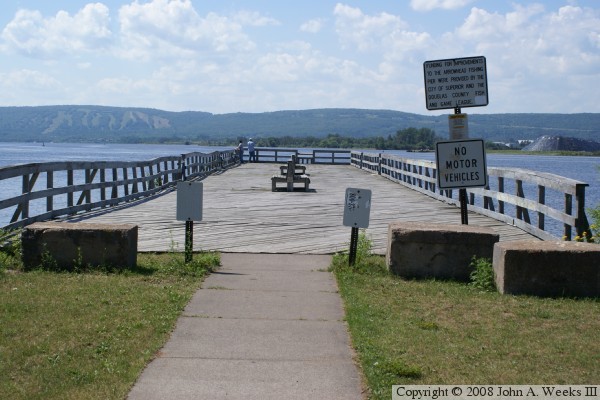
The photo below is a view of the remaining section of the Arrowhead Bridge
since its conversion into a fishing pier. The bridge made a turn to the
right about a third of the way across the bay, so the Minnesota landing
would have been near that large black material pile on the far right.
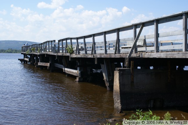
The photo above is a view of the trestle from the side. This gives a
good view of the makeshift nature of the trestle, and how askew the
structure has become. This makes it obvious that the old bridge would
not have withstood the pounding from traffic very much longer.
Below is a view across Saint Louis Bay looking at the area where the
Arrowhead Bridge would have crossed the main navigation channel and
would have landed on the Duluth side of the crossing.
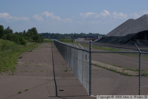
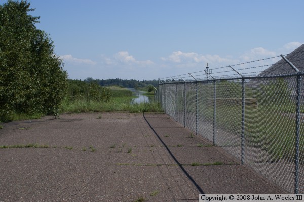
These two photos show the remains of the pavement from the Duluth end
of the Arrowhead Bridge. The end of the pavement is where the natural
land ended and the bay began. The causeway for the bridge was an
earthen fill that extended about 2400 feet. That causeway was dug out
and removed in 1996 to restore the natural wetlands. Prior to that time,
this was an industrial area for a sand and gravel operation. One could
sneak into this area and drive to the end of the causeway. As part of
the 1996 project, a trail and parking area was developed for the general
public. The fence was installed to prevent people from entering the
industrial area.
The photo above is looking down the length of the remaining pavement. The
concrete footing inside the fence was the footings for the steel that held up
the canopy over the toll booth. This area is now a parking lot for a trail
that is being developed along the bayfront area. The original US-2 pavement
from the bridge era behind this location was overlaid as part of the
development of the park. The photo below is a closer view near the end of the
pavement.
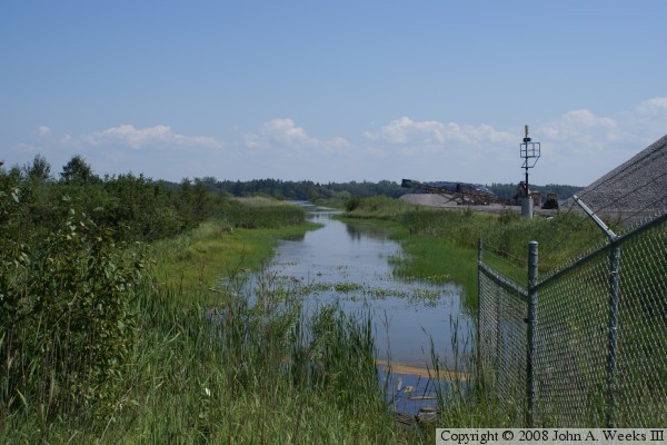
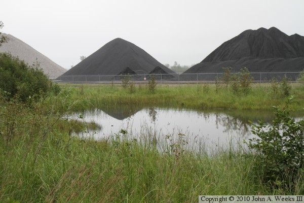
The photo above is looking down the path where the highway causeway was dug
out and replaced with wetlands. The photo below is a view looking across the
this wetland from a nature trail that runs to the tip of Grassy Point.
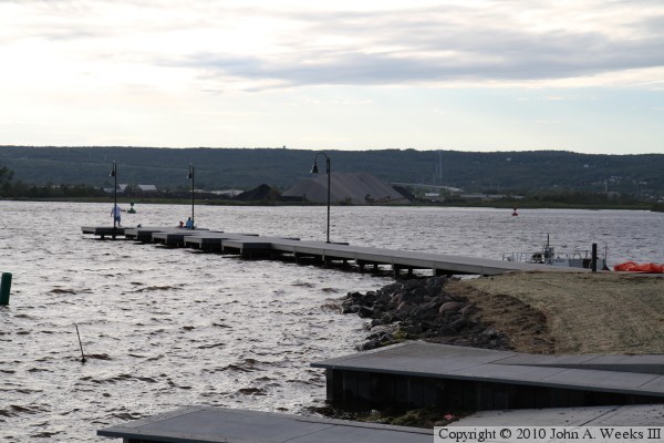
The last remaining section of the Arrowhead Bridge was removed in 2010. These
photos are views of the new fishing pier that was built in its place.
The photo below is looking across the bay towards Duluth, while the photo
below is looking down the length of the new fishing pier. While this project
essentially erases the last remains of the Arrowhead Bridge, at least the
bridge name will live on with this structure being called the Arrowhead Pier.
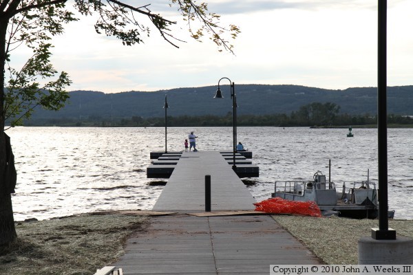
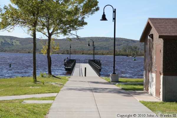
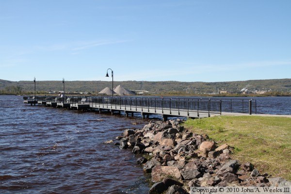
These two photos are views of Arrowhead Pier from early autumn of 2010.
The construction project at this park is not yet completed, but the fishing
pier appears to be done. The railings and decorative lighting has been
completed, and the grass has taken root. The photo above is looking down
the length of the fishing pier deck, while the photo below is looking north
towards the southwest side of the structure.