The Lamborn Avenue Bridge once crossed Howards Bay between the mainland of
Superior, Wisconsin, and the peninsula leading out to Connors Point. This was
an important crossing because it was the most direct route between the
Interstate Bridge (from Duluth) to downtown Superior. The crossing consisted
of an approximately 254 foot long swing bridge flanked by 300 foot causeways
on each end of the bridge. The causeway and abutment still exists on the
northeast end of the bridge. The southwest abutment appears to still exist,
but much of the causeway on that end of the crossing has obscured when part
of the bay was filled in since the 1960s.
I know almost nothing about the Lamborn Avenue Bridge, such as when it was
built or when it was abandoned and removed. It is shown on aerial photos
from the 1930s and early 1940s, but did not exist on a 1960 aerial photo.
The bridge appears to have featured two parallel street car tracks, and likely
served as the only street car path to the Interstate Bridge. If anyone can
fill in more details, please let me know.
The photo above is looking southwest towards Lamborn Avenue from the
intersection of Main Street and Lamborn Avenue on the peninsula leading
to Connors Point. Howards Bay is in the background, with a portion of the
I-535 Blatnik Bridge is visible on the far side of Howards Bay. The photo
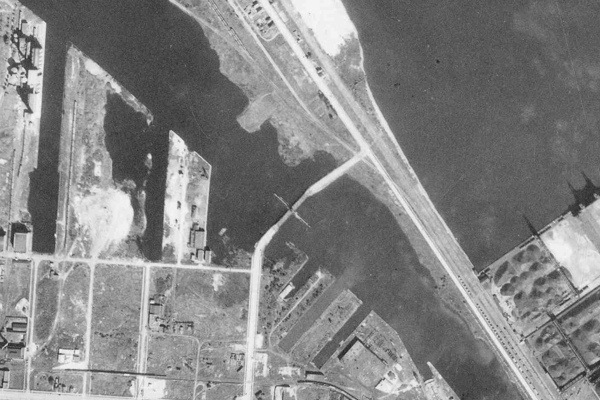
below was clipped from the State of Minnesota DNR aerial photo database.
The area at the southwest end of the bridge is now largely filled in.
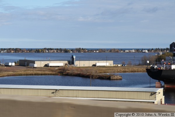
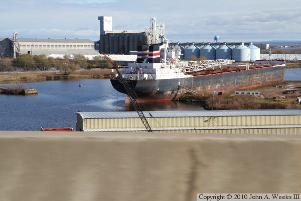
These two photos were taken by pointing the camera out of the passenger side
window of my car while traveling northbound across the highway I-535 Blatnik
Bridge heading into Duluth. The photo above is a view of the causeway on
the northeast side of Howards Bay. The photo below shows the southwest
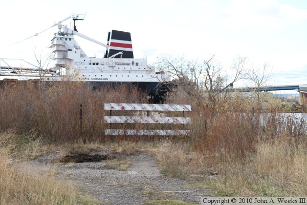
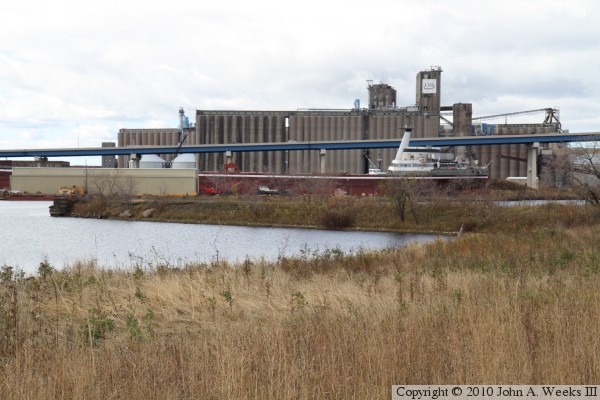
bridge abutment, which is being used as an anchor point for the shipyard.
The land on the right side of the ship is mostly fill that has been added
since the bridge was removed.
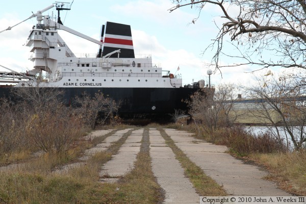
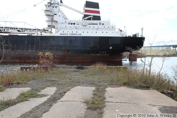
These two photos are looking southwest down the center of the causeway
leading to the swing bridge on the northeast side of Howards Bay. The photo
above shows a long section of the causeway, while the photo below is a view
from near the bridge abutment. The lines in the pavement are where the
streetcar rails have been removed.
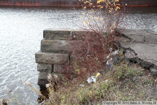
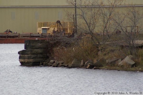
The photo above is the southeast side of the bridge abutment on the
northeast side of the swing span. The stones are about ten inches tall,
putting the top of the abutment about 4 feet above the waterline. The photo
below is looking towards Main Street from the abutment.
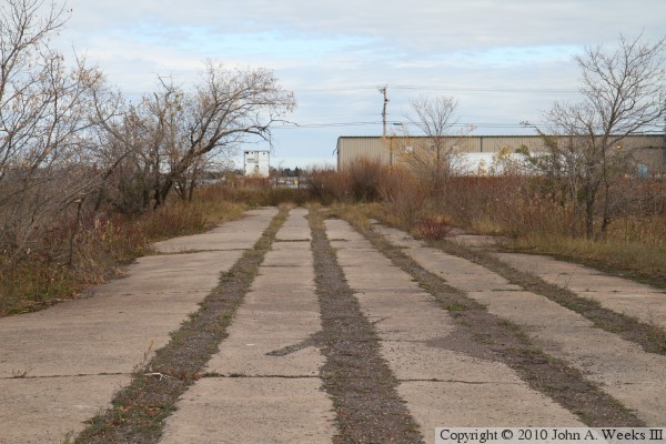
The photo above is looking north towards the causeway leading from Main Street
on Connors Point towards Superior. The photo above is the land on the
Superior side of Howards Bay. The ship blocks any view of the abutment on
that southwest side of the bay.
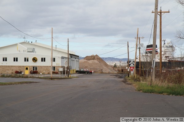
The photo above is looking north from Main Street towards the abutment on
the Connors Point side of Howards Bay. The photo above is Grand Avenue
heading north towards the site of the Lamborn Avenue Bridge. The southwest
bridge abutment sits next to the ship that is visible on the right side of
the photo. This area is private property with no public access.