In geologic terms, Grassy Point is a relatively new feature. Lake Superior
was once much deeper, but it drained at the end of the Ice Age about 8,000
years ago. The area near Grassy Point was once the western end of the lake.
The land in this area was part of a sandbar that formed where the Saint Louis
River flowed into the lake. A series of sandbars formed further out into
the, such as the one under the Blatnik Bridge and Park Point. This allowed
a larger bay to form and partly fill in with sediment, leaving a large
freshwater estuary.
The water at Grassy Point is interesting because it is the point where
river and lake water mix. These two waters are chemically distinct. The
action of the lake and bay seiches (sloshing of water across the lake and
across the bay) alternately raise and lower the water levels every few
hours, acting much line shorter time period tides. These fluctuations
cause changes in temperature, pH level, and oxygen levels.
Grassy Point was used by several sawmills during the late 1800s. The fires of
1918 burned the mills and ended commercial activity on Grassy Point. The
debris and waste products from the mills remained, slowly sinking into the
wetlands. The Arrowhead Bridge was built in 1927. The bridge had a long
causeway through Grassy Point. Industrial waste and runoff from cars
further added to the pollution problem.
The present day changes to Grassy Point began in 1982 when the Arrowhead
Bridge was closed. The bridge structure was removed shortly after the
Bong Bridge opened. Later, in the early 1990s, the causeway was mostly
removed. A clean-up effort was funded to clean up the mess from the mills.
Over 11,000 tons of sawmill waste was pulled out of the water. A number of
invasive plan species were removed, and native plants were reintroduced.
Finally, 1,100 feet of trail, a bridge, and two observation decks were
installed in 1996. The result is an area when you can walk out of view of
much of the industrialization of the Twin Ports Harbor and see Saint
Louis Bay as it must have looked hundreds of years ago before the arrival of
Europeans.
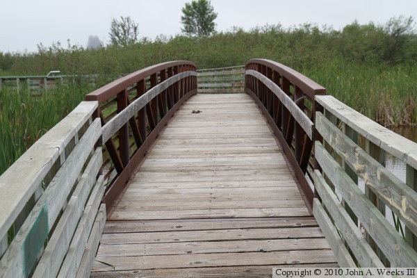
The photo above is looking south towards the northwest face of the Grassy
Point Trail Bridge. This photo was taken on a warm muggy and foggy morning
in the summer of 2010. The dew brings out the color and detail in the plants,
but the fog hides the tall bluffs that normally would be visible in the
background.
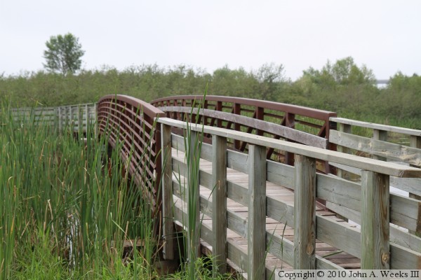
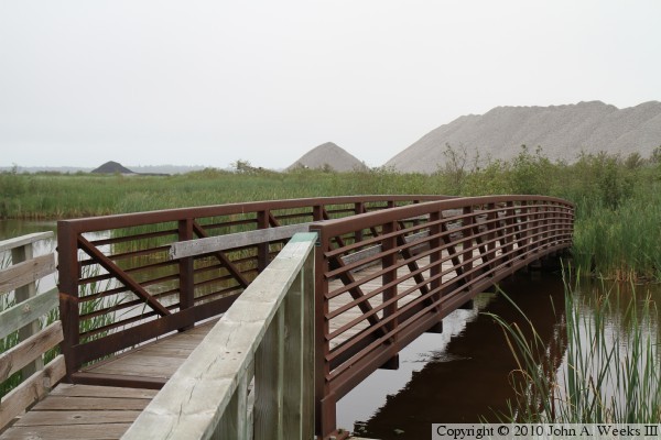
These two photos are views walking down the trail towards the bridge. The
photo above is the looking northeast along the northwest face of the bridge,
while the photo below is the catwalk approaching the southwest end of the
bridge.
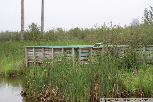
The photo above is the catwalk at the northeast end of the bridge leading to
the observation deck. The photo below is a view looking east towards the
observation deck from across the channel of Keene Creek.
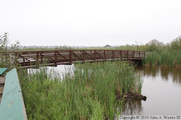
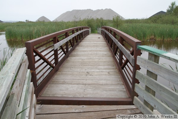
The photo above is looking south towards the northwest face of the bridge
from the observation deck. The photo below is another view looking down
the northwest face of the bridge while heading back to the parking area.
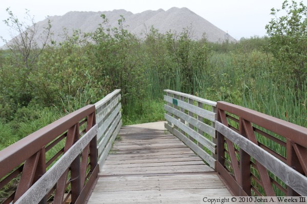
These two photos are views crossing southbound across the bridge while walking
back to the parking area. The photo above is entering the northeast end of
the bridge, while the photo below is existing the southwest end of the
structure.
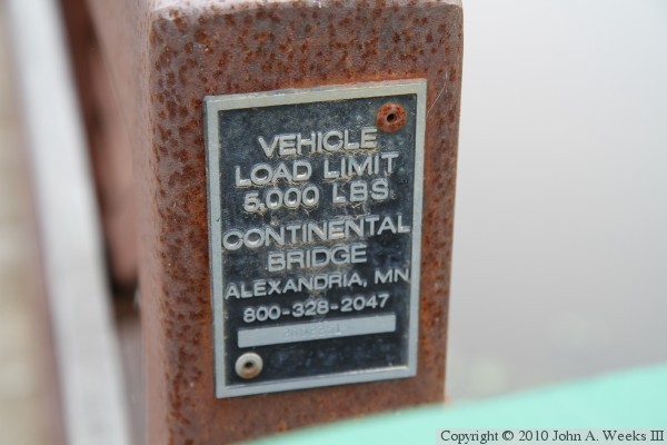
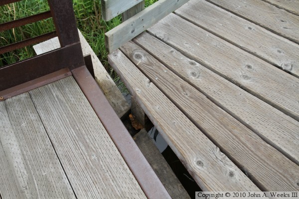
The photo above is the bridge serial number plate. The photo below is a
detail view of the gap between the northeast end of the bridge and the catwalk
leading to the observation deck. While it looks like the catwalk is going to
fall off of the pier, it is actually supported by a steel bracket that is
not readily visible. I did, however, stop and look closely before I walked
across the gap given that I am not able to swim.
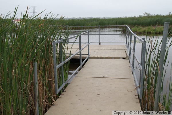
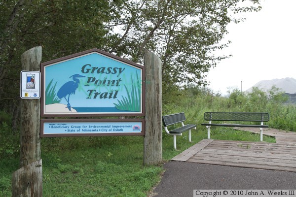
A branch in the grassy point trail crosses a section of plastic walkway
mat that is laid across a swampy area, which leads to this floating
observation deck. The photo below is the sign located at the parking
area. The parking area is located at the end of Lesure Street, which once
carried US-2 to the north end of the Arrowhead Bridge to Superior.