The Grassy Point Bridge was authorized by the states of Wisconsin and
Minnesota in 1887 to cross Saint Louis Bay at the shortest possible location.
It was built by the Minneapolis and Duluth Railroad, which was later
acquired by the Northern Pacific. The bridge allowed the Northern Pacific
to move trains between their railroad lines on either side of the Twin
Ports Harbor.
The Northern Pacific Railroad also had a bridge across the Twin Ports Harbor
near the present day US-53 Blatnik Bridge. This bridge, the Saint Louis Bay
Bridge, featured two swing spans. These spans were known was the Wisconsin
Draw and the Minnesota Draw. The Great Northern Railroad also had a swing
span bridge located just east of the present day US-53 Blatnik Bridge.
Known as the Interstate Bridge, it handled both rail and automobile traffic.
When the NP and GN merged to form the Burlington Northern Railroad, the BN
ended up with three bridges across the harbor. The closed Interstate Bridge
was removed in the 1970s, with one span still surviving today. The Saint
Louis Bay Bridge was also closed due to it being more expensive to operate
than the Grassy Point Bridge. As a result, the BN consolidated onto the
Grassy Point Bridge. Today, most rail traffic that crosses between Duluth
and Superior uses the Oliver Bridge, resulting in the Grassy Point Bridge
seeing relatively little traffic.
The Grassy Point Bridge connects between two small BNSF rail yards. The
yard on the Duluth side is known as ‘Mike’s Yard’. The
east end of the bridge connects to the BNSF 28th Street Terminal, and a
massive maze of rail yards and side tracks (now mostly gone) on the west side
of Superior. The current iron and steel bridge was built in 1912. It was
built to handle two parallel railroad tracks, but only one track is installed
on the swing span. There are two tracks on the causeway leading to the
bridge, but the trestle spans are only wide enough for a single track.
The Grassy Point area was the focus of a major clean up and wetlands
restoration project in the 1990. A waterfront trail now runs through
this area. It presents an interesting contrast between how humans
build and abandon industrial facilities, and how nature builds and
recycles its own infrastructure.
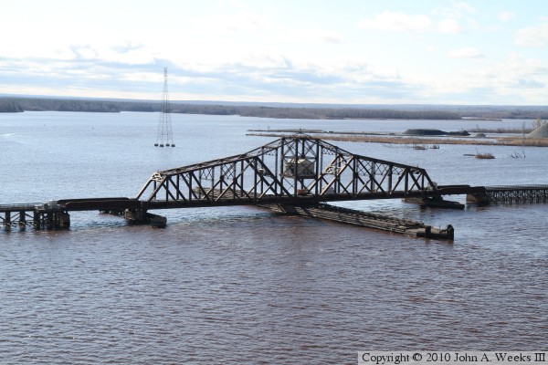
The photo above is looking north from the end of the remains of the former
US-2 Arrowhead Bridge in Superior towards the swing span of the Grassy Point
Bridge. The US-2 Richard Ira Bong Memorial Bridge is visible behind the
railroad bridge. The bluffs of the West Duluth neighborhood is visible in
the background. There is so little railroad traffic across the Grassy Point
Bridge that the bridge is often maintained in the open position, and only
closed when a train needs to cross the bay.
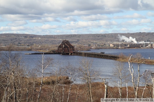
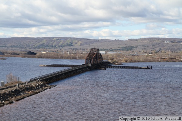
The photo above is a view of the Grassy Point Bridge from the overlook at
Thompson Hill. The overpass where the photo above was taken is visible in the
foreground of this photo. The photo below is a late evening view of the
Grassy Point Bridge, also from Thompson Hill.
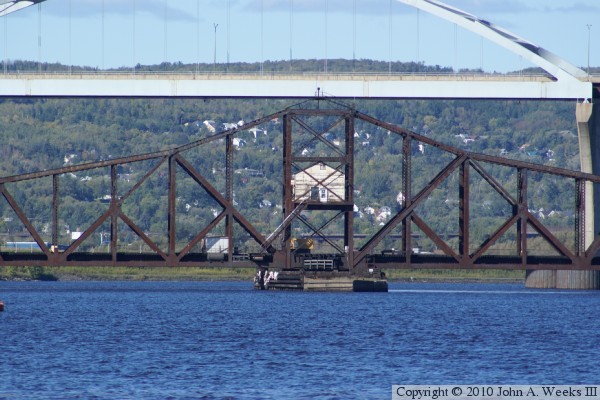
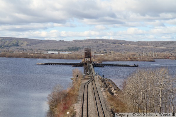
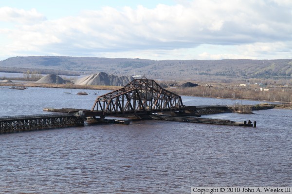
The photo above is looking due north from the vicinity of the east end of
the old Arrowhead Bridge in Superior towards the swing span of the Grassy
Point Bridge. The main span of the Bong Bridge is located just north of
the railroad bridge. The photo below is a closer view of the swing span.
These two photos are the two fixed pony plate girder spans on each end of
the swing span. The photo below is the span on the east side of the swing
span, while the photo below is the span on the west side of the swing span.
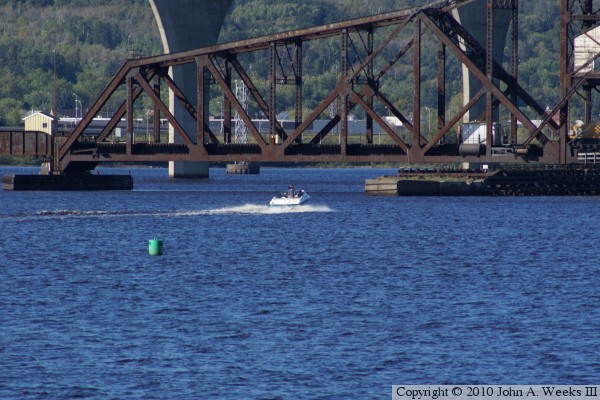
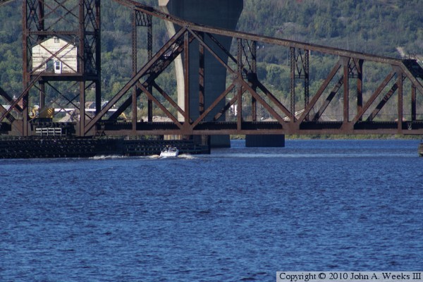
These two photos show a power boat passing under the Grassy Point Bridge.
The photo above shows the boat heading north towards the bridge with the
west side of the swing span in the background. The photo below shows the
boat passing under the east side of the bridge.
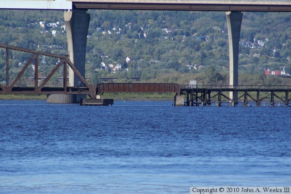
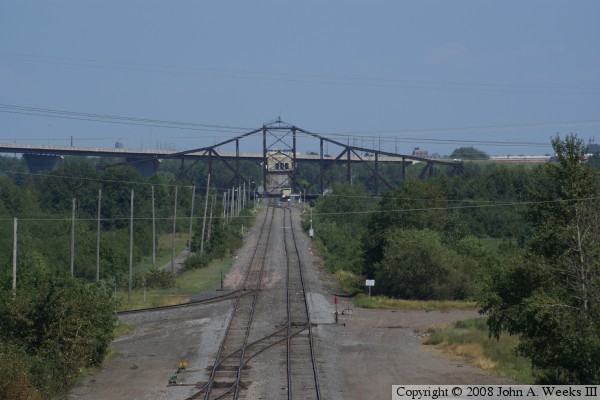
The photo above is looking east down the BNSF tracks towards the Grassy
Point Bridge from the deck of the highway bridge over the tracks on
Waseca Industrial Road. This vantage point is very near where highway
US-2 once crossed over the BNSF trans leading to the Duluth end of the
old Arrowhead Bridge. The photo below is taken from the same location,
however, the bridge is in the closed position.
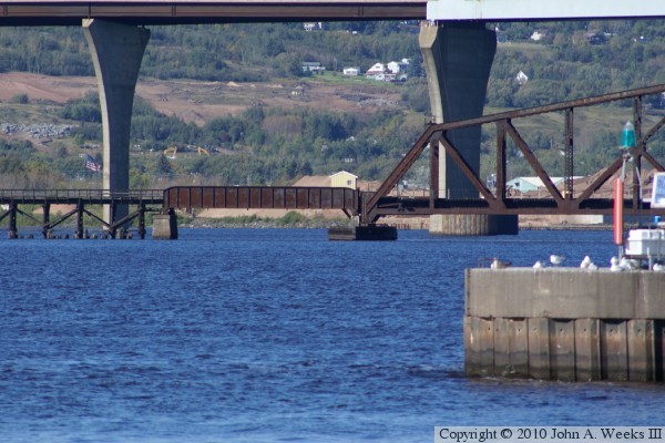
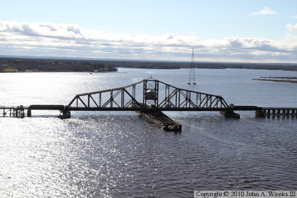
These two photos, and the four that follow, are views of the Grassy Point
Bridge as seen from the walkway on the Bong Bridge. The photo above is
looking northwest towards the south face of the railroad bridge. The photo
below is looking due west down the center of the railroad right-of-way.
These two photos are looking southwest along the north face of the Grassy
Point Bridge.
These two photos are looking south-southwest towards the swing span of the
Grassy Point Bridge. The photo below was taken from the main span of the
Bong Bridge, which is approximately 120 feet above the navigation channel.