| Highways, Byways, And Bridge Photography |
Richard I. Bong Memorial Bridge
US-2 Saint Louis River Highway Crossing
Duluth, MN
|
• Structure ID: |
NBI 69100 |
|
• Location: |
River Mile 8.1 |
|
• River Elevation: |
602 Feet |
|
• Highway: |
US-2 |
|
• Daily Traffic Count: |
19,400 (2004) |
|
• Bridge Type: |
Steel Arch Suspended Deck |
|
• Bridge Length: |
8,320 Feet, 500 Foot Longest Span |
|
• Bridge Width: |
70 Feet, 4 Lanes |
|
• Navigation Channel Width: |
400 Feet |
|
• Height Above Water: |
120 Feet |
|
• Date Built: |
1982 |
The Richard I. Bong Bridge is the longest bridge with at least one end
touching the State of Minnesota. In Wisconsin, the Daniel Hoan Bridge
in Milwaukee is longer, which makes the Bong Bridge be the second longest
bridge with at least one end landing in Wisconsin.
The Bong Bridge was built to replace the US-2 Arrowhead Bridge. That
bridge was obsolete. In addition, it was often backed up due to the
draw spans being open. The two states were also looking for a way to
move cargo from the railroad areas without trucks having to go through
the downtown areas. Finally, shipping interests were looking for a
clear path from Lake Superior to the docks in the far western area of
the Saint Louis Bay.
Construction on the Bong Bridge began in 1982, and the structure opened
on October 25, 1985. The bridge is mostly a steel girder bridge with a
concrete deck. The main span is a large steel tied arch. The bridge
features 8,320 feet of structure over water. With approaches, the total
elevated span is approximately 11,800 feet.
In the end, the Bong Bridge project was not as successful as was hoped.
Both rail and trucking traffic leveled off and dropped in the 1980s, so
the bridge traffic did not develop as expected. Industry in the Duluth
and Superior area evaporated as heavy industry converted to service work
and the lakefront converted to tourism. The road system on the Superior
side was never fully developed, so the bridge did not serve as a bypass.
Finally, the major docks on the west side of the bridge are nearly all
shut down as the steel mill, rolling plants, and foundries in the Gary
New Duluth area closed.
The Bong Bridge is named after WWII hero Richard Ira Bong. Bong lived
in nearby Poplar, Wisconsin. He flew the P-38 Lightning fighter plane
in the Pacific Theater. He was allowed to retire from combat flying
when he broke the record of 26 kills. He later found his way back in
combat, and was again pulled from the combat theater after his 40th
kill. The military was afraid that Bong was becoming a target, and
they didn't want to risk losing their Ace of Aces. Bong relocated to
southern California to begin training on jet aircraft. Bong died on
August 6, 1945, when his P-80 Shooting Star jet fighter crashed. Some
people find it ironic that while Bong fought against the Japanese, and
there was a major steel mill located within sight distance of the Bong
Bridge, the steel for the arch span of Bong's namesake bridge was imported
from Japan.
The State of Minnesota lists the Bong Bridge as a single entry in the
National Bridge Inventory database. Wisconsin, however, lists the bridge
as 19 separate sections as follows:
| NBI ID Number | Location | Length |
| B16003800010000 | 1.1 Miles West Of State Line | 285 Feet |
| B16003800020000 | 1.1 Miles West Of State Line | 144 Feet |
| B16003800030000 | 1.0 Miles West Of State Line | 504 Feet |
| B16003800040000 | 0.9 Miles West Of State Line | 549 Feet |
| B16003800050000 | 0.8 Miles West Of State Line | 402 Feet |
| B16003800060000 | 0.7 Miles West Of State Line | 609 Feet |
| B16003800070000 | 0.6 Miles West Of State Line | 609 Feet |
| B16003800080000 | 0.5 Miles West Of State Line | 427 Feet |
| B16003800090000 | 0.4 Miles West Of State Line | 421 Feet |
| B16003800100000 | 0.3 Miles West Of State Line | 412 Feet |
| B16003800110000 | 0.2 Miles West Of State Line | 412 Feet |
| B16003800120000 | 0.0 Miles West Of State Line | 453 Feet |
| B16003800130000 | 0.0 Miles West Of State Line | 500 Feet |
| B16003800140000 | 0.1 Miles East Of State Line | 570 Feet |
| B16003800150000 | 0.2 Miles East Of State Line | 572 Feet |
| B16003800160000 | 0.3 Miles East Of State Line | 380 Feet |
| B16003800170000 | 0.4 Miles East Of State Line | 380 Feet |
| B16003800180000 | 0.5 Miles East Of State Line | 380 Feet |
| B16003800190000 | 0.6 Miles East Of State Line | 310 Feet |
If you add up these distances, they add up to 8,319, within a foot of the
length that Minnesota lists in their NBI entry for the Bong Bridge.
The Bong Bridge was the seen of a cat rescue on April 2, 2011. A MN-DOT
crew was on the bridge cleaning trash and debris off of the structure following
the last of the winter snow melt. Just after noon, a MN-DOT worker was
on the main bridge span, where he heard the muted cries from a house cat.
After a short search, they found a cat sitting on top of a pier cap some
twenty feet below the highway deck. The MN-DOT worker flagged down a city
of Superior police car, and the rescue began. The first attempt was to lower
a nylon strap down to the cat. The cat, however, did not grab onto the strap,
so this attempt failed. The police office had a bag that was used to carry
rescue gear. They rigged the bag to the nylon strap, baited it with part of
the MN-DOT worker's lunch, and lowered it down to the pier. The cat took the
bait and climbed into the bag. The two men then hoisted the bag containing
the cat up to the sidewalk. The cat had obviously been stuck for a while,
perhaps several days, and was far more interested in food than anything else.
The cat was turned over to an animal control officer, and later went up for
adoption. It remains a mystery how the cat got stuck under the bridge.
While it is possible that the cat walked to the center of the bridge and then
jumped down 20 feet to the pier, it seem more likely that someone tried to
kill the cat by tossing it over the side of the bridge, and the cat landed
on the pier.
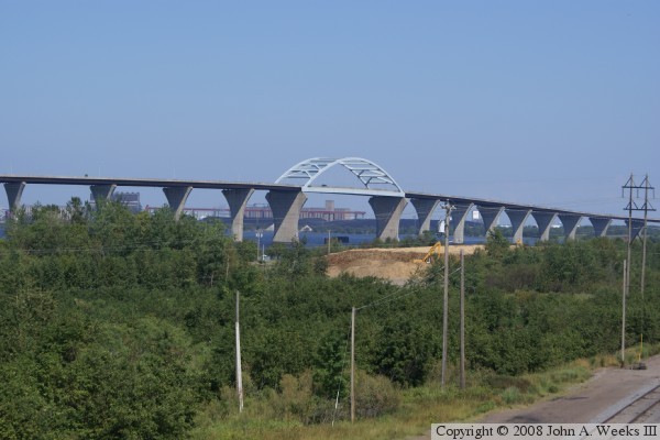
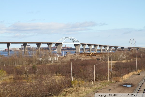
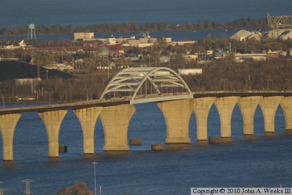
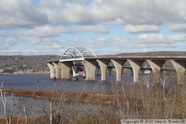
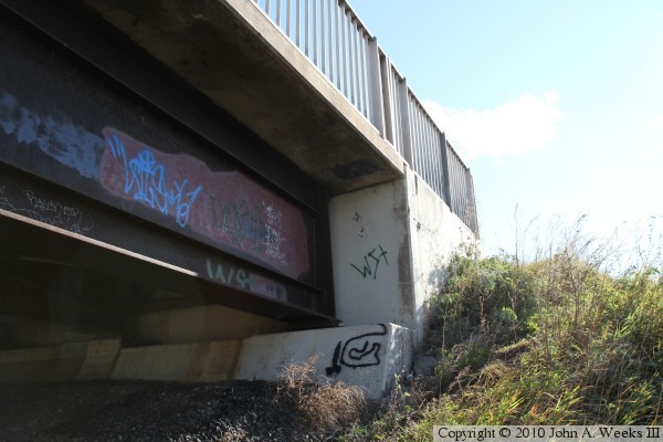
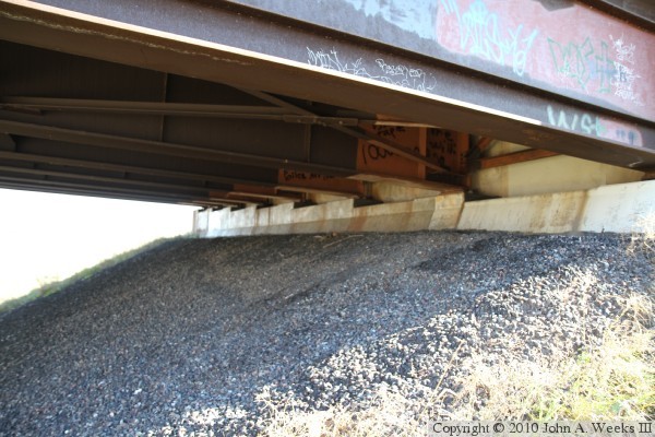
The photo above was taken from a highway overpass behind the Lake Superior
Papermill in Duluth. The view is looking southeast. The photo below is a
view from the same location on a chilly autumn afternoon. The railroad tracks
passing under this overpass connect to the west end of the Grassy Point
Bridge, a BNSF swing bridge that runs parallel to and just south of the
Bong Bridge.

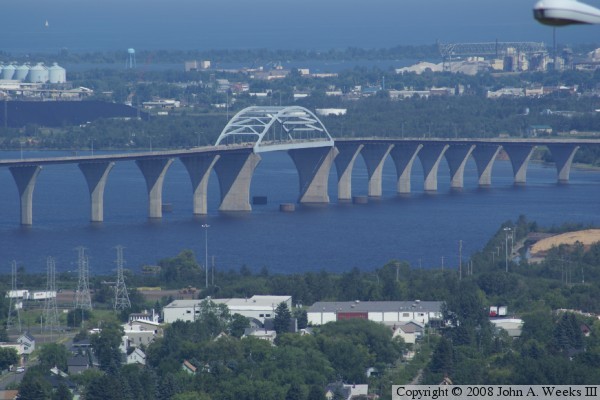
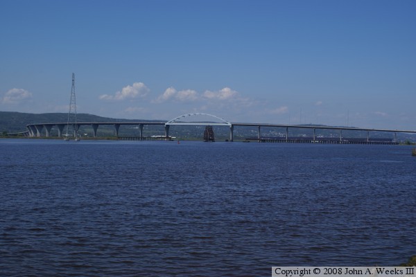
The photo above is looking east towards the main span of the Bong Bridge from
the east end of Raleigh Street in West Duluth were Raleigh Street turns into
Lesure Street. The photo below was taken from Thomson's Hill near the rest
area where I-35 and US-2 meet. This view is essentially the same angle as the
photo above, but shot from a higher elevation. The vantage point in the
photo above was nine-tenths of a mile from the nearest corner of the arch
span, while the the photo below is from three miles away.
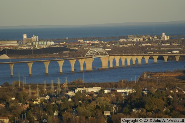
These two photos are late evening telephoto views looking southeast from the
Thompson Hill rest area on I-35. Due to the rotation of the earth, the
sun sets relatively far to the northwest. That allows the sunlight to
illuminate the north side of the bridge piers. The low sun angle serves to
light up the underside of the bridge, including the tops of the piers and
the steel girders. The warm colors of the setting sun gives the bridge a
completely different look.
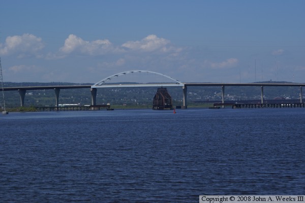
These two photos were taken from the old Arrowhead Bridge fishing deck
in Superior. The view is looking northeast towards Duluth. The wider
shot above shows the wide sweeping curves of the bridge, while the
close up shot below shows the tied arch in more detail. The railroad
bridge in the photo is the BNSF Grassy Point Drawbridge.
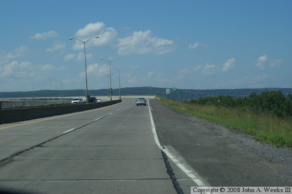
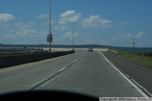
These two photos are the start of a crossing of the Bong Bridge heading
north from Superior to Duluth. These photos show the entrance roadway
to the south end of the bridge. The bridge was intended to flow into
a freeway that bypassed Superior. That freeway never materialized, so
these connector ramps between the Bong Bridge and Belknap Street have
become permanent.
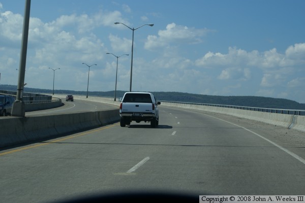
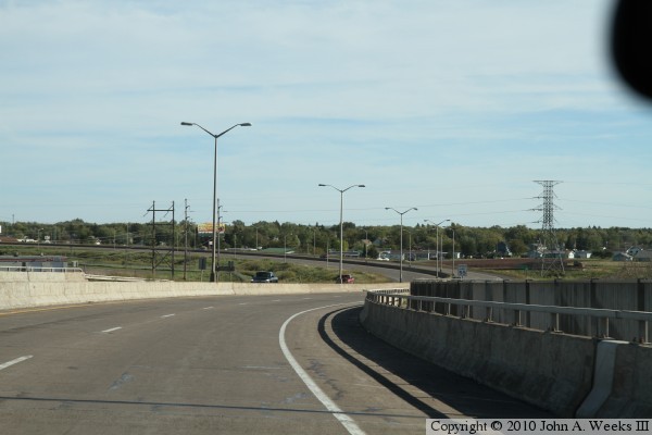
Once we arrive on the bridge proper, we curve to the left (in the
photo above), and we curve back to the right before we reach the
main channel (in the photo below).
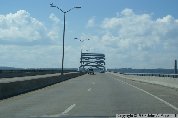
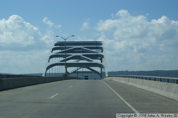
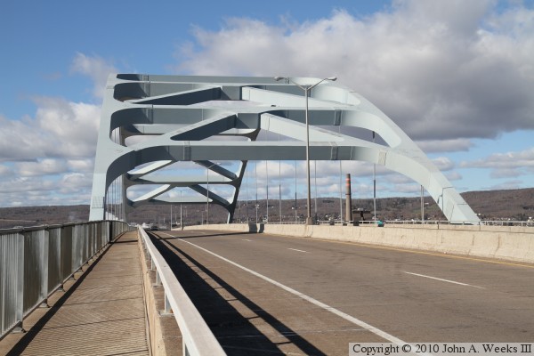
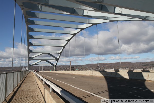
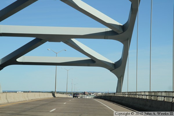
These two photos show the tied arch over the main channel. The arch
structure looks enormous as you approach it (in the photo above), but
it isn't until you are inside that you can see just how massive it
really is. The photo below also shows the suspension cables that are
used to suspend the deck from the arch.
After we exit the arch, we travel though a long sweeping curve to the
right. In the photo above, we cross the state line shortly after entering
this curve. The steam plant for the Lake Superior Papermill can be seen
on the left of the roadway (but at the far right edge of the photo).
In the photo below, this curve to the right continues as we reach the
signs for the exit ramps at the north end of the bridge.

There is one last small curve to the left at the north end of the Bong
Bridge. The photo below shows our travel choices. The ramp to the
right enters I-35 northbound towards downtown Duluth. The road going
straight ahead takes us onto local streets in the West Duluth area of
town. A grade level turn to the left just ahead will take us to I-35W
heading south towards Thompson's Hill.
These two photos, and the 14 that follow, are views captured when walking
northbound across the Bong Bridge from Superior towards Duluth. The photo
above is looking northwest towards the arch span from the bicycle path leading
to the south end of the Bong Bridge. The photo above is the sidewalk at the
south end of the bridge.
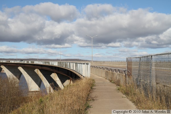
The photo above is looking northeast across the south end of the highway deck.
The photo below is looking north across the bridge. The southbound lanes are
nearest to the sidewalk, with the northbound lanes being behind the center
divider.


The photo above is another view looking northwest towards the arch span of
the Bong Bridge after walking far enough out on the sidewalk to get high
enough to keep the trees out of the frame. The photo above is the first
clear view of the arch after rounding the curve at the south end of the
bridge, some two-tenths of a mile from the arch structure.

The photo above is looking west down the sidewalk on the south side of the
Bong Bridge towards the main span arch structure. The vantage point is about
one-tenth of a mile from the arch, the first location where you can see the
far end of the highway deck as it passes through the arch. The photo below
is a view from under the east end of the arch.
The photo above is looking north across the bridge deck towards the arch on
the far side of the bridge. Note the gusset plate that connects two sections
of the arch. I count two sets of seven rows of bolts with 18 bolts per row,
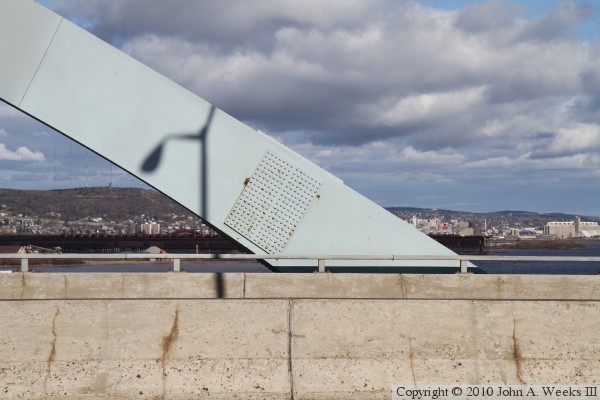
for a total of 252 bolts. The photo above is looking up where a pair of
suspension cables connects to the arch. Note the surface rust on this plate.
I suspect that this is a trim plate and is not a structural component.

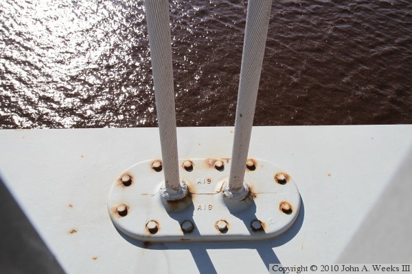
The photo below is where these two cables attach to the structure that holds
up the roadway. Given that the low steel on the bridge is 120 feet above the
water, and the steel on the lower arch tie member is at least 15 feet tall,
the water is probably 140 feet below the sidewalk at this location. The photo
above is looking east down the highway deck as we start our walk back to the
south end of the bridge. The city of Superior is in the background.


The photo above is a view of the bridge as it curves towards the south
bridge abutment. The bridge passes over the BNSF railroad tracks that lead
to the Grassy Point Bridge, a railroad swing bridge that is parallel to and
just south of the Bong Bridge. The large facility on the far side of the
bridge is the Amsoil distribution center. Amsoil is a leading manufacture
of synthetic oil, and is based in Superior. The building was built as a
grocery distribution center. The photo below is looking northbound along
the south side of the bridge from the south bridge abutment.
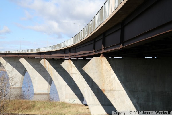
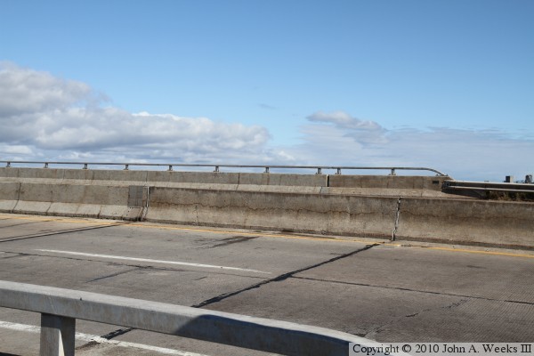
The photo above is the south bridge abutment. The photo below is a view
looking under the south end of the bridge. Note the concrete steps that
causes the bridge deck to slant to the south. The curves on the bridge are
inclined to allow traffic to flow at highway speeds.
These two photos are views traveling northbound on Interstate highway I-35.
The photo above is passing the exit from northbound I-35 to southbound US-2.
The photo below is passing under two more ramps that feed into southbound
US-2. The lower level bridge connects from the Duluth street system, while
the flyover ramp connects from southbound I-35 to southbound US-2. The
construction project in progress is the I-35 Megaproject. This project is
a rebuild of I-35 from Thompson Hill to the I-535 Can-Of-Worms interchange.

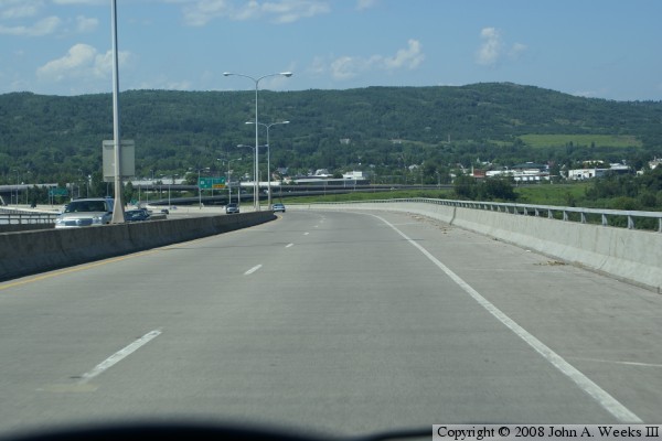
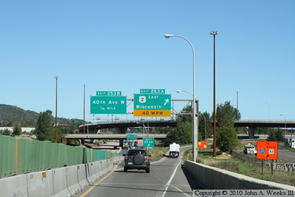
These two photos, and the eight that follow, are views of a southbound
crossing of the US-2 Bong Bridge from Duluth to Superior. This journey
starts in the photo above heading south on N 46th Avenue W. This street
flows onto the Bong Bridge, as seen in the photo below. The bridge above
the roadway is the flyover ramp from southbound I-35 to southbound US-2,
which will merge in from the right shortly. Interstate highway I-35
crosses under the Bong Bridge just beyond this overpass, putting us in the
center of a three level stack interchange.

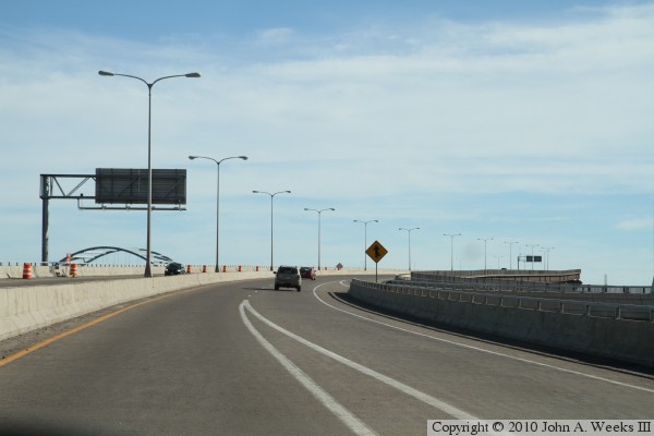
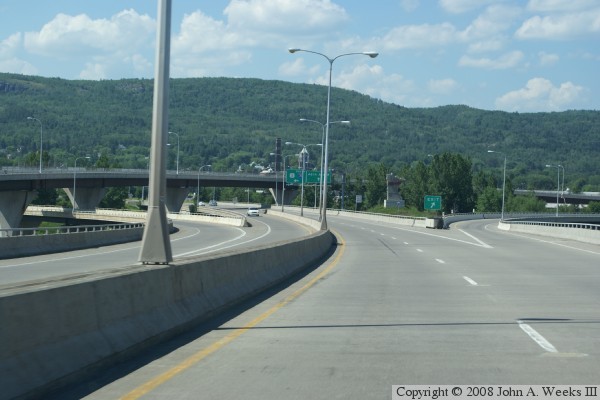
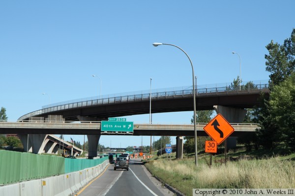
These two photos continue our southbound crossing of the bong bridge. In
the photo above, two ramps are merging in from the right. The nearest
merger into our lane is traffic from northbound I-35. The ramp to the far
right is the flyover from southbound I-35. The photo above is a section
of straight roadway heading almost due south prior to the curve that leads
to the main bridge span.


The photo above is rounding the curve leading to the main bridge span, while
in the photo below, we are on the final climb up to the west end of the
giant steel arch.
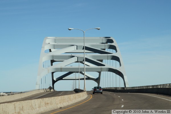
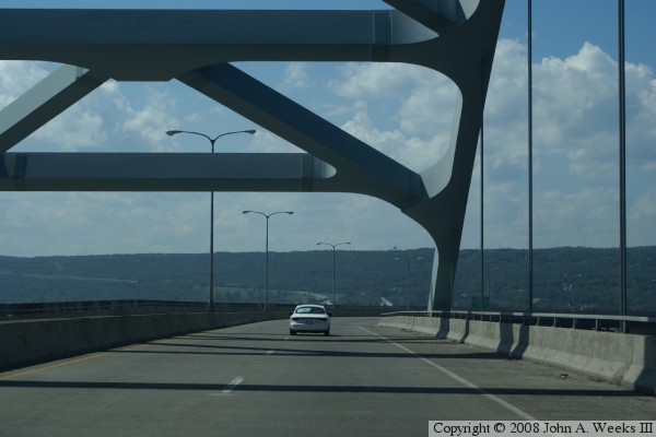
In the photo above, we are passing through the large steel arch span over the
navigation channel. The bridge deck is approximately 150 feet above the
water at the center of the span. The top of the arch is approximately 75 feet
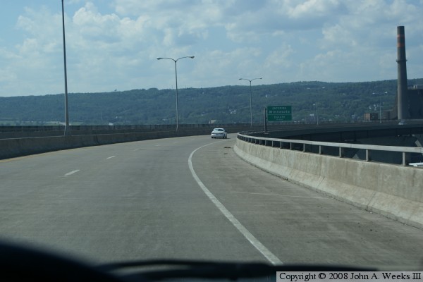
above the highway deck. The photo below is heading east down the incline
leading to the Wisconsin side of the Saint Louis Bay.
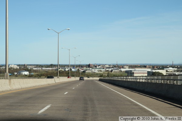
The photo above is exiting the south end of the Bong Bridge into the city
of Superior. The photo below is a marker located in a park set between the
northbound and southbound lanes at the south end of the bridge.

|
