Barker's Island is named after Captain Charles S. Barker. The web site for
the Barkers Island Inn tells the story of how the island came to be. Barker
moved his tug boat and dredging company to Duluth and Superior in 1885.
Legend has it that he had an ongoing feud with Martin Pattison, a local
lumber baron. To get revenge on Pattison, Barker started dumping debris and
dredge sand in front of Pattison's mansion on the Superior Bay waterfront.
Whether or not this feud was the reason, much of the sand dredged from the
Twin Ports harbor in the 1880s and 1890s were dumped along the edge of
Superior Bay forming a large artificial island. Since Captain Barker was in
charge of the dredging operation, locals named the island in his honor.
The island became a popular tourist attraction in the early part of the
20th Century. It featured a bird sanctuary and was a very popular swimming
hole. A causeway and bridge was built out to the island. Later, with
the horse and buggy era giving way to the automobile, and Superior Bay
becoming choked with sewage and pollution, tourists went elsewhere. The
bridge over the railroad track collapsed, and the causeway bridge rotted
into oblivion. The island itself began to sink, and it was almost gone by
the 1950s.
The revival of Barker's Island began when the harbor was dredged deeper in
the late 1950s. The sand from the dredging was again deposited at Barker's
Island. The causeway was improved in the 1960s and tourist attractions started
to locate on the island. The first was the Meteor, the last remaining
whaleback ship, which has been open for tours since 1973. A marina,
conference center, hotel, and housing has followed. More recently, the
city of Superior added a park and charter boat dock, which has proven to be
very successful. Barker's Island is now one of the top tourist destinations
in Superior.
The trail leading out to Barker's Island is a spur off of the Osaugie Trail,
which runs along the Superior Bay waterfront. I don't know when the trail
bridge was added, but it appears to be late 1980s construction. While the
causeway bridge is very short, the trail bridge runs almost the entire length
of the causeway, an estimated 400 feet, comprised of 10 concrete slab spans
each about 40 feet long.
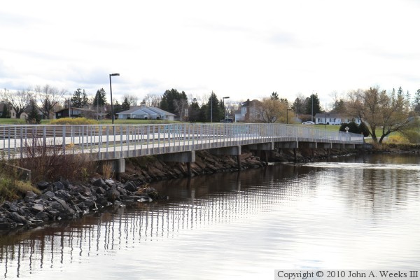
The photo above is looking southwest towards the north face of the Barker's
Island Trail Bridge. The vantage point is a boat dock on the west side of
Barker's Island. The Superior, Wisconsin, mainland is visible on the far
side of the bay.
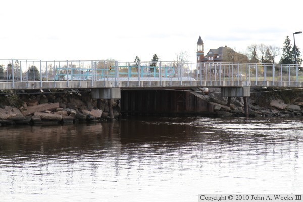
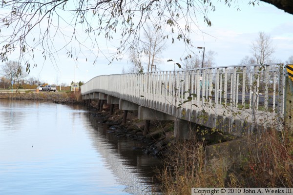
The photo above is the north side of the main channel span of the Barker's
Island Trail Bridge. The Barker's Island Causeway Bridge is located directly
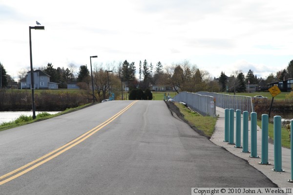
behind the trail bridge. The photo below is looking west down the Barker's
Island Causeway. The trail bridge is located to the right of the causeway.
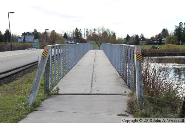
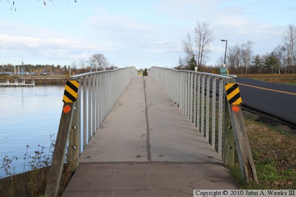
The photo above is looking west down the center of the Barker's Island Trail
Bridge. The photo below is a similar photo looking east down the center of
the bridge.
These two photos are views looking east towards Barker's Island along the
north face of the trail bridge. The trail bridge is built along the north
side of the highway causeway, but is not part of the causeway.
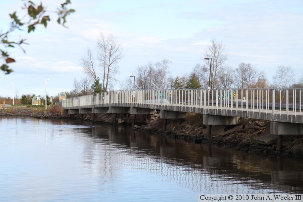
The photo above is looking southeast towards the main channel span of the
Barker's Island Trail Bridge. The vantage point is along the edge of the
Osaugie Trail, which runs north and south along the waterfront in Superior.
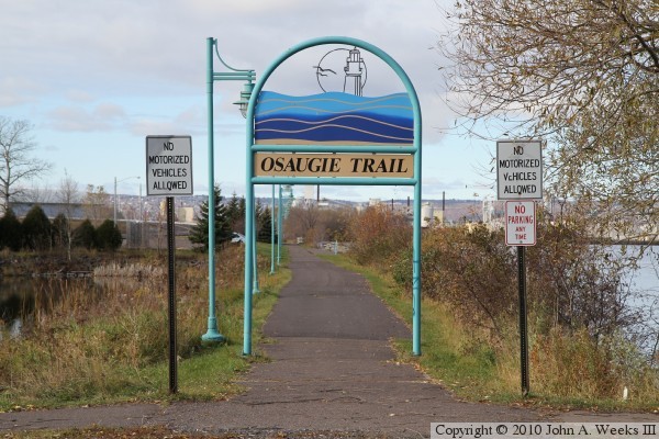
The photo below is a sign for the trail where it intersects the Barker's
Island Trail just west of the bridge.
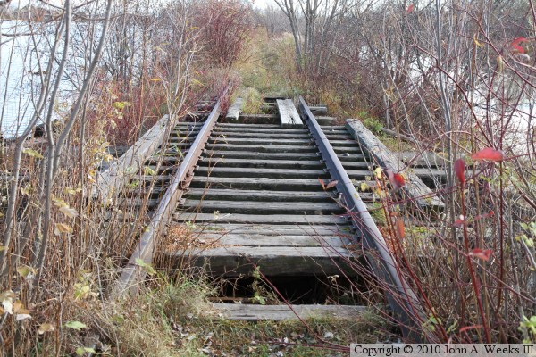
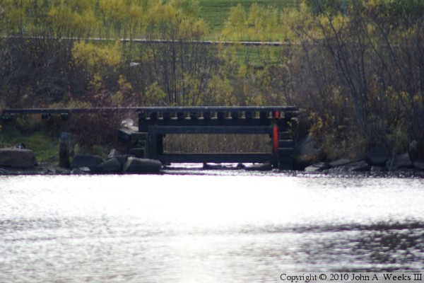
The Osaugie Trail is built on an old railroad alignment north of the Barker's
Island Causeway. The rail line is abandoned for a mile south of the causeway,
and then it is in active use further south. As a result, the Osaugie Trail
does not follow the railroad south of the causeway. I did find an old wooden
bridge on the rail line just below the causeway. The photo above is a view
looking south down the length of this bridge, while the photo below is a
view looking across the bay towards the east side of the railroad bridge.