| Highways, Byways, And Bridge Photography |
Interstate Bridge
Historic Saint Louis River Highway/Railroad Crossing
Duluth, MN
|
• Structure ID: |
N/A |
|
• Location: |
River Mile 5.5 |
|
• River Elevation: |
602 Feet |
|
• Highways: |
US-53 |
|
• Daily Traffic Count: |
8,000 (1961), Now Closed |
|
• Bridge Type: |
Wood Trestle, Steel Truss, Steel Swing Span |
|
• Bridge Length: |
??? Feet, 325 Foot Longest Span |
|
• Bridge Width: |
??? Feet, 2 Rail Tracks, 2 Wagon Lanes |
|
• Navigation Channel Width: |
220 Feet (Estimated) |
|
• Height Above Water: |
??? Feet |
|
• Date Built: |
July 13, 1897 |
The Interstate Bridge was the first bridge to cross the harbor and bay
between Duluth and Superior. Prior to 1897, ferry boats connected the
two cities. However, ice prevented the ferry boats from running in the
winter. The Duluth-Superior Bridge Company, funded by the Great Northern
Railway, was formed in 1894 to build a bridge connecting Connors Point in
Wisconsin to Rice's Point in Minnesota. The bridge was dedicated in April
of 1897, but problems with the land owners on the Wisconsin side prevented
the bridge from being completed until July of that year.
The bridge configuration consisted of a long wooden trestle on each end.
The center of the bridge had a 485 foot long steel truss swing span,
thought to be the longest swing span in the world when it was built.
A 325 foot humpback steel truss was on each side of the swing span.
The main path though the truss spans contained 2 parallel railroad tracks.
A wagon bridge was hung off of the western side of the structure. Since
the rail line required a gradual slope, the wooden trestle extended for
a long distance on each side of the main spans. The wagon bridge, however,
could have a relatively steep slope, so it landed on the ground right at the
shoreline.
By the 1930s, automobile traffic has begun to overwhelm the capacity
of the Interstate Bridge. There was talk of building a new bridge or
even a tunnel under the harbor. The depression and WWII intervened.
A new toll bridge was approved in 1953. The new High Bridge opened on
December 8, 1961. Traffic preferred the free High Bridge over the toll
on the Interstate Bridge, so traffic dwindled. The swing span was locked
in the open position on December 21, 1962. Most of the now retired
bridge was removed in the 1970s.
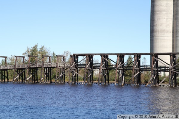
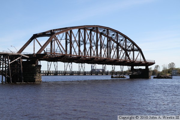
A portion of the Interstate bridge was thankfully saved. A small section
of the trestle and one of the huge 325 foot truss spans still stands on
the Duluth side of the harbor. The bridge has been modified to be
a fishing platform. The ramp to the wagon deck is gone, and only a small
section of the railroad level trestle remains. A pedestrian ramp has been
installed through the center of the railroad trestle, a fishing deck has
been installed under the truss span. This is the best that preservation
fans could have hoped for given that the swing span posed a hazard to
navigation traffic.
The dangers of a narrow swing span in a major harbor was illustrated on
the early morning of August 11, 1906. At about 1AM, the steamship Troy
signaled for the swing bridge to be opened. The captain of the Troy was
unconcerned when the bridge did not start to move right away, the
Interstate Bridge had a reputation of being slow to start to turn. As
it was, the operator apparently was asleep at the post, and did not
engage the bridge until it was too late. The Troy slammed into the
swing span, pushing one side of the swing span into the harbor. The
other side of the swing span collapsed moments later. Not only was
the bridge destroyed and the harbor blocked, but 33 ships were trapped
for the ten days it took to clean up the mess and open the passage.
It took 2 years to rebuild and reinstall the swing span and return the
bridge to service.
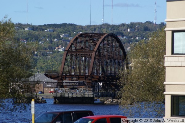
The photo above is looking north towards the remaining span of the Interstate
Bridge. The vantage point is the road leading to the north end of Connors
Point in Superior. The waterfront in this area is blocked off by No
Trespassing signs, so this view is looking between the trees from Main Street.
The photo below is from a Wisconsin DOT flyer advertising the opening of the
Blatnik Bridge. The bridge section on the Superior side of the
channel is not a truss span in this view. Rather, the bridge section looks
like a trestle. It appears that the south bridge truss span was removed and
replaced with a trestle at some point during the lifespan of this structure.

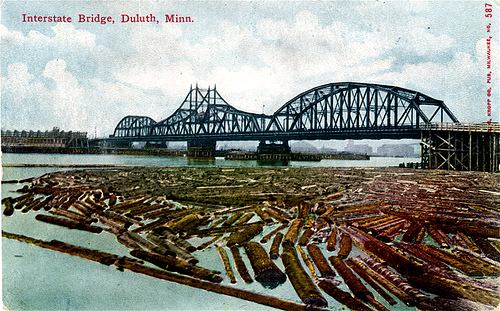
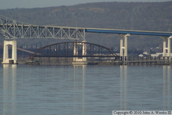
The photo above is a postcard dating back to the early 20th Century. The
photo below is looking east across Superior bay from Park Point on an early
autumn morning. Despite the bright sun, the water has a film of ice on the
surface that turns it into a giant mirror.
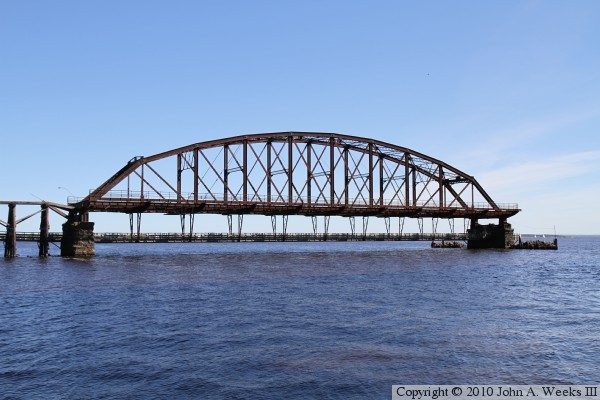
These two photos are looking east from the base of the highway I-535 Blatnik
Bridge at the southern tip of Rices Point. The photo above is the remaining
bridge truss span, while the photo below is part of the bridge trestle at the
north end of the structure.
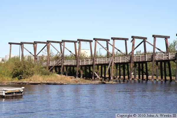
These two photos are views from the boat landing located between the
Interstate Bridge and the Blatnik Bridge at the south end of Rices Point.
The photo above is the truss span, while the photo below is the remains of
the trestle at the north end of the bridge. The railroad track was on the
top of this trestle. The internal vertical posts were cut off and used to
support the walkway that leads to the truss span. The poles that supported
the roadways are cut off at the waterline.
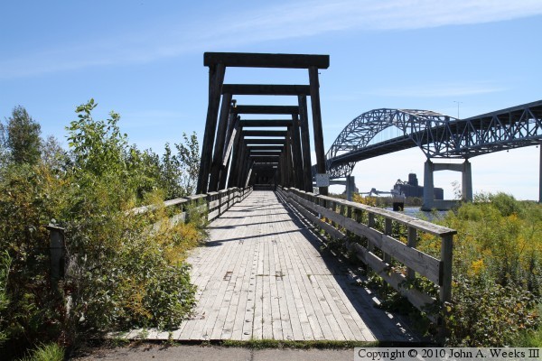
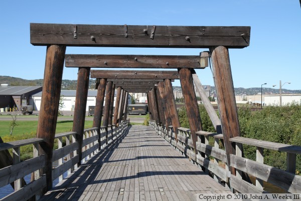
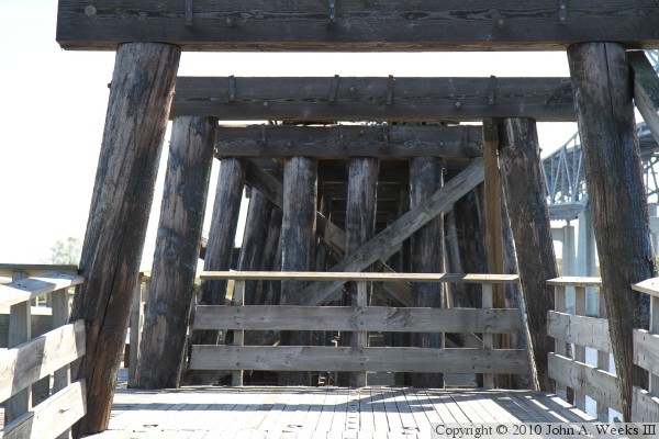
The photo above is looking south down the length of the ramp leading to
the deck that is suspended under the main truss span. The railroad ran
on top of the horizontal beams, and the roadways used ramps on either side
of the railroad trestle. This location can be accessed by taking the Garfield
Avenue exit off of Interstate I-535, and parking in the public lot under
the Blatnik Bridge. The photo below is looking north down the center of
this ramp from a vantage point halfway between shore and the truss span.
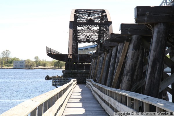
The photo above is the point halfway between shore and the truss span where
the walkway moves from inside the trestle to running along the east side of
the trestle. The photo below is a view looking south down the center of this
walkway towards the truss span.
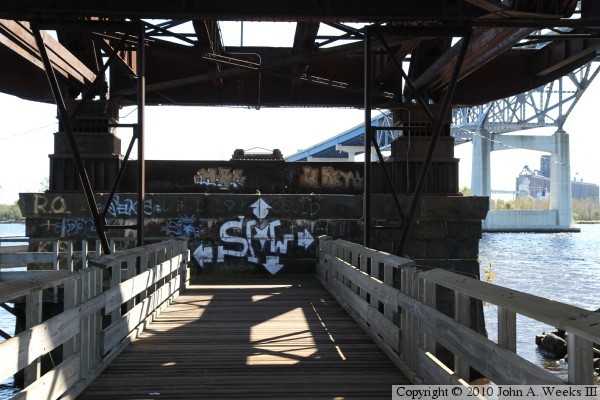
The photo above is looking south along the walkway that is suspended under the
truss span towards the bridge abutment at the south end of the truss span.
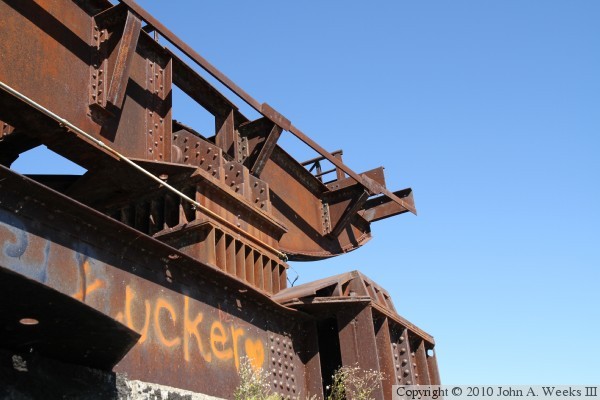
The photo below is the south end of the truss span. The swing span rested on
the steel pad on the lower section of steel when in the closed position.

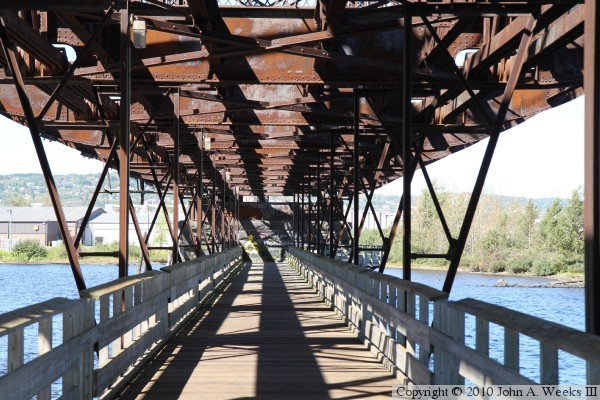
The photo above is looking north under the truss span along the east side
of the walkway. The photo below is a similar view looking north down the
center of the walkway. The web of steel beams makes for some interesting
shadows under the bridge.

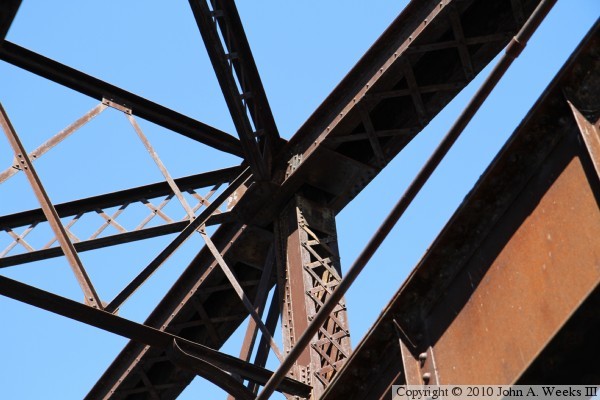
The photo above is looking up towards the steel supports for the former
northbound highway lane. The deck has been removed, but the structure still
remains. The photo below is a detail of a very complex joint where a number
of beams are attached at the top of the truss structure. The crisscross
construction where a beam is formed from two parallel U-channels joined by
riveted tabs is a very common construction technique from the end of the
19th century when steel prices were relatively high compared to labor costs.

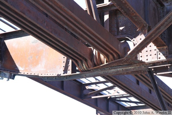
These two photos are detail views of a pin connection in the bridge structure.
Rather than using gusset plates and welds, it was common at that time to
join steel support bars using large pins. There are 16 different
structural members joined at the pin in the photo below.
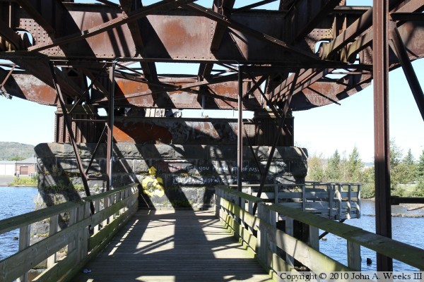
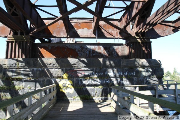
These two photos are views of the bridge pier at the north end of the truss
span. The photo above is looking north along the walkway, while the photo
below is a closer view of the structure that sits on top of the pier. The
walkway wraps around the east side of the pier.
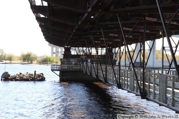
The photo above is looking south along the east side of the walkway that is
suspended under the remaining truss span. The navigation channel to the
inner harbor is located on the far side of the bridge pier. The photo below
is a view of the rock crib that protects the south bridge pier. This crib
was formed by sinking a wooden box to the bottom of the bay, then filling
it with rocks.

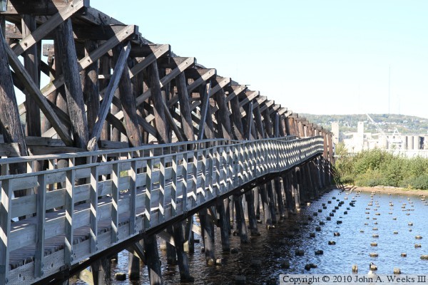
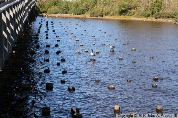
These two photos are looking north along the east side of the trestle at
the north end of the bridge. The walkway runs along the side of the trestle
for half of the distance between the truss span and the shoreline, then runs
inside the trestle for the remaining distance to shore. The piles that once
supported the highway lanes are cut off at the waterline.
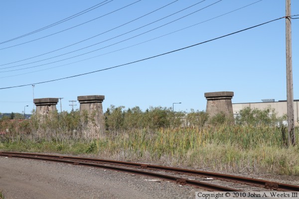
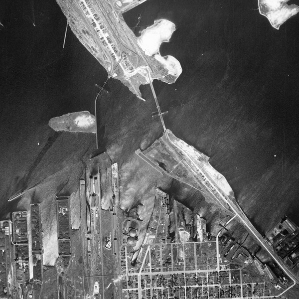
The photo above are concrete piers located north of the Interstate Bridge.
The rail line crossed a large rail yard on Rices Point using these piers to
support a series of short bridge spans. The image below is clipped from the
Minnesota state DNR aerial photo database. It shows the Saint Louis Bay
Bridge on the left, and the Interstate Bridge on the right.
|


