Water power was first harnessed on the Saint Louis River in 1899 when a dam was built near the Potlatch Mill in Cloquet. As the region developed, it was recognized that there was significant power generating potential of the Saint Louis River cascade between Cloquet and Lake Superior. The large Thomson Hydro Project came online in 1907. There still potential for hydro power on either side of the Thomson Hydro Project, as well as another potential dam site in Cloquet. These three projects were developed in the 1920s.
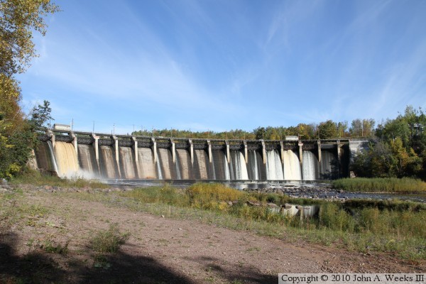
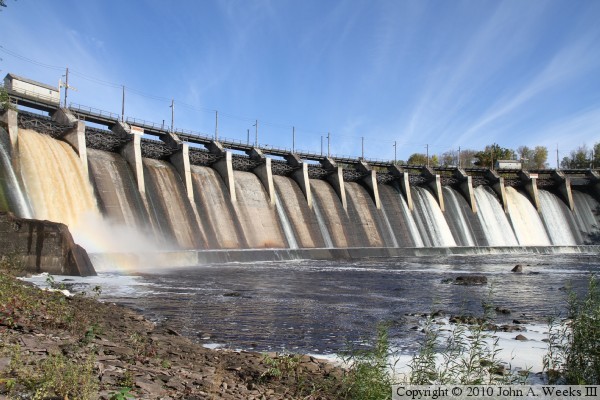
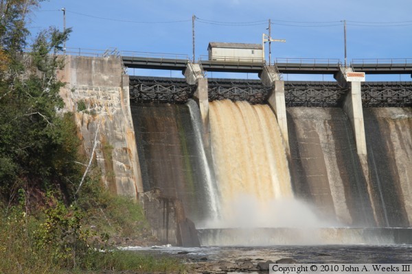
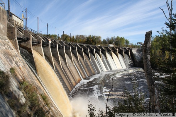
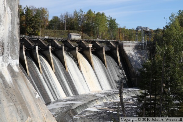
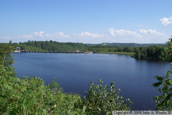
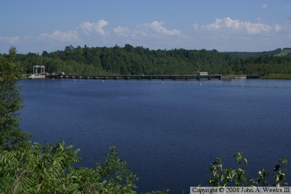
The Fond du Lac Dam was built at the site of a waterfall on the Saint Louis River near the rivers outlet into Saint Louis Bay. The water fall dropped around 50 feet, but there was actually 78 feet of height available between the 602 foot elevation of Lake Superior and the 680 foot elevation of the outlet of the Thomson power plant. The dam was made high enough to take full advantage of this difference in elevation, backing its pool up to the highest level possible at the outflow of the Thomson Hydro Project.
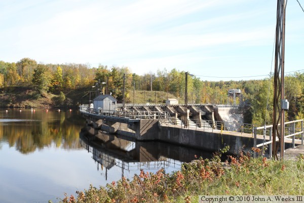
The Fond du Lac Dam is owned by Allete Inc, a spin-off of Minnesota Power. The dam generates 12 megawatts of power. A large volume of water goes over the spillway bypassing the power house. As a result, there are discussions about adding more generators and increasing the power output by 10 megawatts.
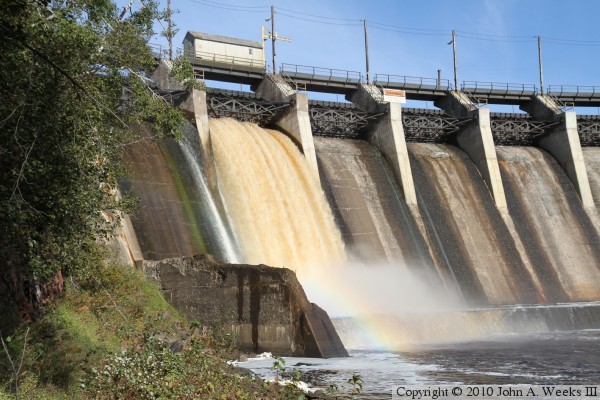
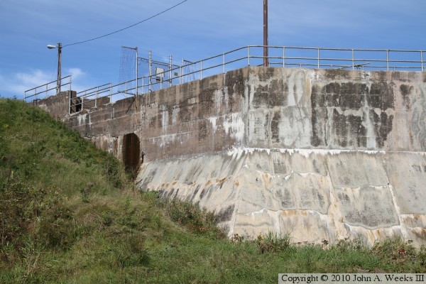
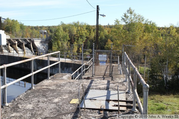
There is no easy public access to this impressively large dam. The access road to the dam is posted for no trespassing, and the facilities near the power house are on private property. The back side of the dam and the pool is visible from highway MN-210 as one drives through Jay Cooke State Park. There is canoe access from a landing at the Grand Portage trailhead, though it is best to stay well clear of the dam. The remaining option is a 3/4 mile hike from highway MN-23 down a haul road through Jay Cooke State Park, which leads to a clearing just below the dam on the west shore of the Saint Louis River. The hike in is well worth the effort in order to see this structure. In winter, the dam often creates very large ice sculptures from the spray coming off of the spillway. The spring runoff can also create impressive water displays.
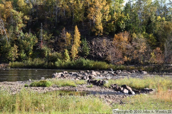
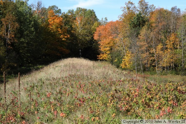
A recent project connected with the dam is an attempt to restore habitat for the Lake Superior Sturgeon. These fish are large, often reaching 100 pounds or more. Destruction of habitat and environmental issues lead to their decline. The fish like to spawn in shallow pools, such as those that once existed on the Saint Louis River before the Fond du Lac Dam was built. Since the dam is in the way, the best option that remained was to attempt to build habitat in the area in front of the dam. Truckloads of large rocks were brought in during the early months of 2009, and those rocks were placed in the river channel that summer to create a number of pools. It is hoped that the fish will again find this location and help bring back their population.
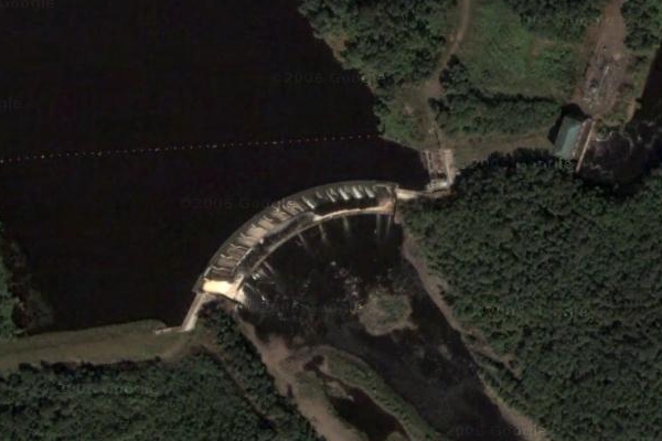
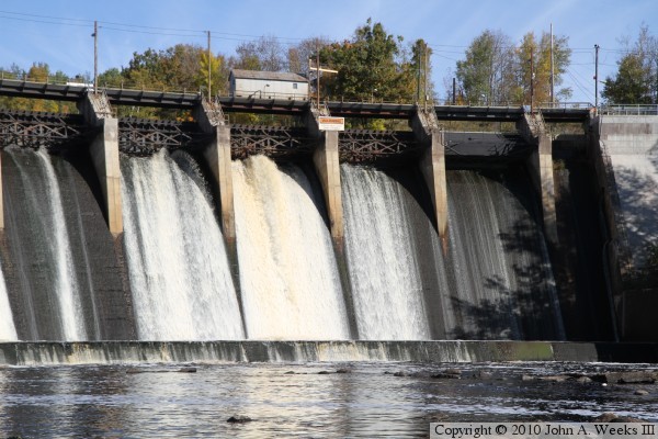
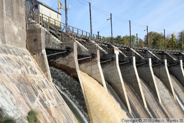
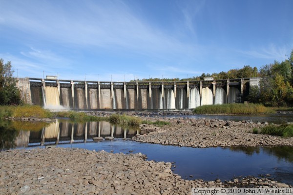
The photo above is looking north towards the downstream face of the Fond du Lac Dam as seen after walking out into the rocks in the middle of the river channel. There is a nice reflection of the dam in the pool on the left side of the photo. The image below is a clip from Google Earth. The arch dam structure is in the center of the photo. The earthen dike is to the left of the dam. An intake structure is at the right side of the dam, with the power plant located at the right edge of the image. The river is divided into two channels below the dam, which merge about a half mile downstream.