The Thomson Dam Powerhouse is part of an unusual dam configuration where
the power plant is located at a different site than the dam structure.
In this case, the power plant is 3 miles from the dam. It is fed by a
2 mile long canal followed by a mile of underground pipes. At the bottom
of the mile of pipes, we find two large surge towers. Surge towers smooth
out the flow of water and prevents sudden changes in water pressure from
reaching the hydro turbines. The water then enters the power plant
building on its lower level, flows through the turbines, and then exits
the power plant back into the Saint Louis River.
The power plant generates 70-megawatts of electricity. While this is
far less than a typical 1000-megawatt nuclear reactor, it is also far
larger than the 10-megawatt upper limit for small scale hydro projects.
The Thomson plant is the largest hydro power project in the state of
Minnesota. Its current owner, Minnesota Power, claims that it has the
capacity to meet the electrical needs of the entire city of Duluth, the
fourth largest city in the state with a population of 90,000.
The generation of this electrical power without burning any fossil fuels,
creating any greenhouse gases, or creating any waste products makes the
Thomson Water Project a very good neighbor in a very sensitive tourist
area.
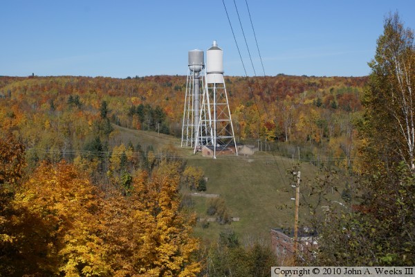
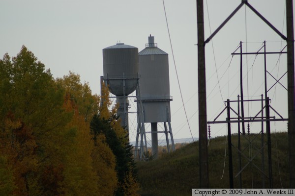
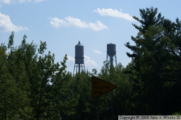
The photo above is looking north across the river from the bluffs on the
south side of the Saint Louis River. The two large water towers are called
surge towers. They act as a pressure regulator in the penstock pipes to
even out the flow of water. For example, if there is a sudden burst of
pressure or a shutdown of one of the turbines, water can back up into the
surge towers. In addition, if there is a lull in pressure, air bubbles, or
a turbine is suddenly turned on, water will flow out of the towers to raise
the pressure. This regulation of water pressure helps prevent a type of
damage to the turbines called cavitation.
The photo below is a view looking upstream from the same vantage point on
the south side of the river. The Saint Louis River flows through a gorge
that is several hundred feet deep, making it difficult and dangerous to
attempt to get down to the water level. As a result, I was not able to get
a clear field of view to take photos of the power plant building and water
outlet.
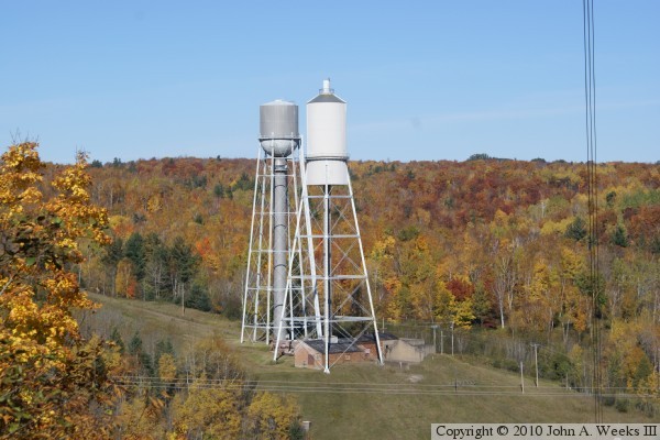
The photo above is a closer view of the surge towers. I suspect that the
closer taller tower is an older structure, while the back tower is a newer
structure, perhaps added in 1975 when the penstock pipes were refurbished.
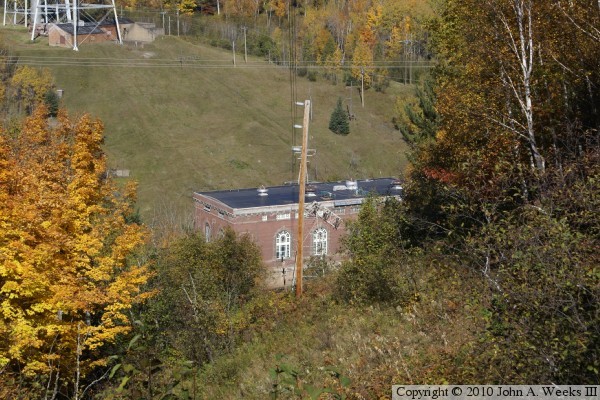
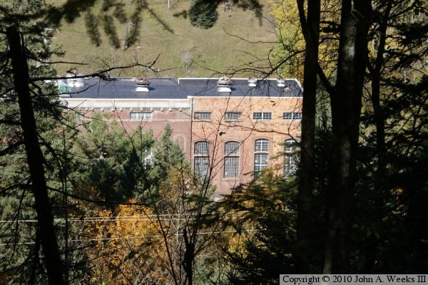
The photo below was my first view of the powerhouse building. Due to the
steep hill, it wasn't possible to attempt to get any closer without safety
equipment or climbing gear.
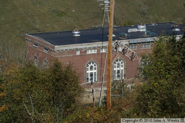
The photo above is a telephoto view of the powerhouse from the same vantage
point. Note that it appears that the river is visible at the base of the
powerhouse near just to the left of the base of the power pole. The photo
below is another view of the power house looking through the trees a little
further east along the ridge. It appears that there are two additions that
have been added to the east end of the power house since it was first built.
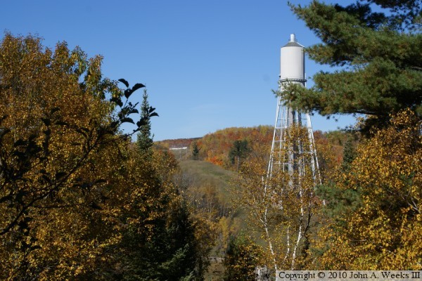
The photo above is looking up the hill leading down to the powerhouse. The
white line in the gap between the trees near the top of the hill is the
concrete foundation of the intake building for the penstock pipes. That
building is located 370 feet above the river level. The photo below is
looking down towards the surge towers from the intake building, providing
the opposite view from the photo above. The penstock pipes are about a mile
long.
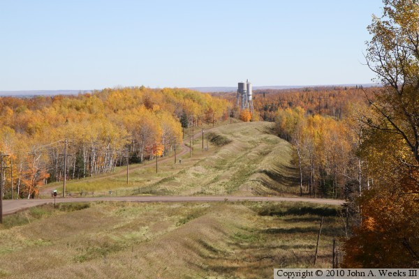
The photo above above is a telephoto view of of the surge towers as seen from
highway MN-210 near the intake structure building. This is the most common
view available of the powerhouse site without taking to the water. The photo
below is another view further east on MN-210. This shows that the two towers
are actually quite far from each other, a fact that is not evident from the
telephoto views.