Most dams have the power plant attached to the dam structure, with
water moving through the dam turning the hydro generators and then
exiting back into the river channel. The Thomson Water Project is
built quite different from this traditional dam style. On the Thomson
project, a dam holds back a large reservoir of water. The dam also
allows some water to flow down the historic river channel. The water
for the power plant actually flows out of an head structure and
along a 2 mile canal to reach this intake facility. From here, water
flows another mile through underground penstock pipes to reach the powerhouse.
Once the water runs through the power plant, it is returned to the
Saint Louis River at an elevation that is 370 below the dam at the top
of the bluffs. In comparison, the 370 foot water fall is about half
the 726 foot height of Hoover Dam.
The intake structure is located at the intersection of MN-210 and
Jay Cooke Road inside the Jay Cooke State Park. The Forbay Canal
brings water in from the Thomson Reservoir. The intake structure
accepts the water from the canal, regulates it using giant valves,
and then channels the water into 3 large pipes. These pipes flow
down the hill to the power plant area.
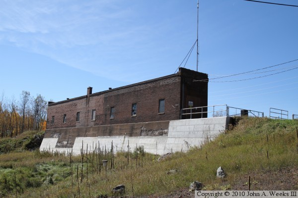
The photo above is looking west from Jay Cooke Road towards the east corner
of the Thomson Dam Intake building. About half of the white stone facing
on the building appears to have fallen off over time. The photo below is
looking upstream to the north on the Forbay Canal as seen from the upstream
side of the intake structure.
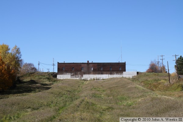
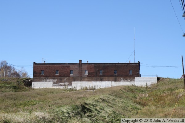
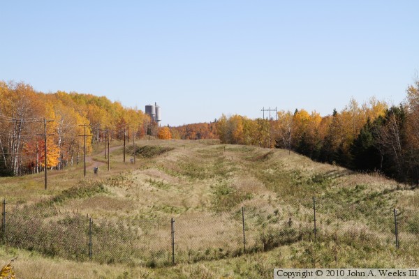
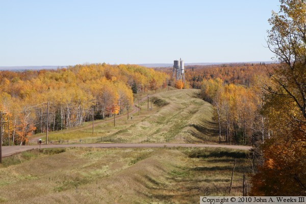
The photo above is looking uphill towards the intake building from the highway
MN-210 bridge over the penstock pipes. The path of the three penstock pipes
are visible and ridges running up the hill. The photo below is a closer view
of the intake building from about 250 feet downhill of the structure.
These two photos are looking downhill along the path of the penstock pipes.
The photo below is the view from the highway MN-210 bridge over the pipes.
The photo above is from the deck located on the west end of the intake
building. The towers in the distance are surge towers that regulate the
water pressure flowing into the power house turbines. The river channel is
located just beyond the surge towers, about a mile southeast of the intake.
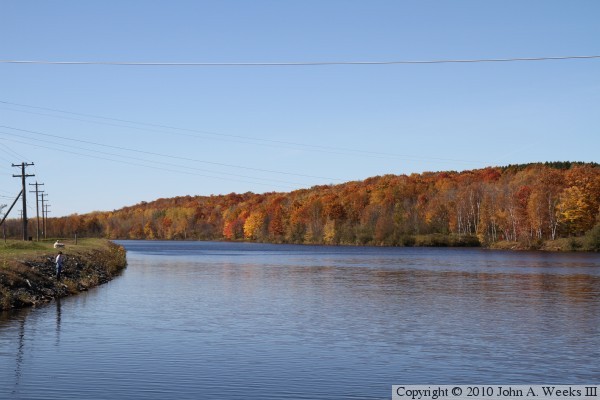
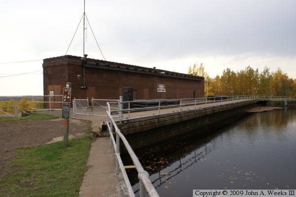
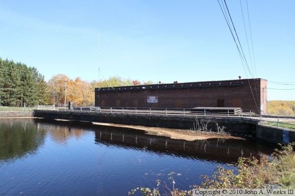
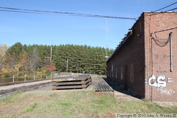
These two photos are views of the upstream side of the Thomson Dam Intake.
The photo above is a view from the northeast side of the building, as seen
from the parking lot for the facility. The photo below is a view from the
far side of the canal. The Superior Hiking Trail crosses the
canal on the concrete apron on the upstream side of the structure.
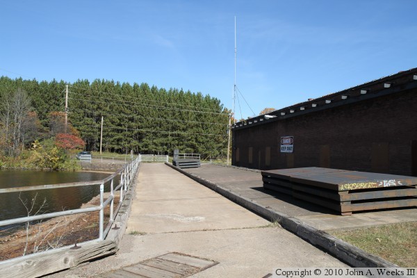
These two photos are views looking northeast from the south side of the canal.
The long narrow wooden grate that runs along the building covers a slot
located in front of the water intake ports. The metal plates that are stacked
on the concrete apron can be inserted into these slots to block the flow of
water into the intake ports, allowing maintenance to be performed. The photo
below shows the sidewalk to good advantage. This sidewalk is used by the
Superior Hiking Trail.
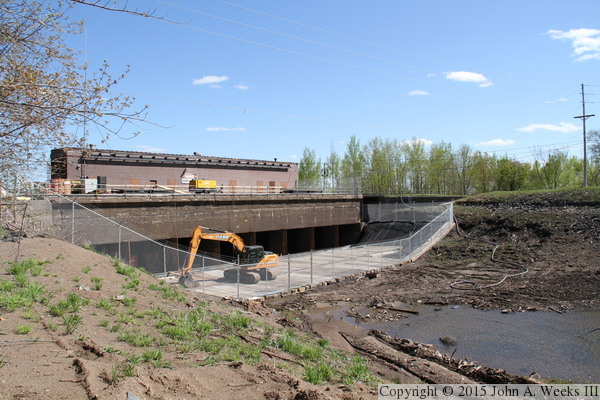
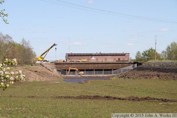
A flash flood of historic proportions hit the Duluth area on July 19-20,
2012, causing the Thomson Dam to overtop. Silt and debris clogged the intakes,
which Minnesota Power calls the Lower Intake, damaging the gates. The south
wall of the Forbay Canal failed causing the canal and Forbay Lake to drain.
These two photos are views of the upstream side of the intake house while
it was under repair. A platform was built to allow heavy equipment to gain
access to the lower level that is normally under water.